The African continent is a vast and diverse landmass, shaped by a variety of geological formations. From the towering peaks of the Atlas Mountains in the north to the vast expanse of the Kalahari Desert in the south, Africa is home to a rich array of landscapes and ecosystems. This map, which draws on data from the U.S. Geological Survey, provides a glimpse into this remarkable geological diversity, highlighting the continent's many mountains, valleys, plateaus, and other landforms.
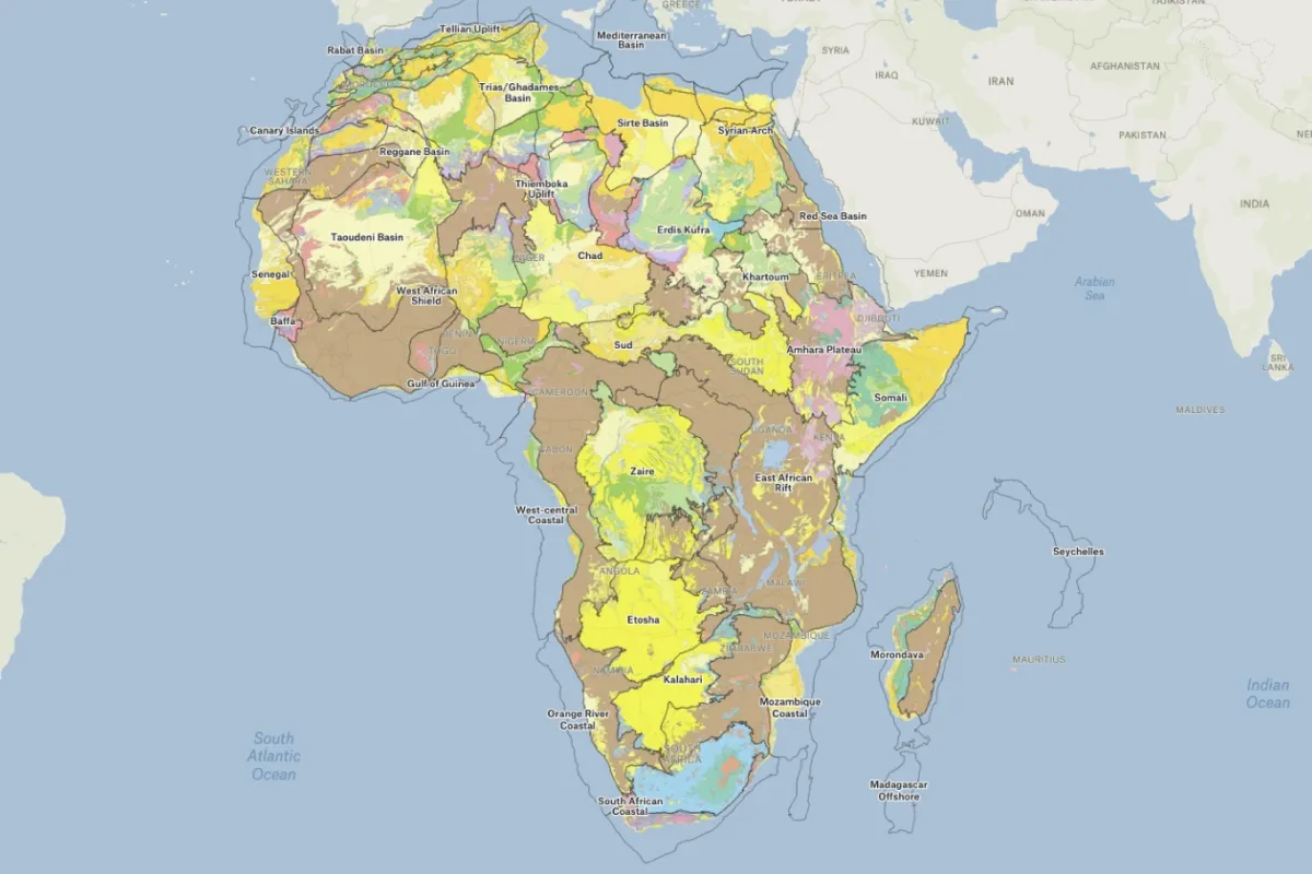
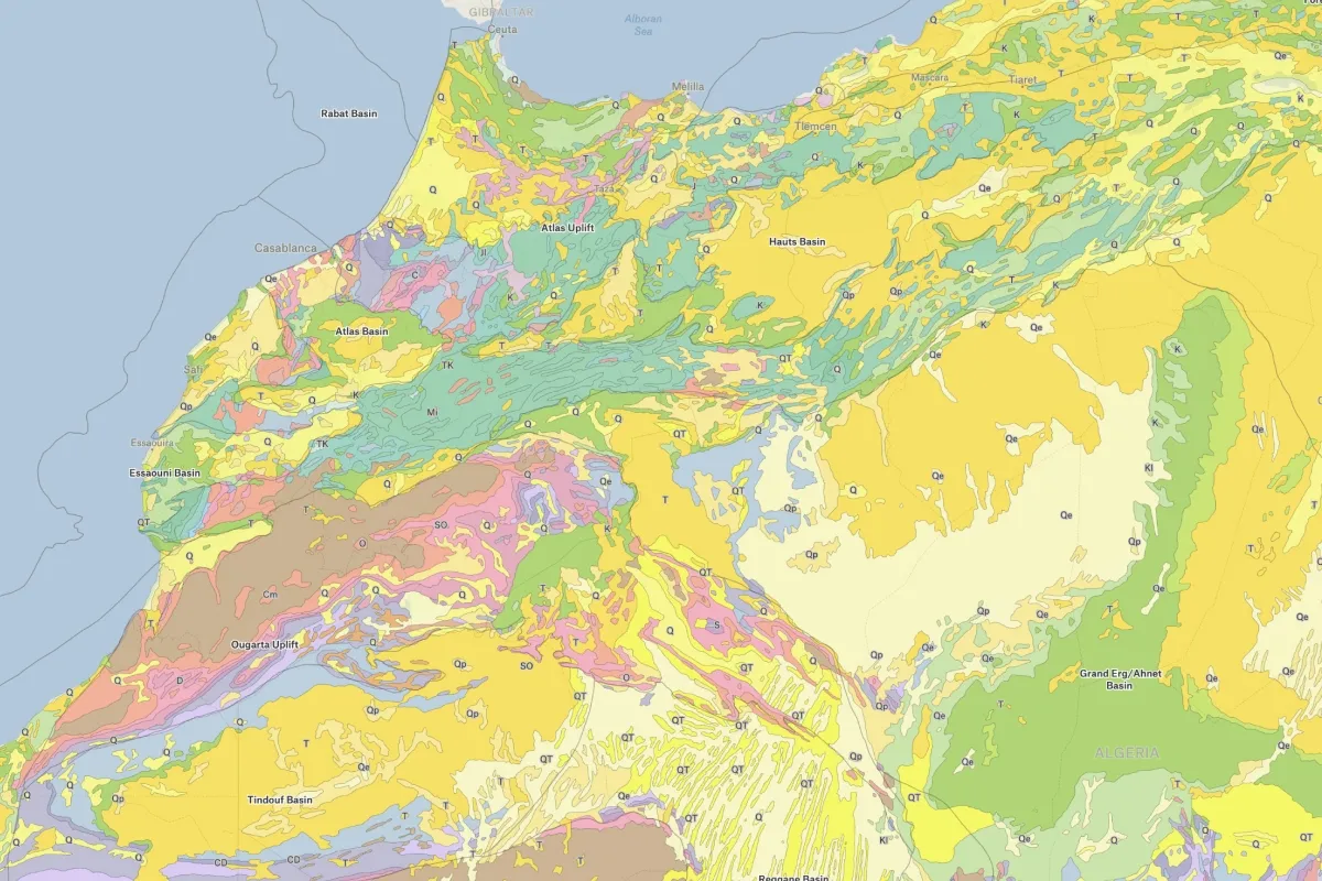
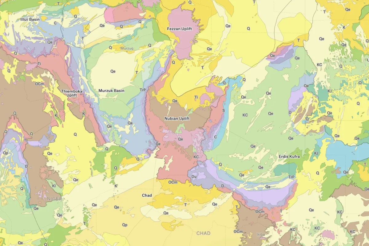
This geological map displays the surface geology and geologic regions across the African continent, sourced from United States Geological Survey (USGS) data. The map uses a color-coded system to distinguish between different geological formations spanning billions of years of Earth's history, from ancient Precambrian rocks (shown in brown tones) to more recent Quaternary igneous formations (displayed in pink), with intermediate periods including Paleozoic, Mesozoic, and Tertiary igneous rocks in various shades. Major geological features are labeled across the continent, including the Rabat Basin and Canary Islands in the northwest, the Trias/Gétames Basin and North Egypt Basin in the north, the Thiemboka Uplift in West Africa, the vast Precambrian shields of central and southern Africa, and prominent features like the East African Rift system, Karoo Basin, and Madagascar's offshore geology. The legend on the left side allows users to toggle different geological categories including water bodies (rivers and lakes), salt domes, kimberlites (diamond-bearing volcanic pipes), and various age classifications of igneous and sedimentary rocks, with an option to "Show 31 more" categories for deeper geological analysis. The map reveals Africa's ancient geological foundation, with extensive Precambrian rocks (over 540 million years old) dominating much of the interior, particularly visible in the brown-toned cratons of West Africa, the Congo Basin, and southern Africa, while younger yellow-colored formations (including sedimentary basins like the Iullemeden, Chad, and Sud basins) overlay these ancient shields in various regions. This comprehensive geological visualization serves as an essential tool for understanding Africa's mineral resources, petroleum potential, groundwater systems, and the deep-time geological processes that have shaped the continent's landscape and natural resource distribution over billions of years.
Africa contains a diverse range of rocks including ancient Precambrian crystalline basement rocks (granite, gneiss), sedimentary rocks (sandstone, limestone, shale), volcanic rocks (basalt, tuff), and metamorphic rocks (quartzite, schist). The continent is particularly rich in ancient cratonic rocks, as well as significant deposits of valuable minerals including diamonds, gold, platinum, and copper-bearing rocks.
Africa contains some of Earth's oldest rocks, with cratonic shields dating back 3.6 billion years or more, making them among the oldest continental crust on the planet. Much of the continent sits on ancient Precambrian basement rocks between 540 million and 3.8 billion years old. Africa is considered geologically ancient because it has been relatively stable with less tectonic activity than other continents.
Major geographical features include the Sahara Desert (world's largest hot desert), the Great Rift Valley, the Congo Basin rainforest, the Nile River (world's longest), the Atlas Mountains, Mount Kilimanjaro, the Ethiopian Highlands, Lake Victoria, extensive savannas and grasslands, the Kalahari Desert, and distinctive plateaus that characterize much of the continent's topography.
.webp)