Create interactive maps, run spatial analysis, and share insights in real time. All-in-one platforms built for teamwork.

Felt's platform hides complexity behind intuitive design, making it easy for anyone to deliver maps fast.
Felt makes common geoprocessing, filtering and analysis workflows intuitive for all users.


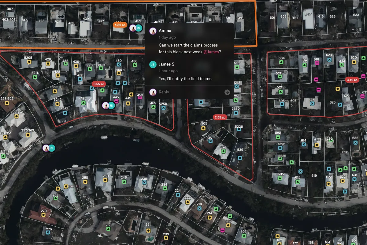
Whether you need to collaborate in real-time or embed on a site for feedback, Felt makes sharing easy.
Felt's robust permissioning systems and security measures scale with your team.


GIS (Geographic Information Systems) software is a digital tool that captures, stores, analyzes, and displays geographic data to help users understand spatial relationships and make location-based decisions.
Felt is a modern cloud-native GIS software that makes it easy for teams to create online maps.
Felt is the fastest way to create an interactive map that are easy to share and edit in real-time. Upload data to our GIS software, comment and share with a single link to begin collaborating on online maps.
Felt makes it simple to work with geographic boundary data or custom boundary data that you add from Felt's library layers.
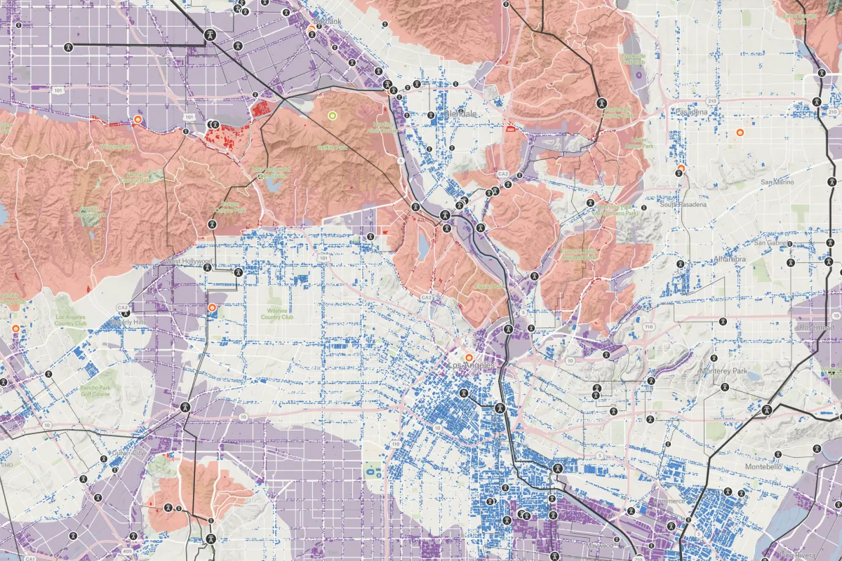
Combine geographic boundary data with custom datasets to conduct addresses territory mapping, region-based analysis, and analyze demographics.
Felt is the go-to tool for clear regional insights. Connect your database or drag and drop your file on the map to display and analyze boundary data.