37° 48' 15.7068'' N, 122° 16' 15.9996'' W
cloud-native gis has arrived
37° 48' 15.7068'' N, 122° 16' 15.9996'' W
cloud-native gis has arrived
37° 48' 15.7068'' N, 122° 16' 15.9996'' W
cloud-native gis has arrived
37° 48' 15.7068'' N, 122° 16' 15.9996'' W
cloud-native gis has arrived
37° 48' 15.7068'' N, 122° 16' 15.9996'' W
cloud-native gis has arrived
37° 48' 15.7068'' N, 122° 16' 15.9996'' W
cloud-native gis has arrived
37° 48' 15.7068'' N, 122° 16' 15.9996'' W
cloud-native gis has arrived
37° 48' 15.7068'' N, 122° 16' 15.9996'' W
cloud-native gis has arrived
37° 48' 15.7068'' N, 122° 16' 15.9996'' W
cloud-native gis has arrived
37° 48' 15.7068'' N, 122° 16' 15.9996'' W
cloud-native gis has arrived
Build mapping apps 6x faster with Felt's new APIs Learn more

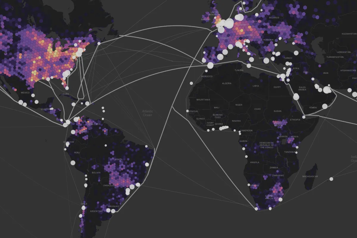
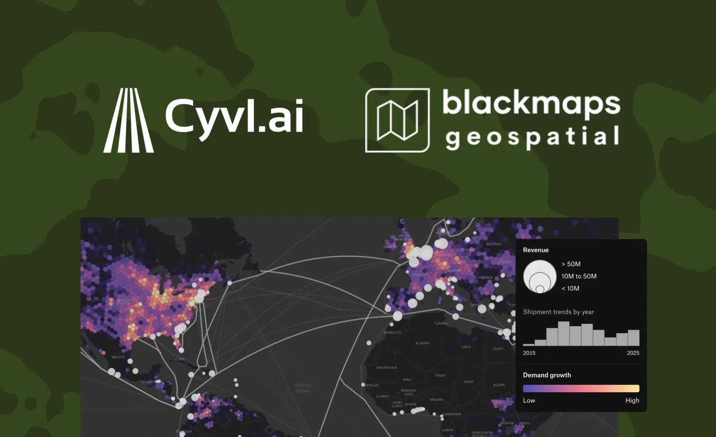
Advanced mapping solutions for spatial intelligence

Felt's powerful mapping platform makes it easy to build maps, apps and dashboards with exceptional speed and simplicity, letting your teams focus on impact rather than implementation.

Island-like shape.

Specifically designed to address the unique challenges of the spatial intelligence sector

View live map
Make complex data immediately accessible and actionable
View live map

Showcase your data without a line of code

Felt’s intuitive mapping platform helps spatial intelligence teams collect, process, and deliver data directly to clients entirely in the cloud.

Accelerate your roadmap with workflows that scale

Felt’s collaborative platform makes it easy to scale QA/QC, data science and data monitoring workflows across the team, so you can focus on impact.
View live map
Streamline road condition validation with collaboration
View live map
View live map
Combine maps and charts to power interactive spatial analytics
View live map

Focus on impact, not infrastructure

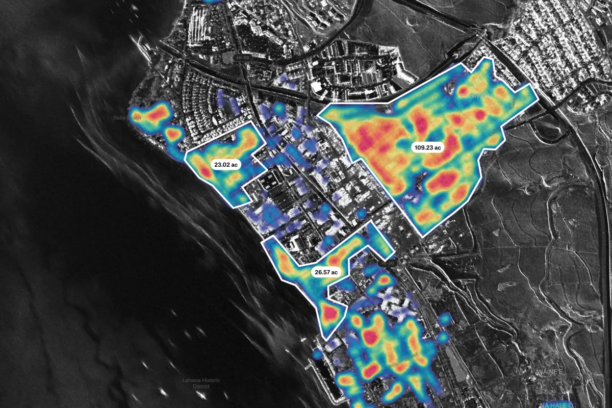
Quickly build, automate and launch custom mapping tools for location analytics, visualization, and spatial data processing—without the bottlenecks of traditional development cycles.

Make your source-of-truth accessible to those who rely on it daily.

Amazon S3
BigQuery
Databricks
ESRI
Google Cloud
Microsoft Azure
MS SQL
Postgres
Snowflake
STAC
WMFS
WMTS

Faster project delivery

$2.6M

Average annual cost savings

95%

Less time spent on maintenance
Start creating maps today