Skip to content
LAT37.8044° NLON122.2711° WX-13611157 mY4551831 mE564166 mN4184363 mE6050014 ftN2120204 ftBRG041.0°041.0°040.6°042.1°ZOOM11.0CRS
← Gallery
Emergency response

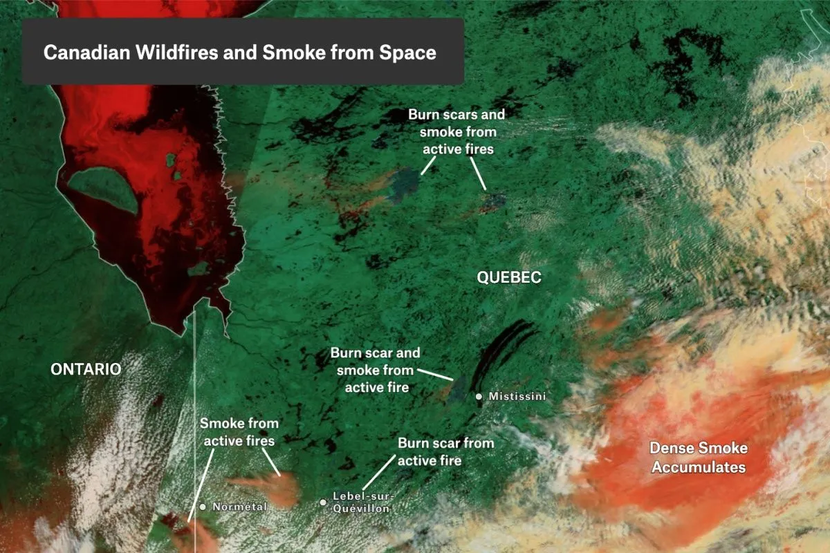
Canadian Wildfires and Smoke from Space

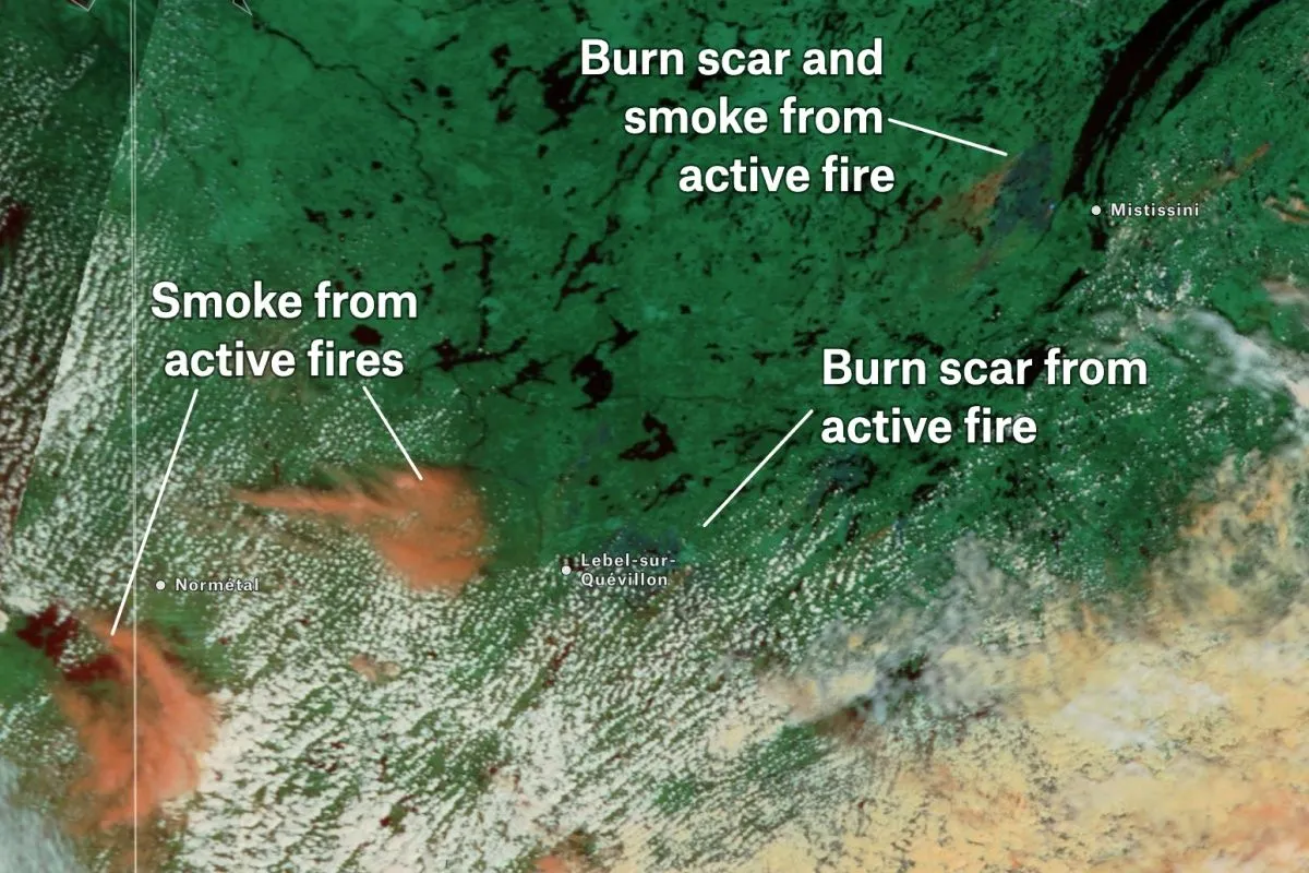
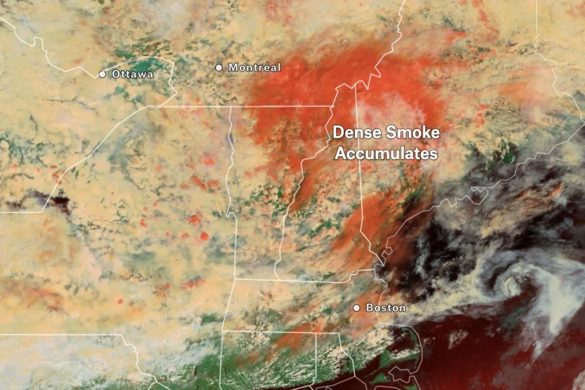
The Terra MODIS 3-6-7 Color Reflection composite from NASA aids in detecting active fires and assessing the extent of smoke plumes. Using Felt annotations, these areas can be highlighted on the image contributing valuable insight into Canada’s worst wildfire season and its impact on air quality.

Preview of Canadian Wildfires and Smoke from Space, an interactive Felt mapExplore this interactive map →
Canadian Wildfires and Smoke from SpaceOpen in Felt →
CartographerFeltCategoryEmergency response

The Terra MODIS 3-6-7 Color Reflection composite from NASA aids in detecting active fires and assessing the extent of smoke plumes. Using Felt annotations, these areas can be highlighted on the image contributing valuable insight into Canada’s worst wildfire season and its impact on air quality. Take this hands-on tutorial to recreate this map and start annotating your imagery in Felt.
More views

Try Felt

Bring your data, see it on the map

Connect a database or drop in a file and see your data live on a map in minutes.