Skip to content
LAT37.8044° NLON122.2711° WX-13611157 mY4551831 mE564166 mN4184363 mE6050014 ftN2120204 ftBRG041.0°041.0°040.6°042.1°ZOOM11.0CRS
← Gallery
Emergency response

Mauna Loa Hazard Zones

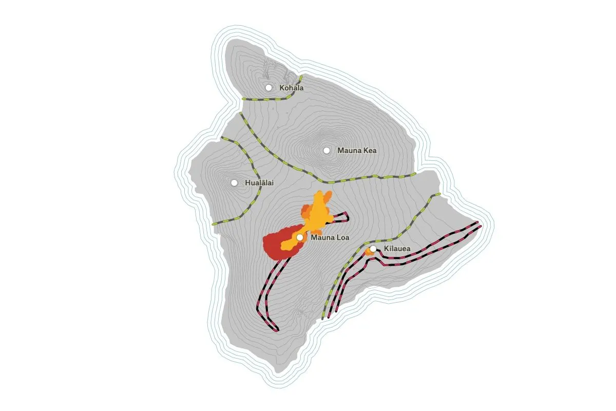
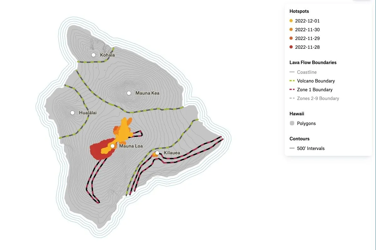
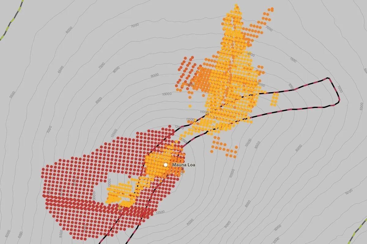
Lava flow hot spots from the 2022 eruption of Mauna Loa on the island of Hawai'i.

Preview of Mauna Loa Hazard Zones, an interactive Felt mapExplore this interactive map →
Mauna Loa Hazard ZonesOpen in Felt →
CartographerFeltCategoryEmergency response

In 2022, Mauna Loa, the world’s largest active volcano, erupted, spewing molten lava down its slopes and into the surrounding areas. The eruption was a serious hazard for the people of Hawaii, and local authorities were quick to respond. This map displays the eruption using data from VIIRS Active Fire Product to track the hot spots, and determine the hazard zones using data from the State of Hawai’i’s open data portal.
More views

Try Felt

Bring your data, see it on the map

Connect a database or drop in a file and see your data live on a map in minutes.