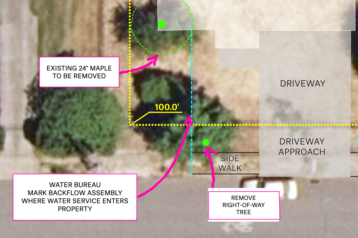
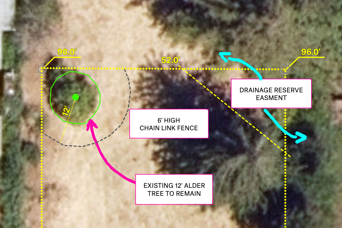
Felt makes it easy to add annotations or vector files to your high-resolution imagery. For instance, you could overlay a site plan onto an aerial image of the City of Portland, providing a comprehensive view of your project area. In so doing, your partners are set up to duplicate the map and add relevant data sources for their particular use case and expertise.


