37° 48' 15.7068'' N, 122° 16' 15.9996'' W
cloud-native gis has arrived
37° 48' 15.7068'' N, 122° 16' 15.9996'' W
cloud-native gis has arrived
37° 48' 15.7068'' N, 122° 16' 15.9996'' W
cloud-native gis has arrived
37° 48' 15.7068'' N, 122° 16' 15.9996'' W
cloud-native gis has arrived
37° 48' 15.7068'' N, 122° 16' 15.9996'' W
cloud-native gis has arrived
37° 48' 15.7068'' N, 122° 16' 15.9996'' W
cloud-native gis has arrived
37° 48' 15.7068'' N, 122° 16' 15.9996'' W
cloud-native gis has arrived
37° 48' 15.7068'' N, 122° 16' 15.9996'' W
cloud-native gis has arrived
37° 48' 15.7068'' N, 122° 16' 15.9996'' W
cloud-native gis has arrived
37° 48' 15.7068'' N, 122° 16' 15.9996'' W
cloud-native gis has arrived
Ask a question. Get a map. The new era of GIS, powered by Felt AI.
Learn more
PLATFORM
Web GIS
Dashboards
Cloud Sources
App Development
Raster
Felt AI
Field App
Industries
agriculture
Cities and Government
CLIMATE and NATURAL RESOURCES
Education
Energy and Utilities
Engineering and Infrastructure
Insurance
Real Estate
Retail
Spatial Intelligence
Telecom
Transportation
Resources
Customers
Webinars
Help Center
Developer Docs
map Gallery
Blog
QGIS Plugin
PRICING
BOOK A
DEMO
Log in
Sign Up
Log in
SIGN UP
Book Demo
Pricing
Product
WEB GIS
Dashboards
Cloud Sources
App Development
Raster
Felt AI
Field App
Industries
agriculture
Cities and Government
CLIMATE AND NATURAL RESOURCES
Education
Energy and Utilities
engineering and infrastructure
Insurance
Real Estate
Retail
Telecom
Transportation
Spatial Intelligence
Resources
Webinars
Help Center
Dev Docs
Map gallery
Customers
BLOG
QGIS Plugin
Map Gallery
Planning
Felt Picks
Our selects for maps that we love, whether they’re useful, interesting, beautiful, or just unique.
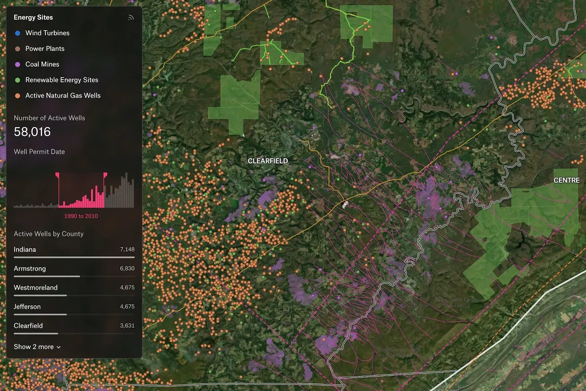
Energy Dashboard
A sample dashboard from an energy company that tracks renewable energy sites, active natural gas wells, and well permitting time series data. Natural features like tectonics are also included, along with historical imagery from NAIP for highlighting temporal trends.
Buenos Aires Real Estate Valuations
Ever wondered about the price of housing in Argentina? Real estate company Nemchin has put together an interactive map of prices per square-meter for different types of apartments in Buenos Aires.
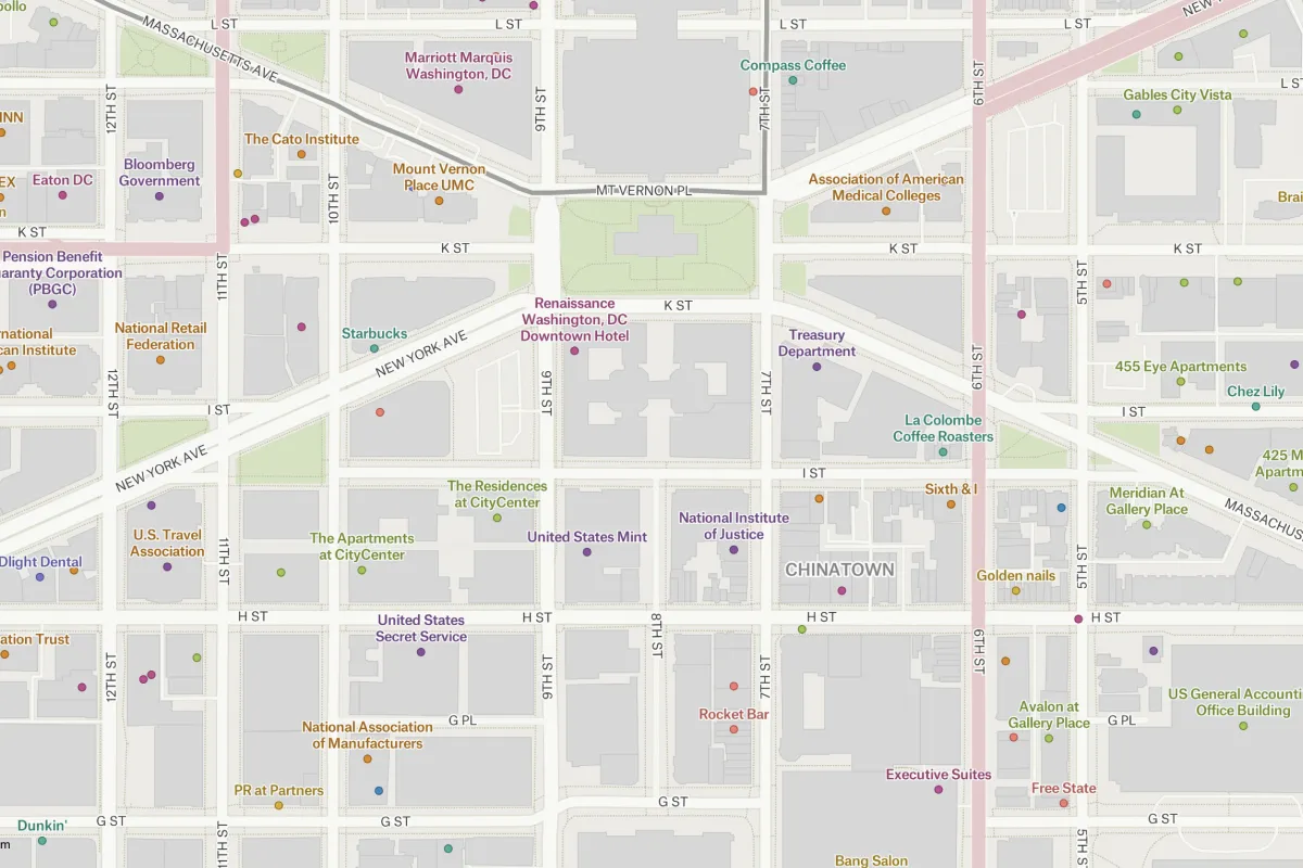
Overture Places of Interest, Washington, D.C.
This map applies Felt's powerful zoom-based styling tools to Overture Maps Foundation POI data, providing our users with a template for polishing and presenting POIs.
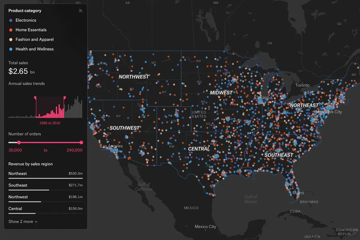
Sales Performance Dashboard
Measure sales performance across territories in the USA. Filter by: sales trends, revenue by region and sales rep, order volume, and more.
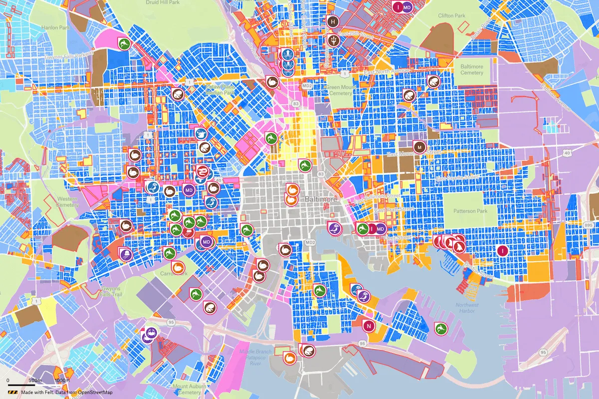
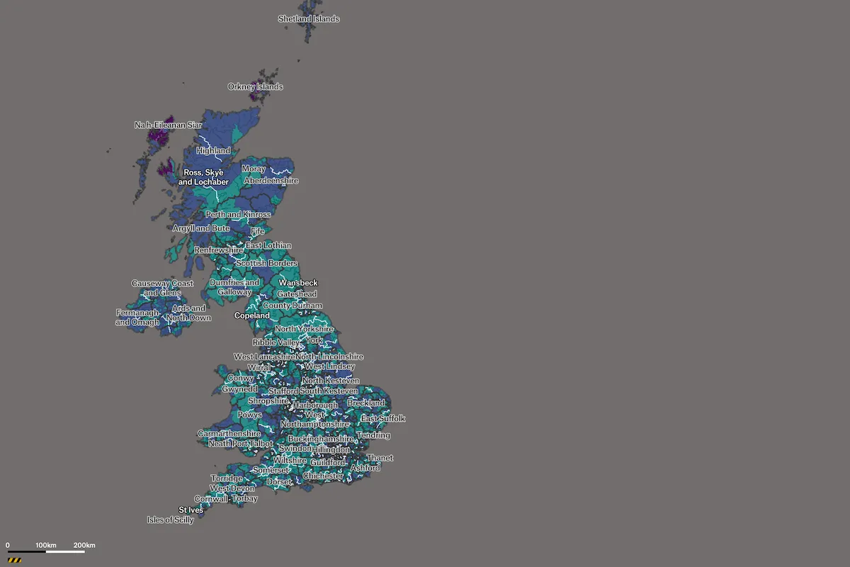
Baltimore City Land Use Map
The City of Baltimore released its first Comprehensive Plan since 2006 to guide policies, programs, and land use changes, for the next decade. As part of the initiative, the city built a land use proposal map in Felt to gather feedback from the public – from residents, to city agents, to the real estate community.
Nashville Zoning Expansion Map
This map illustrates the proposed expansion of Nashville's Adaptive Residential zoning provision by highlighting affected parcels. It ncludes a breakdown by district, and affordabie housing unit data from 1987 to 2024 to visualize trends.
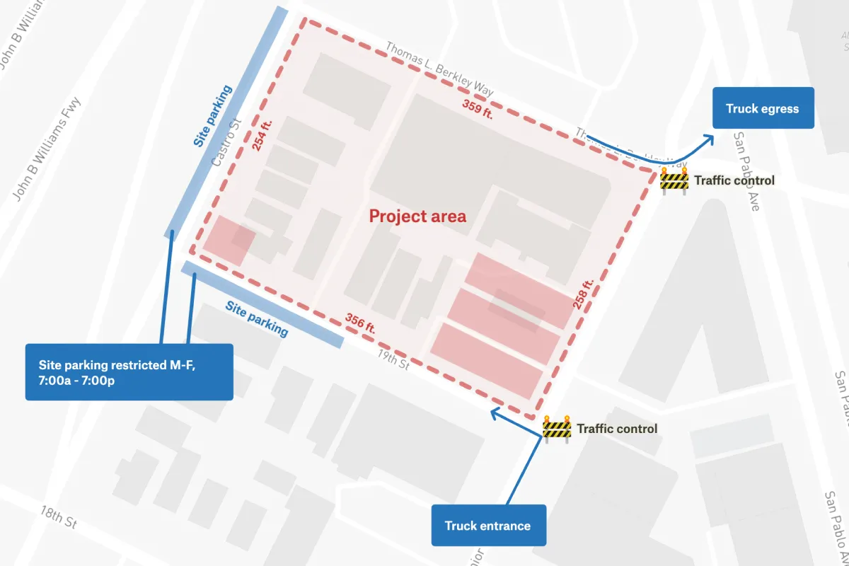
Construction Site Plan
A construction site plan which clearly communicates entrance, egress, and lot size to stakeholders.
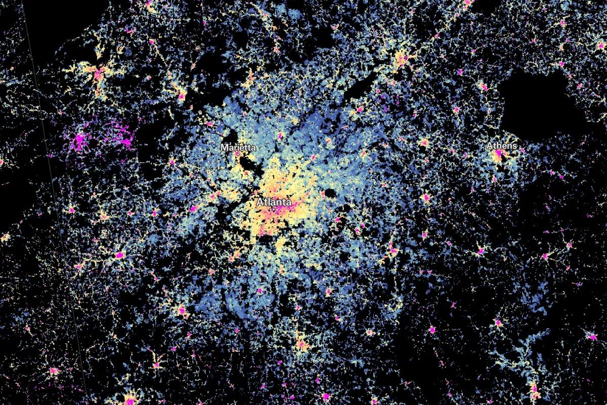
Urbanization Analysis
An analysis of urban development across America.
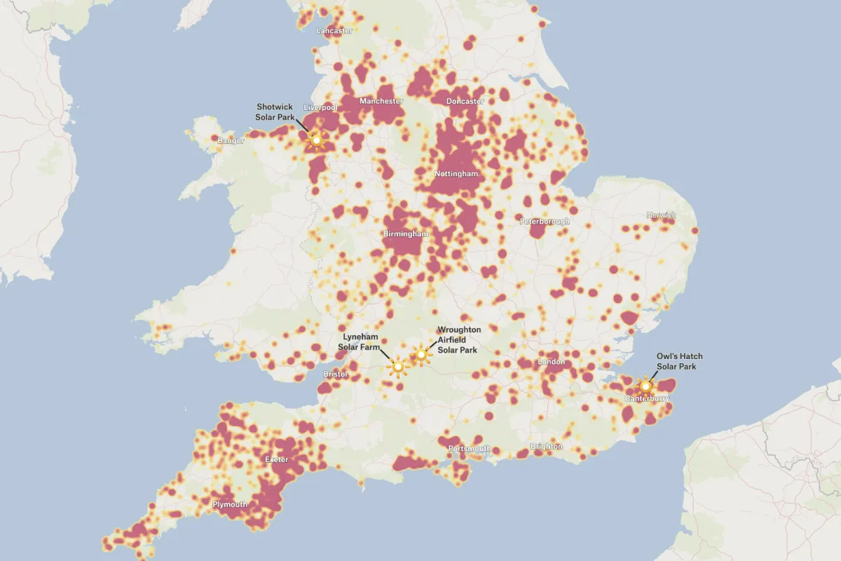
Solar Panels and Solar Farms in the United Kingdom
This heat map shows the density of solar panels and solar farms across the United Kingdom using Geographic Open Data (UKPVGeo).
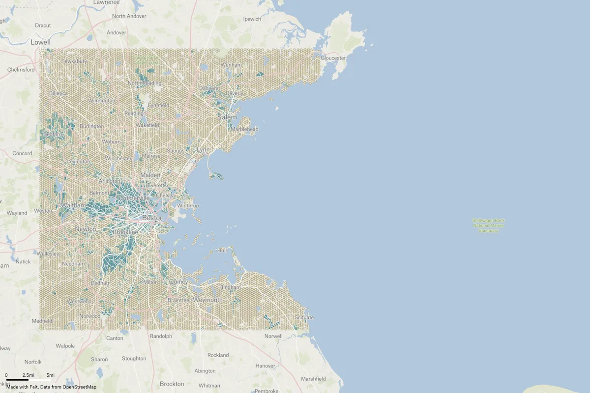
OSM Pedestrian Density Visualization
This project showcases an innovative approach to visualizing pedestrian mapping quality in OpenStreetMap (OSM) data using QGIS and Felt. The creator Martijn Van Exel developed a method to calculate a "quality index" based on the ratio of pedestrian infrastructure to total road network length, displayed in visually appealing hexagonal grids. By leveraging open-source tools and Felt's user-friendly platform, the project demonstrates how complex spatial analysis can be transformed into interactive, easily shareable maps for urban planning and pedestrian infrastructure assessment.
Minimum Digital Living Standard (MDLS) Population Study
The Nuffield Foundation created a geographic model to estimate MDLS (Minimum Digital Living Standard) rates for local areas, with a focus on households with children in the UK, to inform policy debates and moving beyond measures of digital access and skill.
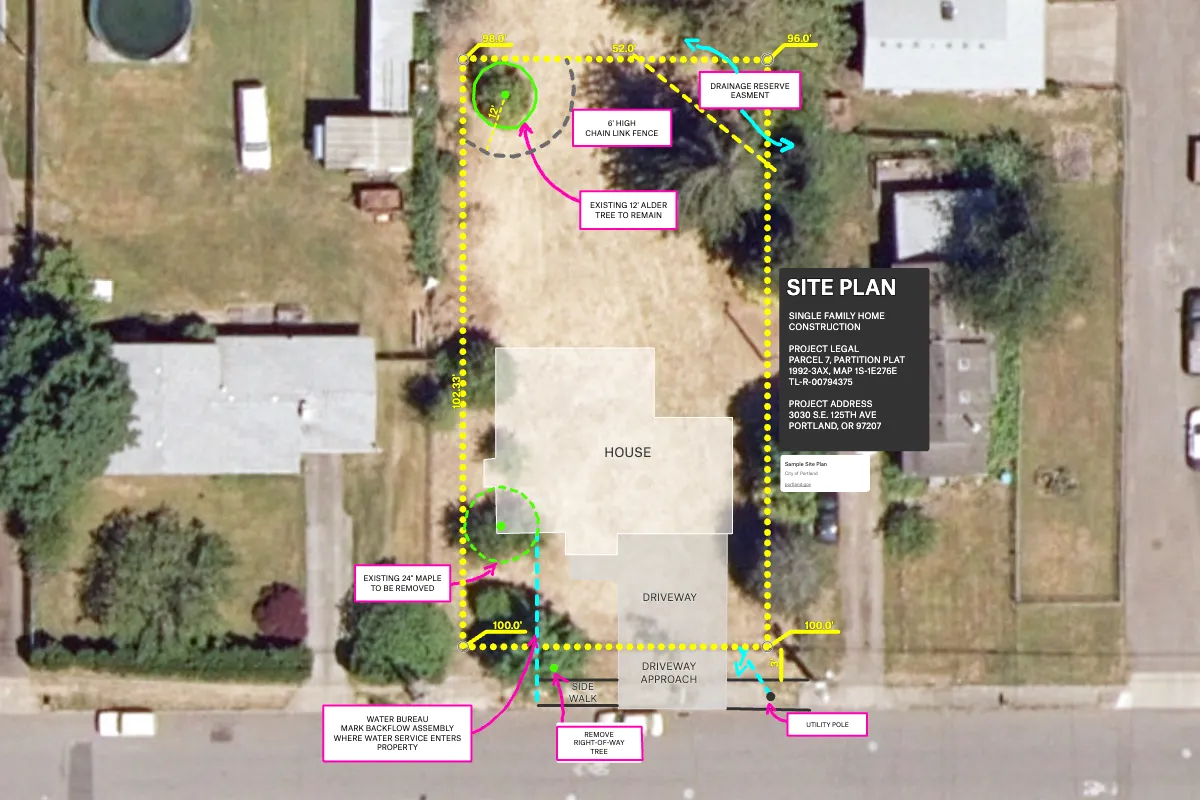
Portland Residential Site Plan
Upload vector files or annotate with Felt’s tools on top of your high-resolution imagery, like this site plan over City of Portland aerial imagery.
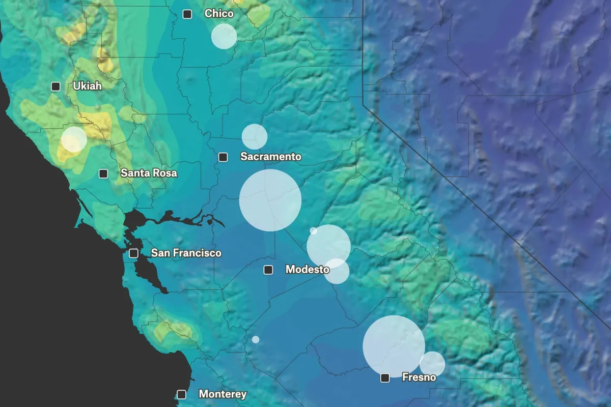
California Reservoirs
The percentage of reservoir capacity utilized in State of California in January of 2023.
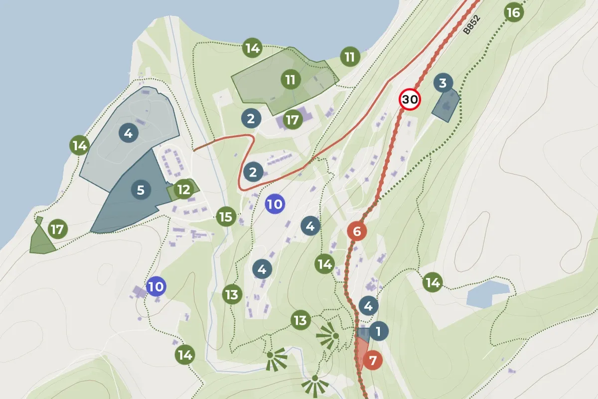
Stratherrick and Foyers Local Place Plan
Small town community planning consultant Nick Wright used Felt to depict the focus area for a Local Place Plan. The overall map showcases the general service areas, while the zoomed-in views provide the locations of planned projects aligned with the community's general principles.
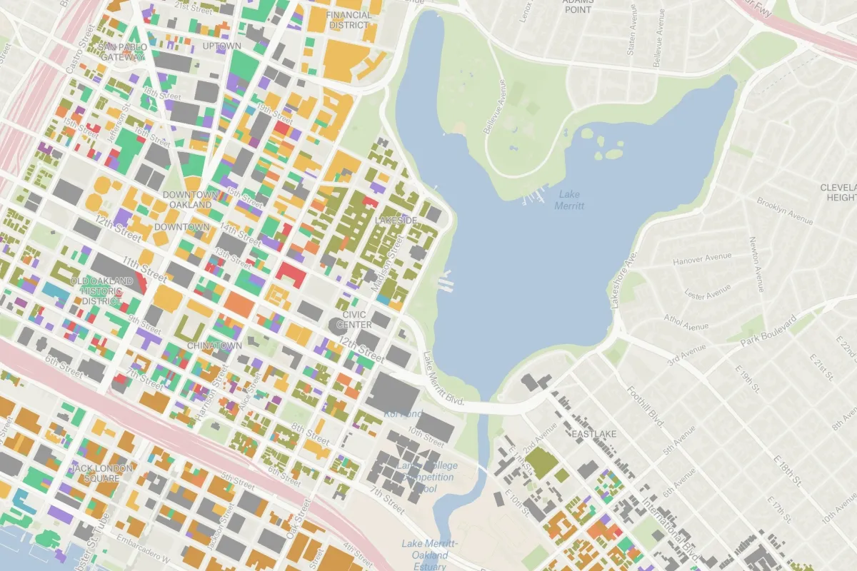
Oakland Building Use
Buildings displayed by their permitted use in Oakland, California.
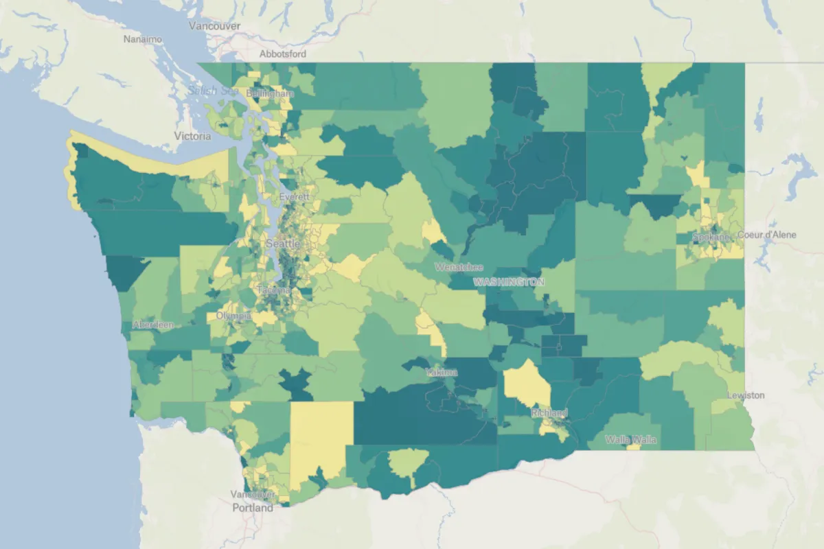
Social Vulnerability Index
The social vulnerability index for Washington State's population.
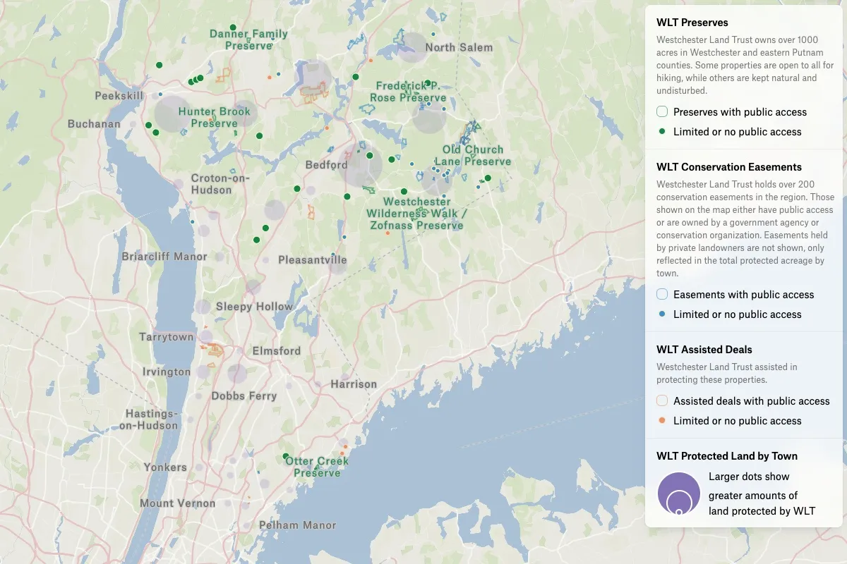
Westchester Land Trust Impact Map
Land protection is one way to combat climate change. The Westchester Land Trust is making a big impact in New York State and using Felt to tell their story on their brand new website.
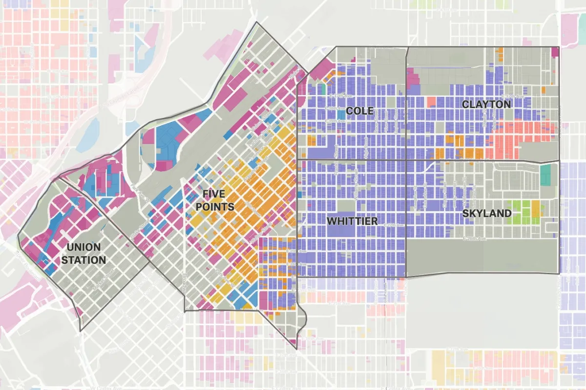
Denver Parcels Study Area
Parcel data from the City and County of Denver Colorado.
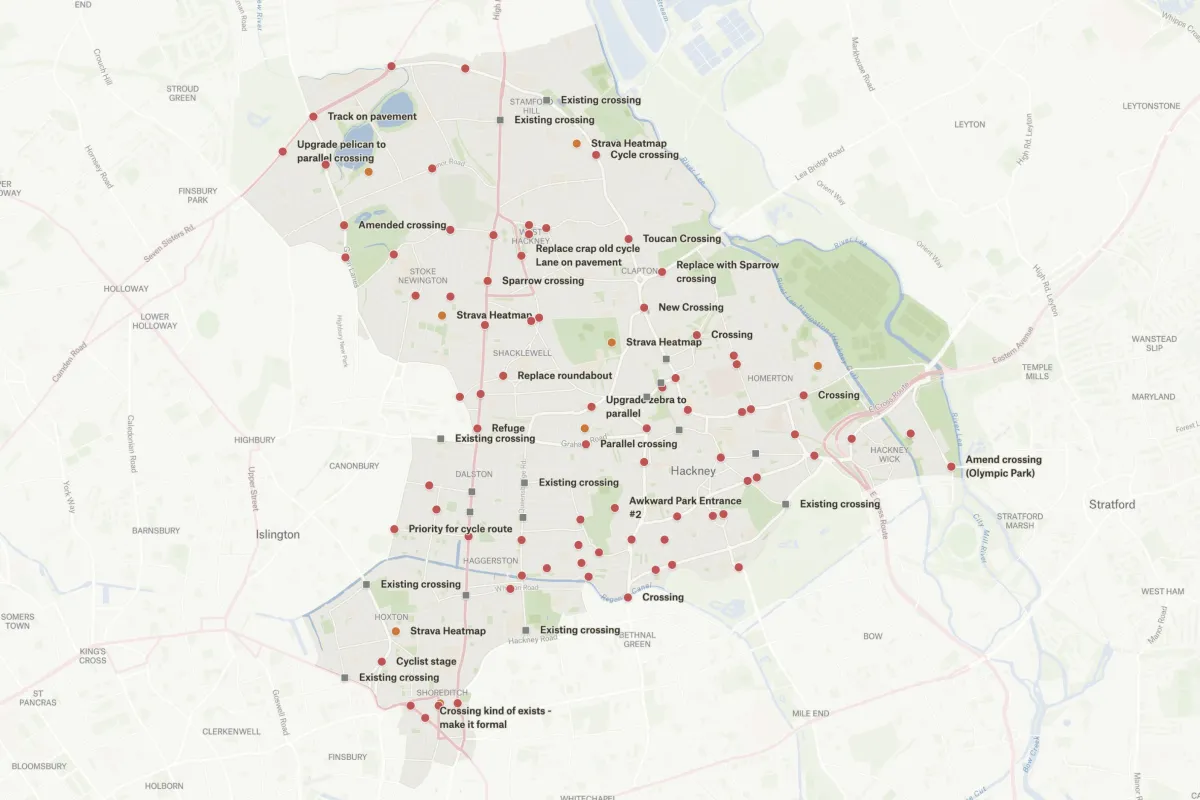
Cycling Improvements Campaign
Task force collected data to improve cycling intersections in Hackney, London.
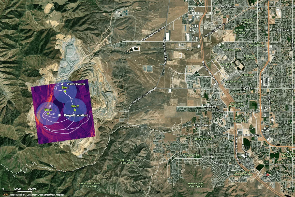
Resource Staging Plan
For mining operations in challenging terrain, this example map showcases a resource staging plan with Umbra SAR (satellite) imagery, local road routing, and powerful transformations in Felt like Buffer to create detailed visualizations of the staging sites.
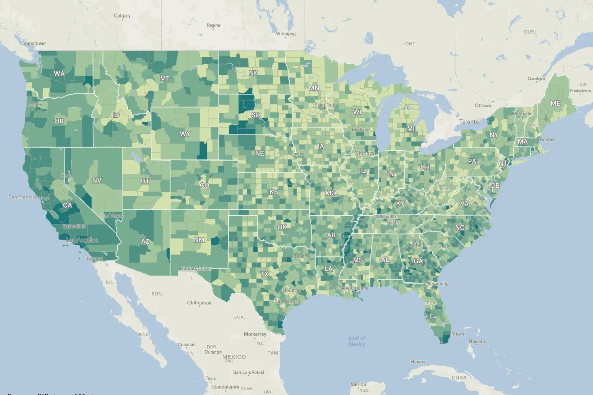
Percent Occupied Housing Units
The percentage of occupied housing units in the United States by county.
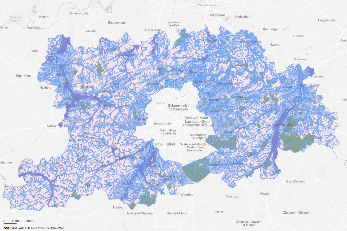
Brussels Densification Study
Atelier Romain is a team of urban planners, landscape architects, geographers and architects, who specialize in complex spatial research and design issues from built to open space. They've been using Felt to identify areas suitable for densification around Brussels, Belgium.
Categories
Agriculture
Cities and government
Climate and natural resources
Emergency response
Energy and utilities
Exploration
Finance
Insurance
Planning
Real estate
Spatial intelligence
Telecom
Transportation