


Belle Lipton is the GIS Outreach Librarian at Harvard Library's Map Collection. With a background in geospatial web development and library science, she specializes in making spatial data and GIS tools accessible to students and researchers across various disciplines.
In spring 2024, Lipton teamed up with Professor Joyce Chaplin to teach the spatial component of Chaplin’s Re-wilding Harvard course. Re-wilding is a history course and is described in the course guide as “return[ing] a place to an earlier form to promote biodiversity.” To be successful, the students would need to understand Harvard’s historic form. Lipton knew of tons of maps in the collection that could ground the student’s research and set about preparing an engaging 4-part course and workshop for them to be successful.
Time to success is always an important factor when planning a workshop for non-GIS students. One of the challenges of working with old maps is visualizing them quickly. While the collection has tons of digitized maps that would formulate the basis for her analysis, easily viewing geotiffs or XYZ file formats would require time spent getting each student’s desktop GIS set up with plug-ins or add-ons. With only four short sessions available to her, this was out of the question.
Lipton, a librarian, is always thinking about building on existing data. She empresses on her students that the spatial data created should be preserved in open, accessible formats for long-term use. Proprietary desktop GIS systems do not always allow for this, and it was important to her that she utilized a tool that could work with and export in open formats. Lipton needed a platform that would make it easy to visualize GeoTiffs and allow for exporting in an open format.
This led Lipton to Felt. Using Felt’s free Classroom plan, her students could easily upload any file to the platform without installing anything.
“Felt let us tackle learning certain GIS competencies in classes where time was limited; it allowed us to engage in ways that would have been much more challenging without Felt.”
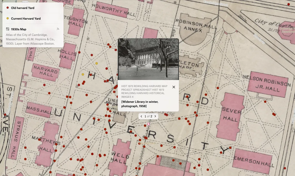
Additionally, Felt’s collaborative platform made each student’s work build on the others, instead of being stuck in isolation on their individual desktops. Lipton asked students to drop their georeferenced atlas data on the a single Felt map and enjoyed watching all the data come in live, now available to the entire class as-needed:
“I felt like I was this orchestra conductor. I was like, okay, now everyone upload to Felt and –boom- the maps were all popping up at the same time. It was great to be able to have students all working together.”
By creating incredibly engaging GIS coursework, Lipton and Chaplin saw 85% of the students, many of whom did not have a greater background in GIS, opt to use GIS as part of their final projects. You can check out the incredible results here.
By incorporating Felt into her teaching toolkit, Lipton has been able to make the engaging part of GIS more accessible.
