Spatial work just changed permanently
For forty years, asking a spatial question meant finding someone who knew GIS. You described what you needed. They opened a desktop application, tracked down the right datasets, converted file formats, ran the analysis, and sent you a PDF three days later. If you wanted something different, you went back to the end of the queue.
That workflow shaped entire careers. People spent years mastering the tools, the projections, the data sources, the formats. And that expertise built real value. Decisions got made. Infrastructure got built. Risks got identified. The constraint was always the same: spatial intelligence moved at the speed of the specialist, not the speed of the question.
AI changed the expectation. Every other kind of knowledge work moved into chat over the past two years. Your team drafts emails, writes SQL, builds presentations, and queries databases through natural language. Spatial is the last holdout. Ask an LLM for a map today and you get hallucinated addresses and a Leaflet snippet nobody would put near production data.
The gap between what AI can do everywhere else and what it can do with spatial data is the largest unresolved mismatch in enterprise software. Felt AI closes it.
This is a fundamentally new way to do spatial work.
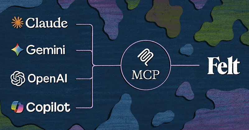
Last year, we brought AI to the parts of the product where you write code: custom extensions, SQL queries, popups.
Today we’re introducing something much bigger. One conversational agent. Dozens of AI capabilities. Connected to your warehouse, your data sources, and the largest catalog of authoritative public geospatial data on the internet.
Type a question. Get an interactive map your whole team can open, filter, and build on.
The spatial bottleneck was never the analysis
Every organization has spatial questions. Which assets sit in flood zones. Where should we expand next. Which neighborhoods lack service coverage. Getting those answers has required a GIS specialist, a desktop tool, and a timeline measured in days or weeks.
The bottleneck was never the analysis itself. It was finding the data, preparing it, loading it, and getting it into a system where anyone could ask a question.
Felt AI collapses that entire chain into a conversation. You ask, and the agent works from the authoritative data you've already connected: Snowflake, BigQuery, Databricks, Postgres, etc. It fills any gaps from the Global Library, a curated index of public datasets from USGS, NOAA, FEMA, and dozens of other agencies. Our powerful new query language joins everything in one pass, runs the analysis, and styles the result. The output is a live, shareable URL, already governed by your workspace permissions.
Your GIS team built the maps and connected the data sources that make this possible. Felt AI lets the rest of the organization ask questions against that work without filing a ticket.
From question to map with just a prompt
Step 1: Ask the question
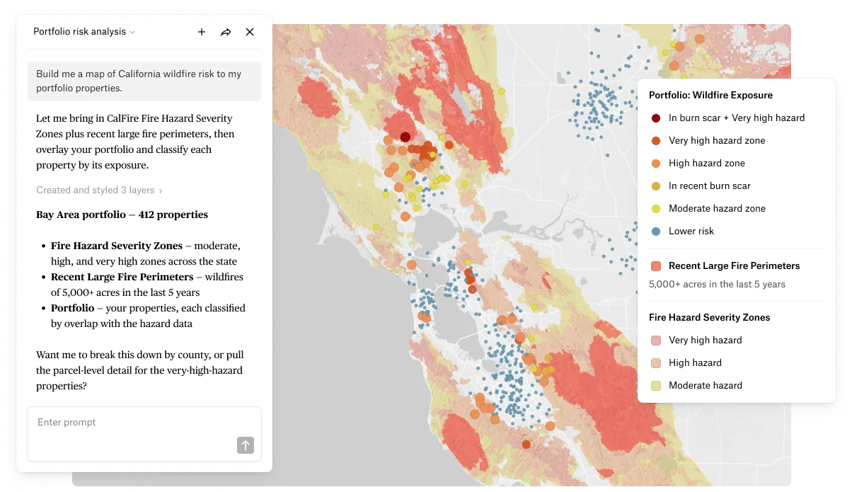
"Build me a map of California wildfire risk to my portfolio properties."
Step 2: The agent finds the data
The CalFire Fire Hazard Severity Zones endpoint is validated and imported along with recent large fire perimeters. Your property portfolio is already connected through Databricks.
Step 3: Refine the analysis
"Spatially join each property to the hazard zones and burn scars, then style the portfolio locations by risk tier."
Step 4: Share it
"Summarize the exposure by hazard tier and share the map with the underwriting team."
Four prompts. A multi-layer spatial analysis against authoritative public hazard data, warehouse property data, and styled visualization. Live URL at the end. No GIS software opened. No file downloaded. No projection converted.
How Felt AI works under the hood
Data from your systems
Felt AI reads directly from your warehouse. It generates queries that execute against your infrastructure. The agent inherits user permissions through SSO and RBAC. If a user can't see a layer, the AI can't query it. Full audit logging at the Enterprise tier.
Our Global Library eliminates the data scavenger hunt
One of the hardest parts of spatial work has always been finding the right dataset, downloading it, converting formats, and loading it. The Global Library is a curated catalog of authoritative public sources, validated and ready to query. The agent reaches for it when your own data doesn't cover the question, then analyzes both together.
All the power, none of the model building
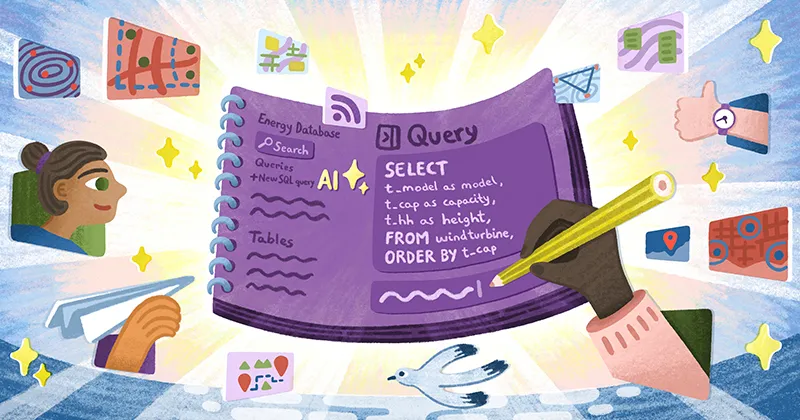
Felt AI reads schemas, understands SQL dialects across Databricks, Snowflake, BigQuery, and Aurora PostgreSQL, and generates spatial queries from scratch. Nobody needs to pre-build a workflow or template before the agent can answer a new question. A powerful new query language introduces a whole new way to do analysis through natural language.
A hundred million features render at interactive speed
AI-generated queries are only useful if the results render at scale. Felt handles 100M+ features with sub-second performance in the browser. No desktop app. No tile pre-generation. The same prompt that maps a thousand points maps a million.
GIS teams stay in control
Your spatial engineers curate the maps, connect the data sources, and set the governance standards. Felt AI answers questions against what they've built. The routine one-off requests that eat their week get handled by the agent. They focus on data modeling, pipeline architecture, and the analysis that requires domain expertise.
A new GIS superpower, at your fingertips
A single prompt to Felt AI often lands the answer. From there, you can continue to refine and explore by asking. "Now exclude the flood zones." "Add the demographics layer." "Why is this cluster ranked highest?" Felt AI holds context across every turn, so each refinement builds on the last instead of starting over.
Dozens of capabilities, one agent
Felt AI orchestrates dozens of functional categories across three tiers:
Understand the question before acting: schema discovery across your layers, conversational refinement with the user, and dialect-aware SQL guidance for your specific warehouse.
Act on the question: connect to your data warehouses, discover data through the Global Library, write queries, run spatial analysis (buffer, join, aggregate, classify), and generate map styles automatically.
Deliver the answer: create and manage maps, build interactive extensions and dashboard components, and control the viewport to focus on what matters.
These capabilities share a single conversational interface. You ask a question. The agent decides which capabilities to invoke, in what order, and delivers the result.
What this means for your team
Your GIS team stops fielding one-off map requests and starts building the spatial data platform that powers self-serve access across the organization. The routine questions that filled their queue get answered by the agent, through the same maps and data standards they maintain.
Operations teams get spatial answers in their workflow. "Which substations are within 2 miles of active wildfire perimeters" returns a live map, not a ticket number.
Analysts turn natural language into interactive geographic applications inside the same environment they use for everything else.
Leadership gets spatial context in decisions that were previously made without it, because the turnaround dropped from weeks to minutes.
Felt AI is available today
If your organization has spatial questions and a GIS team that deserves better than a request queue, we want to talk.
Compare Felt using AI