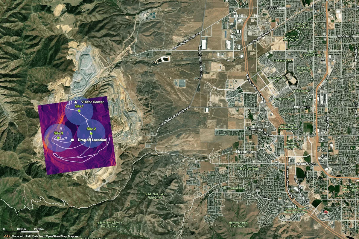
Felt's GIS platform supports engineering and infrastructure teams by integrating geospatial data, drone imagery, and AI-powered visualizations to plan sites, track progress, and manage complex projects with accuracy across workflows.

Make your source-of-truth accessible to those who rely on it daily.


The 7 stages of construction projects typically include project conception, planning and design, preconstruction, procurement, construction, closeout, and post-construction. Across these phases, teams use construction mapping software, BIM, and GIS workflows to visualize sites, coordinate data, improve accuracy, and manage construction projects from early feasibility through final delivery.
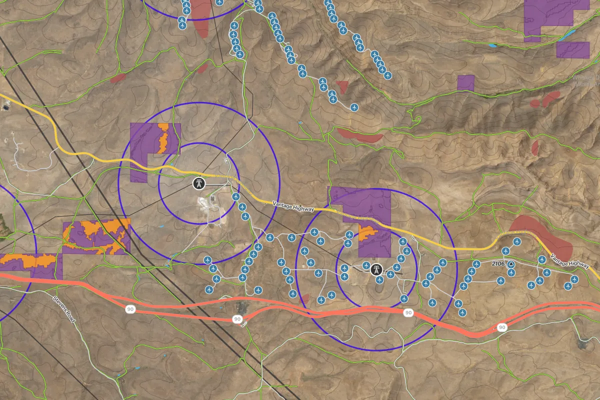
Spatial data helps teams visualize sites, coordinate workflows, and improve accuracy across construction projects. By combining GIS, BIM contexts, and drone imagery, platforms like Felt enable real-time collaboration, mapping, and better infrastructure planning.
The four main types of construction are residential, commercial, industrial, and infrastructure construction, though projects can also be classified by sector, ownership, occupancy, or fire resistance. Across all types, teams use construction mapping software, BIM, and GIS workflows to visualize sites, coordinate planning, and manage construction projects with greater accuracy.