SkySat Walvis Bay
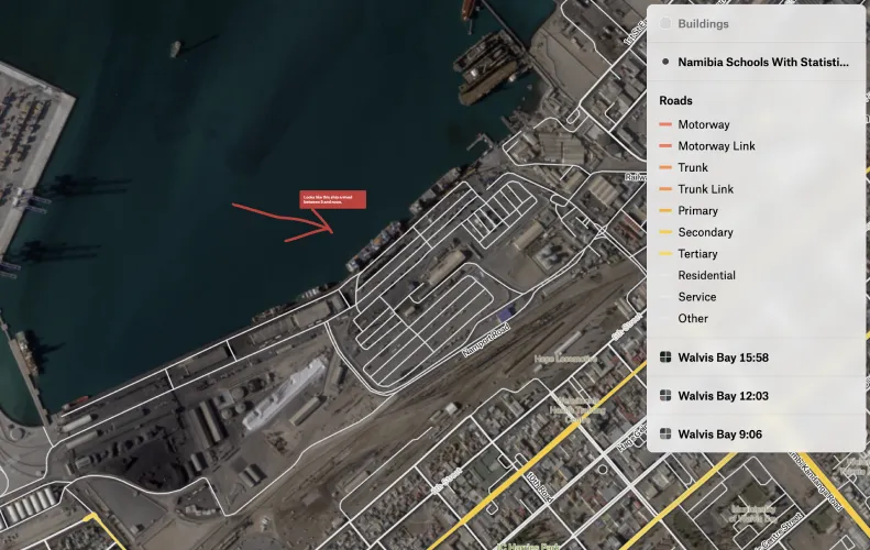
Chris Holmes, Planet's VP of Product, Strategy, and Partnerships, built a Felt map of Walvis Bay (Namibia) — he loved being able to add vector layers, like roads and buildings from Felt's data library, on top of the raster imagery.
California Water History
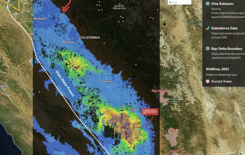
Felt champion Angelica Rodriguez-Arriaga used this map for a lecture on California water history where she highlighted subsidence in California's Central Valley. She added LiDAR data using the new raster capabilities to illustrate this concept. Students didn't have previous GIS experience but it was easy for them to navigate the map Angelica created!
Paterson, New Jersey - Sanborn maps
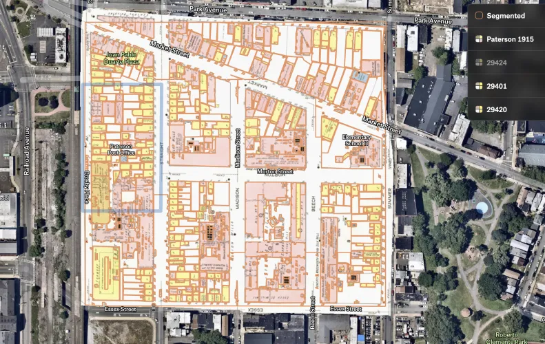
GIS analyst Chris Soriano used a 'Sanborn Fire Insurance' map from 1915 overlaying an aerial map. Also shown are outlines of the buildings from the 1915 map (using Segment Anything Model) so you can compare where the buildings were 100 years ago to where they are today. Much of the factory type buildings are gone now (silk factories, foundries, machine shops), replaced with retail and homes.
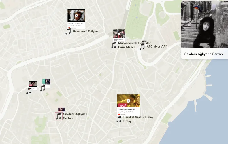
Locations of Turkish music videos from 90's
BBC motion graphic designer Mesut Ersöz created this viral map of Instanbul locations where popular 90s music videos were shot.
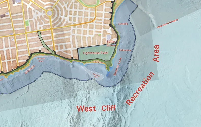
Santa Cruz: West Cliff Recreation Area
Stamen Design and Al Ramadan, Founder & CEO at Play Bigger, built a map of environmental factors impacting Santa Cruz's West Cliff Drive, to aid in planning for its future. They dug into their toolbox to bring this to life and combined QGIS, Blender, and Felt to deliver the final product. You can follow the process of creating this map on Stamen blog.
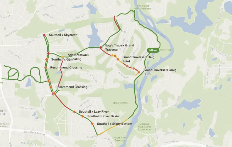
Hedingham Pedestrian Improvements
GIS Technician Katherine Rudzki used Felt to to raise awareness of the pedestrian improvements that can be made in the Raleigh neighborhood.
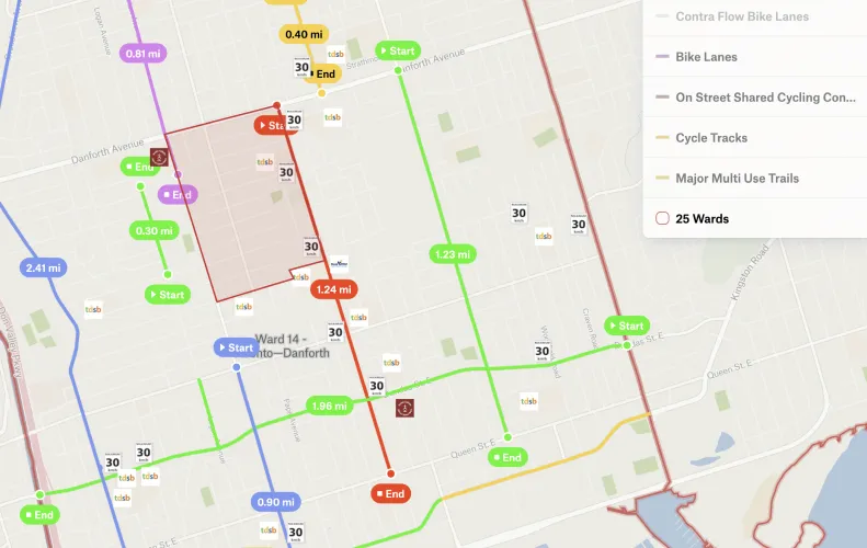
Mobility Upgrade in Toronto Danforth
Lanrick Bennett Jr. worked with volunteers from a Toronto-based organization EastEnd4All to collect ideas on lowering speed limits & upgrading mobility lanes throughout Ward 14.
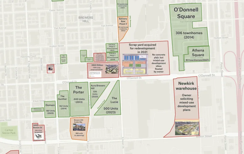
SE Baltimore Multi-Unit Housing Projects
Urban planning enthusiast Ian Wolfe created a Felt map of the multi-unit development projects in the southeast Baltimore.
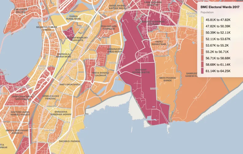
BMC Electoral Wards 2017
Cartographer Arun Ganesh created an interactive electoral ward map of Municipal Corporation of Greater Mumbai with corporator names and population data. This map makes it much easier to find out who's your local representative if you live in Mumbai.
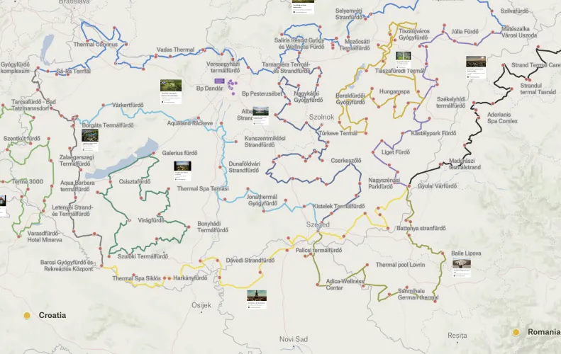
Hot spring based biking network
GIS analyst Márton Leitold built a map that shows the Hungarian thermal waters and the cycling tours around them. If you zoom in on the map you can see the long-distance tours with detailed stage descriptions via the picture links.
Want to share your map and get featured?
We recently launched our new Slack group where you can connect with other folks using Felt. Post your favorite Felt maps in #showoff-your-map channel and we will feature the best maps in the beginning of June!
Compare Felt using AI