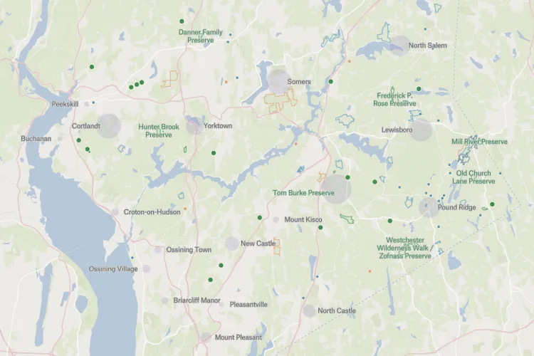
Westchester Land Trust
Westchester Land Trust that owns over 1000 acres in Westchester and eastern Putnam counties (New York). Some properties are open to all for hiking, while others are kept natural and undisturbed. The team built a map of preserves and conservation easements in the region to share it on the trust's website.
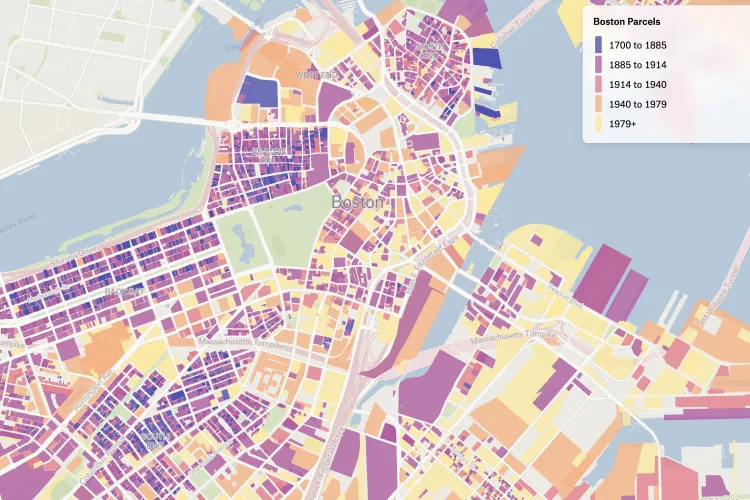
Boston buildings, colored by year built
MuckRock's journalist and developer Chris Amico made a map he has been wanting to create for a while: Boston buildings colored by year built.
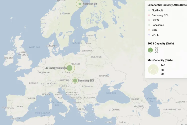
Global Battery Gigafactories
David mapped global battery plants from Ratel Consulting's Global Battery Factory Database so everyone can explore the top ten gigafactories for electric vehicles and renewable energy storage.
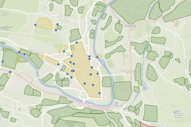
Bath's Existing Liveable Neighbourhoods
Adam mapped the neighborhoods of Bath that feature roads or groups of roads with no vehicular through traffic. You can click on the pins to see photos of the locations.
Monterey County System Status Plan
Jared works as a paramedic in Monterey County, CA. Paramedics have to provide coverage to the entire county, and based on call volume and number of ambulances available, they have to move around to different points. Each “level” of coverage has its own posting locations and distances that they are allowed to roam. The map that Jared created shows posting locations based on system status level.

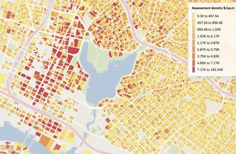
Alameda County Parcels 2022
Jeff had this dataset of the assessment density, dollars per ground area, of every parcel in northwest Alameda County locked away for many years. He was delighted to learn he could share it with other YIMBYs via Felt and enable housing advocates to duplicate it for their own purposes.
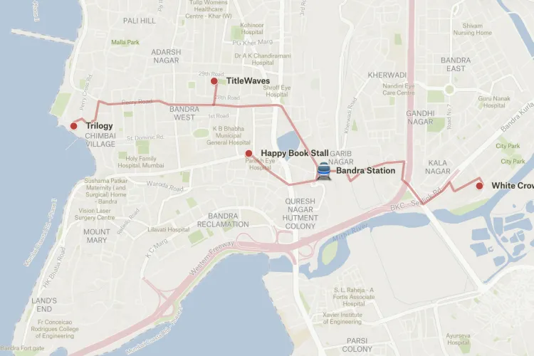
Mumbai Bookshops
Mumbai Paused is working on a map of Mumbai bookshops with walking routes to the nearest train stations. Let them know your favorites and they will add them to the map.
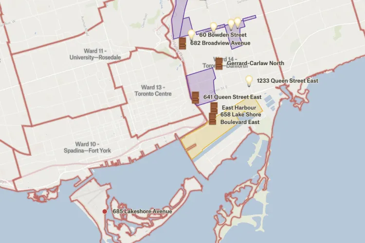
Building Housing in #TorontoDanforth
Lanrick mapped the proposed development of affordable housing on Danforth Avenue in Toronto.
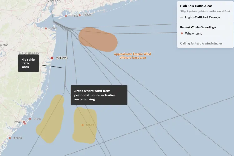
Whale Strandings 2022-2023
Investigative Data Editor Stephen Stirling created a map to better understand the cause of recent whale strandings on the East Coast.
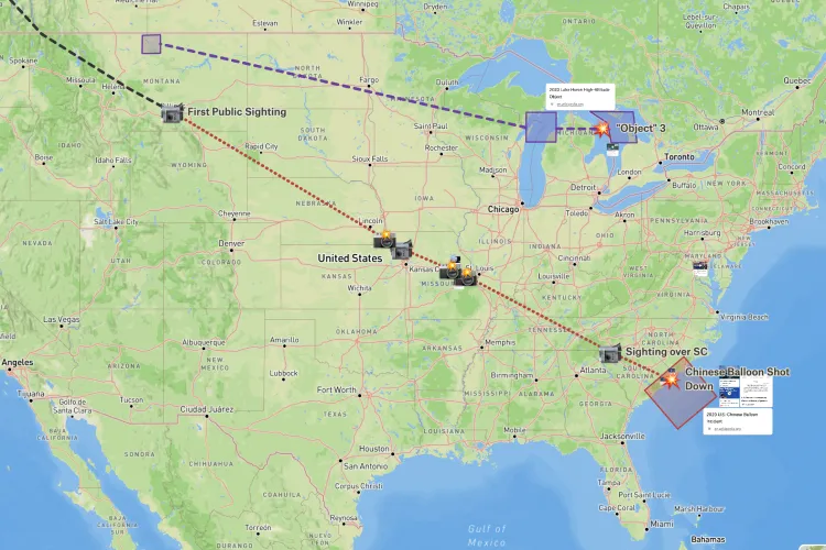
2023 High-Altitude Object Incidents
David created an interactive map for some of the high-altitude aerial "objects" that have gotten attention in February. You can press on any line, polygon, icon, or link on the map for more information.
Want to share your map and get featured?
We recently launched our new Slack group where you can connect with other folks using Felt. Post your favorite Felt maps in #showoff-your-map channel and we will feature the best maps at the end of March!
Compare Felt using AI