.webp)
Enterprises are dealing with unprecedented volumes of location‑centric data. Until recently, geospatial analysis was largely the domain of specialized GIS software or bespoke web applications—tools that were difficult to integrate with modern data platforms and time‑consuming to operate.
We’re excited to announce that Felt is now an official Databricks partner, bringing a more unified approach to spatial analytics on the Lakehouse. By combining Databricks’ scalable data platform with Felt’s cloud‑native GIS, organizations can visualize data, build interactive maps and perform spatial analysis within a single ecosystem.
How geospatial mapping works with Databricks & Felt
With this partnership, you can turn your Databricks tables into the powerful backend of your dynamic web GIS, map dashboards and native mapping applications.
“Felt makes GIS easy and fast – you can go from a table in your Lakehouse to an interactive geo app in minutes.”- Michael Johns, Databricks Geospatial Specialist
Build powerful data visualizations
Whether you’re analyzing vector data, or looking to stream raster data into the browser, Felt makes it simple to build real-time data visualizations. Common use cases include mapping customer density, asset locations, climate risk and more. By connecting Databricks and Felt, teams can visualize, map, and use data from Databricks to create rich, interactive maps and dashboards that make decision-making easy.
Use Felt’s data mapping tools to group records, add labels and generate heat maps, H3 or choropleths in a few clicks. With live data updates and components such as statistics, bar charts, histograms, filters and time sliders, your team can visualize trends, compare categories and drill into details without leaving the map.Felt’s performant platform supports many visualization types and statistical filters that integrate directly with your Databricks tables, including:
- Heat maps
- H3
- Choropleth
- Color range
- Timeseries
- Bar charts
- Histograms
- Spatial filters
See a complete list of Felt’s visualization types here.
Run spatial analysis with Spatial SQL & Felt AI
Databricks SQL now includes Spatial SQL, giving users a world class spatial analysis experience on the Lakehouse platform. Spatial SQL accelerates geospatial queries, enables high‑performance spatial joins and eliminates manual indexing. Specifically, the 2025.5 release of DatabricksSQL introduced native GEOMETRY and GEOGRAPHY data types and added more than 80 new spatial SQL expressions. These functions support importing, editing, transforming and joining spatial data, allowing you to store geospatial objects directly inside your Lakehouse.
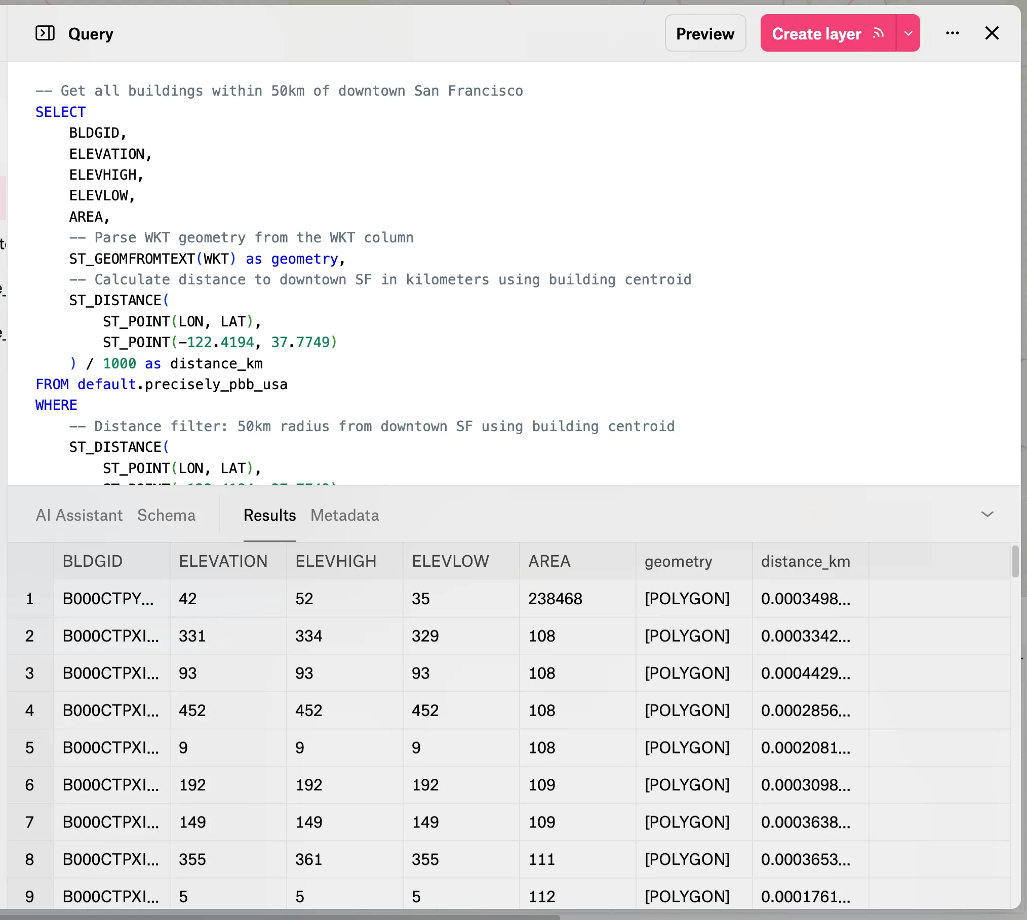
The introduction of Spatial SQL also opens up sophisticated analytics to Felt’s Databricks users. Databricks users can now calculate distances, areas and perimeters, perform spatial joins (e.g., ST_Contains, ST_Intersects), transform coordinate systems and validate geometries. Industries such as retail, transportation, energy and agriculture are already seeing 20x faster spatial joins and 50% lower costs compared with legacy systems. Because Databricks uses open formats like Parquet, Delta and Iceberg, there’s no proprietary lock‑in.
.webp)
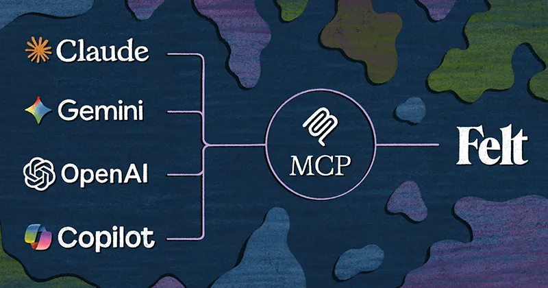
And with Felt AI now you can query data in natural language, letting business users pose spatial questions—“Where are our customers within five miles of our stores?”—without having to learn ST functions or writing complex SQL.
How to connect and work securely
Felt makes it easy to visualize, map, and explore your data and connecting Felt with Databricks is easy.
- Create a read‑only user on your Databricks cluster
- Open the Library in Felt, choose “New Source → Databricks”
- Enter your connection details and click Connect
Once connected, you can browse a catalog of tables, drag layers onto your map, and build out the spatial apps your team needs to make informed decisions while referencing your source of truth.
Accessing interactive maps and dashboards built from your Databricks tables is easier than ever. Felt’s Databricks integration supports secure connection methods—whether you use Personal Access Tokens or machine‑to‑machine (M2M) OAuth—so you can authenticate without sharing long‑lived credentials. Once connected, your Databricks tables appear as layers that you can style, filter and combine to create compelling interactive maps.
Join the webinar: Building geospatial apps with Felt AI & Databricks
To help customers put these capabilities into practice, Felt is hosting a webinar “Building geospatial apps with GenAI and Databricks.” The session is scheduled for October 7 2025 at 9:00 AM PT (45 minutes). During this webinar you’ll learn how to:
- Teach your language model geospatial concepts so it can understand and answer questions about places and shapes.
- Build and host geospatial apps using natural language—starting from your own Databricks lakehouse.
- Store and query billions of spatial records using Databricks’ new Spatial SQL.
Speakers include Jaime Sanchez, Director of Partnerships at Felt , and Michael Johns, Specialist Leader at Databricks. This session is ideal for business leaders, data visualization practitioners and enterprise architects who want to democratize geospatial analysis.
Compare Felt using AI