37° 48' 15.7068'' N, 122° 16' 15.9996'' W
MODERN MAP MAKING HAS ARRIVED
37° 48' 15.7068'' N, 122° 16' 15.9996'' W
MODERN MAP MAKING HAS ARRIVED
37° 48' 15.7068'' N, 122° 16' 15.9996'' W
MODERN MAP MAKING HAS ARRIVED
37° 48' 15.7068'' N, 122° 16' 15.9996'' W
MODERN MAP MAKING HAS ARRIVED
37° 48' 15.7068'' N, 122° 16' 15.9996'' W
MODERN MAP MAKING HAS ARRIVED
37° 48' 15.7068'' N, 122° 16' 15.9996'' W
MODERN MAP MAKING HAS ARRIVED
37° 48' 15.7068'' N, 122° 16' 15.9996'' W
MODERN MAP MAKING HAS ARRIVED
37° 48' 15.7068'' N, 122° 16' 15.9996'' W
MODERN MAP MAKING HAS ARRIVED
37° 48' 15.7068'' N, 122° 16' 15.9996'' W
MODERN MAP MAKING HAS ARRIVED
37° 48' 15.7068'' N, 122° 16' 15.9996'' W
MODERN MAP MAKING HAS ARRIVED
Maps
Editorial
Transforming our National Park maps: a conversation with Nate Irwin
Nate Irwin's team made the first digital National Park Service maps. We sat down to understand how they transformed the visitor experience one map at a time.

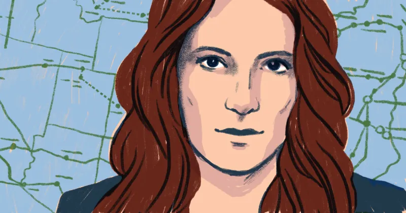
Your entire career, from the National Park Service to OuterSpatial, has centered on mapping parks across the country. What drew you to the work?

It was a complete accident. Growing up in the foothills of the Smoky Mountains, I had long enjoyed outdoor activities like hiking, climbing, and camping. I never, however, really considered applying this love of the outdoors to my career. After graduating from the University of Tennessee with a degree in International Relations (obviously completely disconnected from the outdoors), my plan was to go to grad school for politics. I didn’t really have much to do over the summer though, so I took a Student Conservation Association internship with the National Park Service (NPS). I was looking for an opportunity to be closer to D.C. and I ended up doing trail maintenance and wildfire mitigation at a Civil War battlefield south of Richmond, Virginia.

As part of that work, I started to learn Geographic Information Systems (GIS) while mapping the trail system. It just so happened that the GIS Specialist at the National Battlefield had recently moved on to another position. This gave me the opportunity to start digging into GIS on my own. I never even intended to get into mapping and was actually planning to go to graduate school in D.C. This opportunity just kind of fell into my lap and I ran with it. I ramped up by taking a bunch of online classes, and I even ended up getting a graduate certificate in GIS. So, yeah, I wasn't planning on getting into mapping or working for the federal government at all.

What did you find when you started working at the National Park Service?

The people who work for the NPS are so passionate about their jobs and the special places they protect. People literally work for years, in many cases in seasonal or part-time furloughed positions, just to get their foot in the door! That doesn’t just happen at larger parks like the Yosemites and the Yellowstones; it happens at smaller parks too. Every park draws people who are passionate about the NPS mission. Being able to experience that kind of energy early on in my career was incredibly motivating, and it got me interested in all of the things I've been pushing forward since then.

I was also drawn to the number of stories to tell at NPS. A lot of people think of natural resources and recreation when they think of the NPS. In fact, only 63 of the 423 NPS units are National Parks. The other 360 units are National Battlefields, National Historical Parks, National Monuments, etc. So, NPS is in large part responsible for helping people understand and digest narratives of our country's history. I’ve always been more interested in using GIS to tell stories than I have been in the “science” aspect of GIS, and at NPS, there are endless stories to tell.

It didn't take long for me to get drawn in by this. My first taste of using GIS to tell a story while working at Petersburg National Battlefield in Virginia. I was working in the area where the 292-day siege of Petersburg occurred during the Civil War. Because the siege lasted for so long (the troops had to have something to do!), the city of Petersburg is surrounded by miles and miles of earthworks— many of which are completely overgrown with heavy forest. My job was to go out and mapping as many of these earthworks as possible, which often meant tramping through swamps and heavy vegetation (read: slow and painstaking work).

Once we had a solid understanding of the location of these earthworks, we were able to use the locations to georeference a series of 36” x 48” hand-drawn battle maps that were created by an NPS historian/cartographer back in the 1960’s. Using the georeferenced maps, we were then able to hand digitize the position of different troop positions and movements for a series of battles that occurred during the siege of Petersburg.

This was a transformative project because it opened my eyes to how GIS can be used to tell stories and this ultimately led to my career-long interest in creating visitor-facing experiences that engage and encourage people to get outside more. Ultimately, one of my driving principles is inclusivity, and that’s something that was really drilled into me during my time at the NPS. I share the service’s passion for getting more people outdoors and making outdoor experiences more accessible to all—especially for those who may not traditionally have had the means, the experience, or the skillset to get outside.

Existing digital NPS map of Petersburg National Battlefield can be found on their website.


How did you end up leading the team that made National Park Service maps digital?

I transitioned from Petersburg to Denver where the NPS’ national GIS office is located to help develop service-wide GIS datasets. This was really a massive data standardization and aggregation effort focused on critical and foundational geospatial features across the entire NPS. For example, one of these foundational geospatial datasets was getting accurate building footprints for every structure that exists in the NPS. It sounds like a simple task, but it was incredibly in-depth and it was the first enterprise GIS standard the NPS worked on. That meant working at the national level with each of the regional GIS offices as well as other national-level offices like facility management. It was a huge collaborative effort to get everyone to agree on what types of information to collect and aggregate and tie back into the GIS (or to find where the data was currently being held to aggregate it) and then implement new ways of maintaining it. It took years! We also tackled important datasets like boundaries and trails.

Once that data foundation was in place, I wanted to do something with it. So, I started a program called NPMap within the NPS that focused more on the storytelling aspect I love so much.

NPS is known for their beautiful print maps. Why were you so set on making them digital?

There are so many stories out there waiting to be told! Just because a National Park is focused on natural resources doesn’t mean there aren’t cultural stories to tell there as well, and vice versa. This is why we focused NPMap on enabling these employees to tell their own stories by putting solid tools and data into their hands. Every NPS employee has their own story to tell, and with NPMap they could.

You have to understand that around 2010, the only map you got as a visitor was the brochure an NPS ranger handed you as you drove into the park. These maps were beautifully designed, but there’s only so much you can fit into a single, printed map. The goal of NPMap was to replace this map with a multi-scale, zoomable map, using – whenever possible – the standardized enterprise GIS datasets, and then give NPS employees the ability to create custom versions of this map to tell their own stories.

For the first time, we had comprehensive datasets we could use as the foundation to make digital maps targeted at visitors. But, of course, to actually build those maps, we had to aggregate even more information from the distributed parks themselves. Think of everything from elevation models to boundaries to points of interest (e.g. visitors centers, trailheads, restrooms, and geysers) to trails. We even started aggregating road data sets for a lot of parks!

Do you think you were successful at bringing the essence of print maps to the digital realm?

NPS has a design center called the Harpers Ferry Center that has done a great job in terms of creating brand guidelines and styling that's used consistently across all of the print media that NPS does. We were able to borrow different bits and pieces of that and apply it to the digital media and products we were creating. For example, we started developing a symbol set that was derived from the NPS’s print map symbol set, but was much broader in scope and was optimized for use on the web. Another example: we worked with the NPS’ Cartographer, Tom Patterson, to translate the shaded relief he used in his print maps to a version we could use in our interactive maps.

Shaded relief, referenced above, is a technique cartographers use to more realistically show the shape of terrain by showing how the three-dimensional surface would be illuminated from a point light source, like in image taken from an NPS map of Crater Lake National Park.

So there are a lot of design elements that are at the heart of an NPS map, but, as a storyteller and product person, I can also focus on elevating the information that’s most important to tell a particular story. And this really changes from park to park. For Yellowstone, the story may be the geothermal landscape while, for Petersburg National Battlefield, the story is the position of historical man-made structures and temporal troop movement data in relation to those structures.

Around 2009 or 10, the only map you got as a visitor was the brochure an NPS ranger handed you as you drove into the park. The goal of NPMap was to replace this map with a multi-scale, zoomable map.

Trails ended up being your last priority–why?

Well, what we learned over time is that you can address a lot of the most important use cases with relatively simple geospatial data. So we were able to start at the easiest use case and incrementally add complexity only when needed. This is often a great approach, by the way.

One of the data standards I worked on while at NPS was trails. Trail systems are obviously a super important part of outdoor recreation, but they can also be very complex. For example, a single trail segment can be shared by multiple trails and segments often need to be split into multiple representations to highlight surface type, accessibility, etc. So really when you look at trails you’re looking at several complex relationships.

The thing is, most NPS visitors never actually get out on a trail! By starting with trails, we were spending 90% of our time on a dataset that only addressed 10% of the use case (or something like that). When we realized this, we decided our time was better spent developing a comprehensive, visitor-facing point of interest dataset that captured the information that was most important to visitors. If you ask park rangers what question they get asked the most by visitors, it’s usually something like, “Where’s the nearest restroom?” Addressing that question requires a relatively simple dataset, so we worked on that first.

When you look back over your time there, what are you most proud of?

I am proud of carving out a space within the NPS organization that allowed maps to become a medium for visitor-facing media and outreach. The Harpers Ferry Center had been doing this with print for a long time, but there was a big gap in terms of applying it to digital. I am proud of being part of a great team of people who were able to bring that part of the Park Service into the 21st century. And I think our work has persisted; it’s part of the ethos at this point. So I'm very proud of that.

You now work as Chief Product Officer at OuterSpatial, where you help make digital tools for parks and recreation organizations across North America. What are some of the highlights working in this role for parks of all shapes and sizes?

I think the special thing for me is being able to take all the experience I gained while working at the NPS–where I really learned about the connection between visitors, staff, and operations – and bring it to life in a product that can be used by parks and recreation organizations around the world. I focus on a lot more than maps nowadays, but my emphasis on accessibility/inclusivity and building great user experiences is just a natural extension of what I learned at the NPS.

Working from outside the government also empowers me to create experiences that a government agency simply cannot because of technical or bureaucratic constraints. And I can tackle the problem on a different scale. Whereas in the NPS I was focused on a single agency and its visitors, I’m now focused on creating healthy “communities” that are made up of parks and recreation organizations, nonprofit organizations, private companies, and (obviously) visitors. Ultimately, we believe that getting all these different entities working together is the best way to preserve and protect our outdoor resources and ensure everyone can get outside to play. It’s a pretty great feeling to enable something like that.

Only 63 of the 423 NPS units are National Parks–the other 360 units are National Battlefields, National Historical Parks, National Monuments, etc. NPS is responsible for preserving and telling the story of our country's history.
Bio
Nate leads product for OuterSpatial, an outdoor recreation technology company. He lives and plays in beautiful Denver, Colorado, where he enjoys building stuff and running, skiing, biking, and backpacking.
LinkedIn
More articles

Cartography Tips for Designing Web Maps

Search, filter, select — data discovery done right

Getting the most out of Felt’s new Workspaces

Teaching Spatial Analysis with Felt

Powerful new admin tools and a streamlined billing experience

Three key UI upgrades in Felt 2.0