37° 48' 15.7068'' N, 122° 16' 15.9996'' W
cloud-native gis has arrived
37° 48' 15.7068'' N, 122° 16' 15.9996'' W
cloud-native gis has arrived
37° 48' 15.7068'' N, 122° 16' 15.9996'' W
cloud-native gis has arrived
37° 48' 15.7068'' N, 122° 16' 15.9996'' W
cloud-native gis has arrived
37° 48' 15.7068'' N, 122° 16' 15.9996'' W
cloud-native gis has arrived
37° 48' 15.7068'' N, 122° 16' 15.9996'' W
cloud-native gis has arrived
37° 48' 15.7068'' N, 122° 16' 15.9996'' W
cloud-native gis has arrived
37° 48' 15.7068'' N, 122° 16' 15.9996'' W
cloud-native gis has arrived
37° 48' 15.7068'' N, 122° 16' 15.9996'' W
cloud-native gis has arrived
37° 48' 15.7068'' N, 122° 16' 15.9996'' W
cloud-native gis has arrived
Maps
Product
Felt 3.0: Apps and dashboards powered by native Postgres & Snowflake integrations
Introducing Felt 3.0–apps, databases, and dashboards for your entire organization.

A look back on Felt 2.0

Last year, we launched Felt 2.0 to unlock powerful GIS operations for teams. No longer was geospatial data siloed inside of a massive GeoJSON or Shapefile, or hidden behind an experts-only UI. Felt’s modern capabilities like Upload Anything and Transformations made it possible to share valuable GIS insights with your team and be recognized for your work. Today we’re thrilled to launch our latest major update that expands Felt’s mission from the team to the wider organization.

Introducing Felt 3.0 for fast-moving organizations

Felt 3.0 introduces even more ways to get your data out of data silos, and into the hands of stakeholders across the organization–from sales to management, to clients and constituents. With their newfound GIS superpowers, every team can build and interact with apps and dashboards to visualize the operational insights that matter to them.

Book a demo

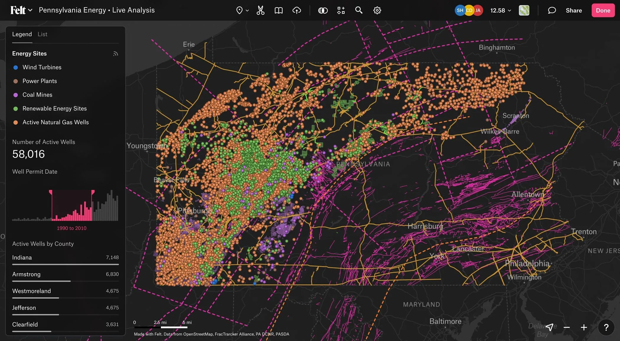
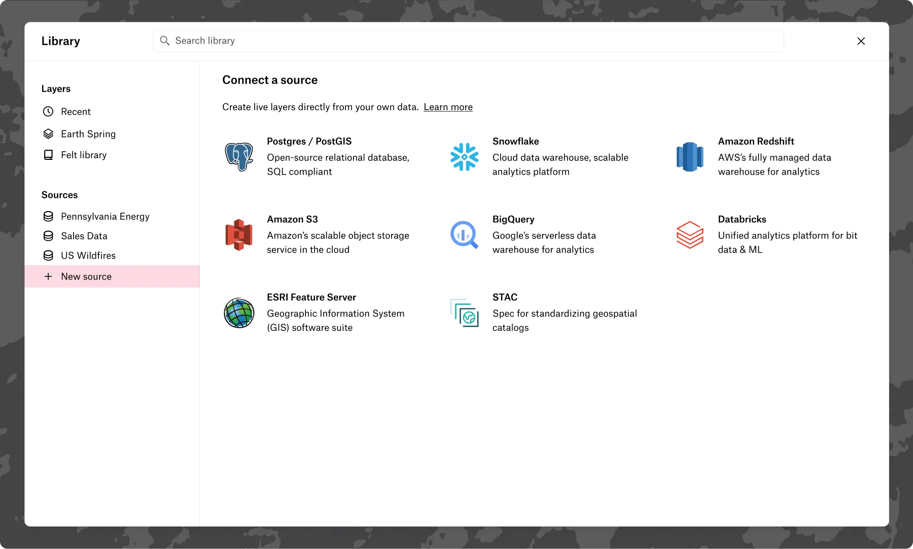
Connect your database and auto-refresh with live data updates

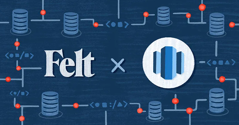
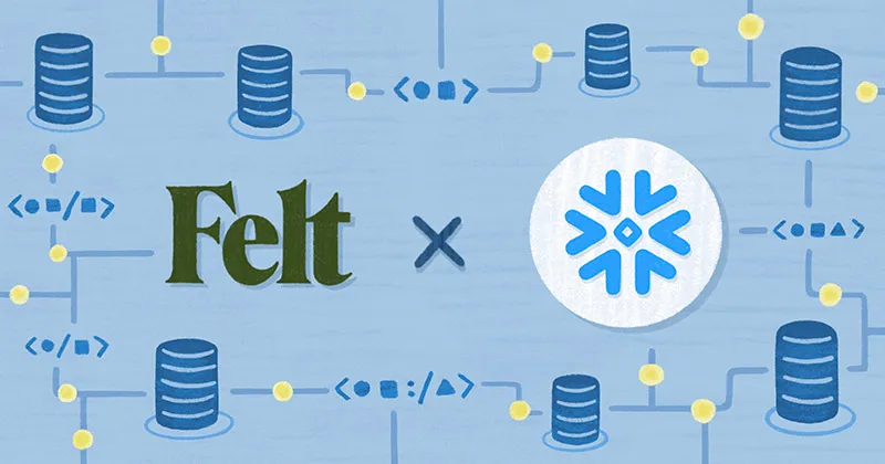
Working with geospatial data that’s connected to your source of truth and up-to-date is the foundation for expanding GIS use cases to the wider organization. That’s why we’ve now built-in the ability to connect your Postgres/PostGIS and Snowflake database directly to Felt. Support for other third-party data sources–Databricks, S3, BigQuery, Redshift, Esri Feature Service, and STAC–is coming soon!

Connect Live Layers from your Database and Keep Maps Up-to-Date 📡

Empower your organization with interactive components and dashboards

Every team comes to a map with a set of questions specific to their operations. How is sales coverage across our territories? Where are the most valuable residential properties within a 50 mile radius? A client might ask: Which areas have the highest wildfire risk? We’ve built the most intuitive components and dashboards right into Felt so every team can visualize and measure map data to get the insights they need.

A U.S. Sales Performance Dashboard Built with Felt 3.0 📈

Right out of the gate, your organization can build their dashboard using 5 types of components:

  • Time series: Explore spatial trends with an intuitive time slider and reveal key patterns across different locations and time periods.
  • Histogram: Quickly identify data patterns and trends by displaying frequency distributions in easy-to-read bins.
  • Statistics: Gain instant insights with summarized numeric values, providing key metrics at a glance.
  • Bar chart: Visualize and compare categories to easily spot differences and trends between various groups of data.
  • Filter: Drill down and filter on-the-fly for specific categories or ranges of data to focus on the most relevant information.

Instead of futzing with other tools–like a BI tool that wasn’t built to filter or visualize geospatial data, or a legacy GIS tool that wasn’t built for collaboration–teams from all corners of the organization can interact with Felt’s components and dashboards to make sense of geodata as it fits their operational context. All in no time to deploy.

"The amount of data we had caused constant crashes or would take our sales reps five minutes to load in our old software. It was so easy with Felt." – Michelle Denna, VP of Sales at Sharetown

Automate costly custom builds with the new API

For truly custom implementations, we’ve built an API to cut development time and give you a straight path to launch.

An Active U.S. Wildfire Dashboard Built in Felt 3.0 with Real Data 🔥

The new API makes it possible to programmatically create and style elements, listen to map updates via webhooks, and flex your Python muscles with our Python SDK.

Developers won’t have to build from scratch–and can instead focus those precious engineering cycles on other areas of the business. Forward our developer docs to an engineer on your team and make their day.

Build the future of geospatial apps

With databases, dashboards, and the API, Felt is the best place to build geospatial apps specialized to a team’s use case and workflow. Take these examples from our customers:

Sharetown: The sales team at Sharetown, a logistics company, isolates geo and sales data in Felt to monitor field rep performance and spot coverage gaps across territories.
View a Sales Performance Dashboard ↗

County of Santa Barbara: Santa Barbara Public Works lays routes in Felt to map road closures and communicate them out to first responders and the general public.
View an Active Wildfires Dashboard ↗

Terrabotics: The analytics team gathers oil & gas intel to monitor industrial gas emissions from across the planet, and turns them into an interactive Felt map for clients.
View an Energy Company Dashboard ↗


Teams no longer have to be stuck in a static map, PDF, or a complex tool. And best of all, you can spin up apps in Felt without heavy development or extended trainings. We can’t wait to see what you build!

BUILT TO FIT ANY GEOSPATIAL WORKFLOW 🌐

Get started on 3.0

Felt 3.0 is available on all Enterprise plans starting today. If you aren't on Enterprise yet, you can schedule a demo with our technical sales team and trial all these features with your organization. Plus, all of the other Enterprise features–including embeds, SAML, SOC 2, SSO, VPC, and a dedicated technical customer success manager.

Book a demo with our technical sales team, and unlock GIS for your organization today!

Book a demo


Not ready for databases and dashboards
? Try our new Team plan where you can trial all of Felt's other features–from Upload Anything to Transformations–with room for 25 people and 25GB of data storage. Free for 14 days with no credit card required.

"With Felt's API solution, maintaining better, high-quality maps takes less time for us" - Erwin Kuhn, Software Engineer at Brimstone
Bio
LinkedIn
More articles