In today's data-driven world, understanding and analyzing location-based information has become crucial for businesses, researchers, and policymakers. Enter spatial indexes - powerful tools that organize and optimize geospatial data for efficient analysis and visualization. This post delves into the world of spatial indexes, with a special focus on the innovative H3 system.
What Are Spatial Indexes?
Spatial indexes are data structures designed to make searching and querying large sets of geographic data more efficient. They organize spatial data into a grid or hierarchy, allowing for faster retrieval and analysis of location-based information.
Common Types of Spatial Indexes
Several spatial indexing systems exist, each with its unique features and use cases. Let's explore some of the most popular ones:
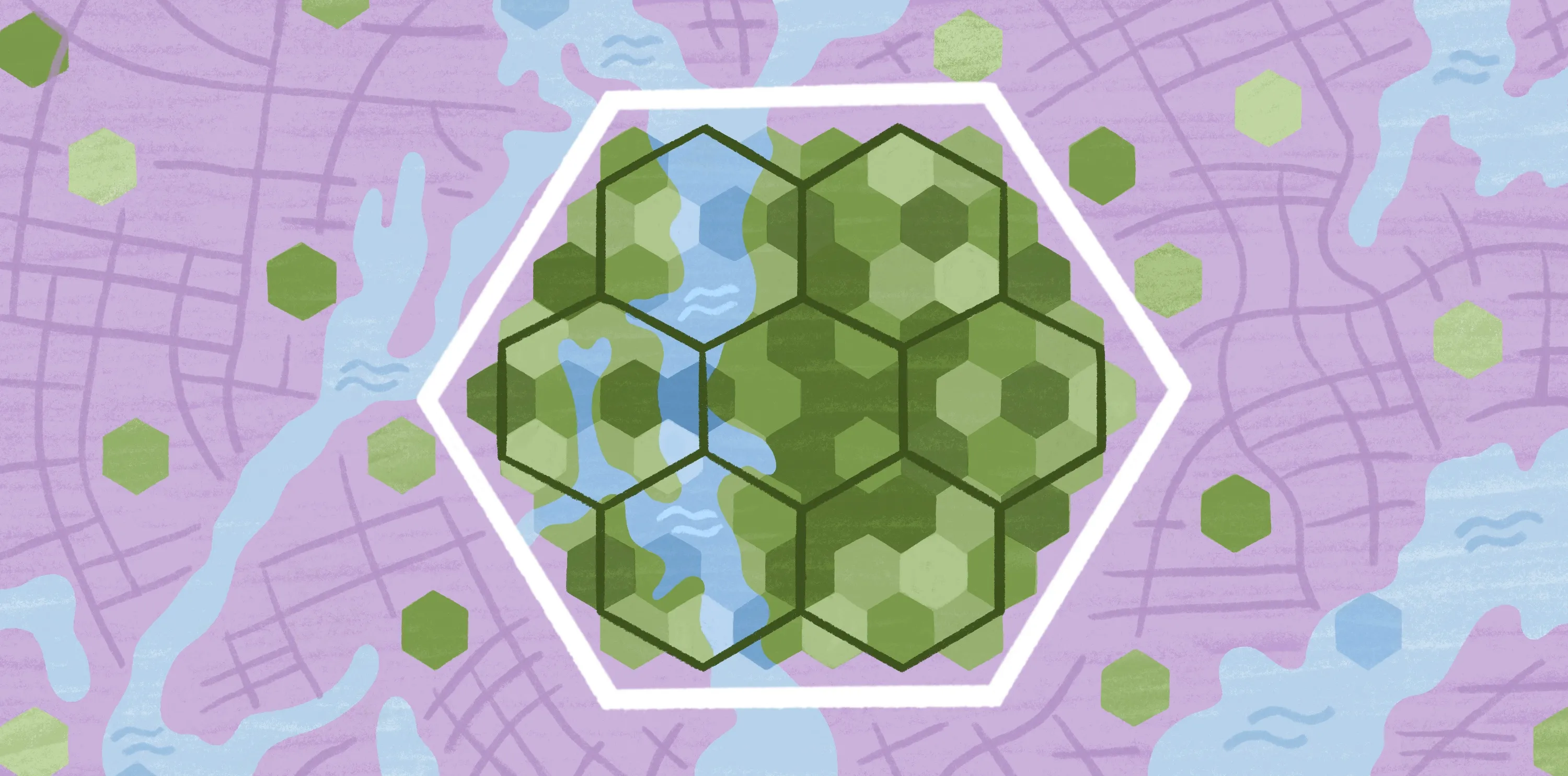
1. H3 (Hexagonal Hierarchical Spatial Index)
H3 is a cutting-edge spatial index developed at Uber to address their complex data science needs. It divides the Earth's surface into hexagonal cells at multiple resolutions.
Key features of H3:
- Hierarchical structure for multi-scale analysis
- Hexagonal grid shape for more accurate representation of distances and areas
- Supports efficient joining of disparate data sets
- Includes features for modeling flow and movement
- Well-suited for applying machine learning to geospatial data
2. S2 (Spherical Geometry Library)
S2 is an open-source system developed at Google that uses square cells to create a hierarchical, discrete, and global grid system.
Key features:
- Hierarchical structure
- Square cells
- Global coverage
- Efficient for point-in-polygon operations
3. Geohash
Geohash is a system that encodes locations using strings of characters, creating a hierarchical, square grid system (essentially a quadtree).
Key features:
- Simple string-based encoding
- Hierarchical structure
- Square grid cells
- Easy to implement and use in databases
4. Hexbin
Hexbin is not a spatial index per se, but a process of aggregating coordinates into hexagonal cells for analytics or mapping.
Key features:
- Hexagonal shape for more accurate representation
- Commonly used in data visualization
- Not hierarchical by default
5. Administrative Boundaries
While not a spatial index in the technical sense, administrative boundaries (like counties, zip codes, or census tracts) are often used for aggregating and analyzing spatial data.
Key features:
- Familiar and widely used
- Often have associated demographic data
- Irregular shapes and sizes
Why H3 Stands Out
Among these spatial indexing systems, H3 has gained significant attention for these key reasons:
- Efficient neighbor finding: The hexagonal structure makes it easy to identify adjacent cells, which is useful for many spatial analysis tasks.
- Good area preservation: H3 cells have more consistent areas across different locations, which is important for aggregation and analysis.
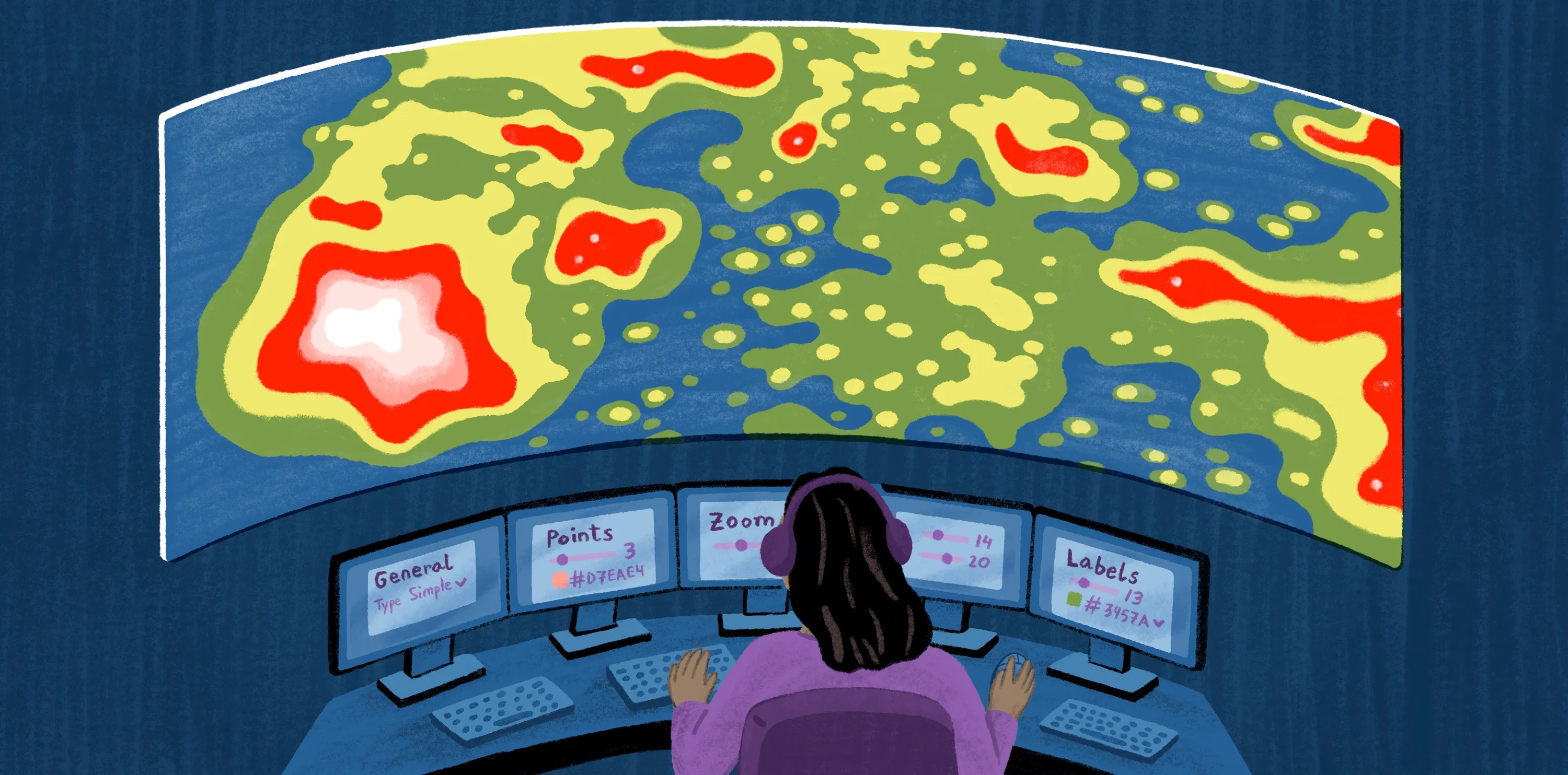
Exploring H3 with Felt
While H3 offers powerful capabilities, visualizing your data effectively can be challenging – especially if you're not familiar with tools like Postgres/PostGIS or MySQL. This is where platforms like Felt come in, offering user-friendly tools to leverage the power of H3 as a visualization technique.
Felt provides an intuitive interface for working with H3, allowing users to:
- Visualize data using H3 hexagons
- View spatial patterns at multiple scales
- Combine H3 analysis with other geospatial data layers
By simplifying the process of working with advanced spatial indexes like H3, Felt makes sophisticated geospatial analysis accessible to a wider range of users, from GIS experts to business analysts.
To explore how you can harness the power of H3 and other spatial indexing systems in your geospatial analysis, reach out to our sales team today.
Compare Felt using AI