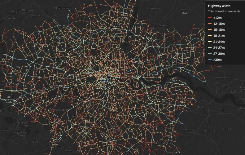
Road Widths of London
Road width plays a key role in the speed cars drive, as well as the amount of space that can be allocated for cycling improvements. Will uploaded lane data and styled it by width such that it's easy to see areas of opportunity. By adding this layer to Felt, anyone can duplicate and draw on top of this valuable pre-styled dataset to make their own map or proposal.
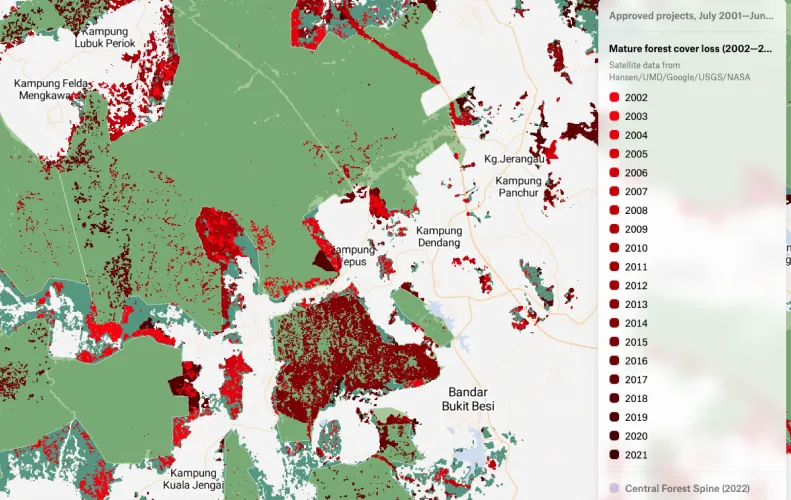
Projects that Replaced Malaysian Natural Forests
Macaranga, a journalism portal covering environment and sustainability in Malaysia, used Felt to display their compilation of development projects that replaced forest land on the peninsula. Most of these projects are forest plantations, farms and aquaculture, logging, oil palm and rubber plantations and mines and quarries. You can read more on their findings here.
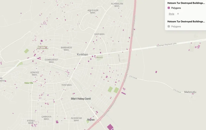
Earthquake Destruction Documentation
Turkey experienced a massively damaging magnitude 7.6 earthquake in February, causing widespread humanitarian issues. Mesut pulled data of all documented destruction from Humanitarian OpenStreetMap, painstakingly collected by volunteers, and uploaded it to Felt, making it easily accessible for all to visualize.
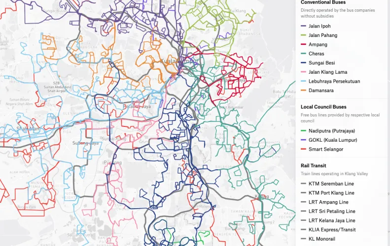
Klang Valley Bus System
This map of was painstakingly compiled by Slainthayer who brought all 315 bus lines into Felt by manually drawing them from different sources. Now that they are in digital format and exportable as .geojson, the bus system is now a dataset that can be used by everyone.
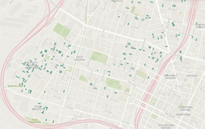
Real Estate Investment in West Oakland
When Jeff read that a Bay Area investor controls hundreds of Oakland rental properties, he decided to make a map to understand just how many of the 249 properties reported in the article existed in the economically disadvantaged neighborhood of West Oakland.
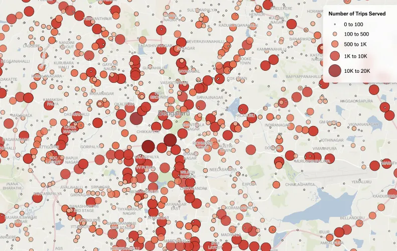
Stops Scaled by Trips Served in Bengaluru
Vivek mapped bus stops in Bengaluru scaled by the number of trips they serve daily, based on static Bangalore Metropolitan Transport Corporation timetable data from 2018. The data can be found on OpenCity. The map demonstrates which areas of the city are massively underserved.
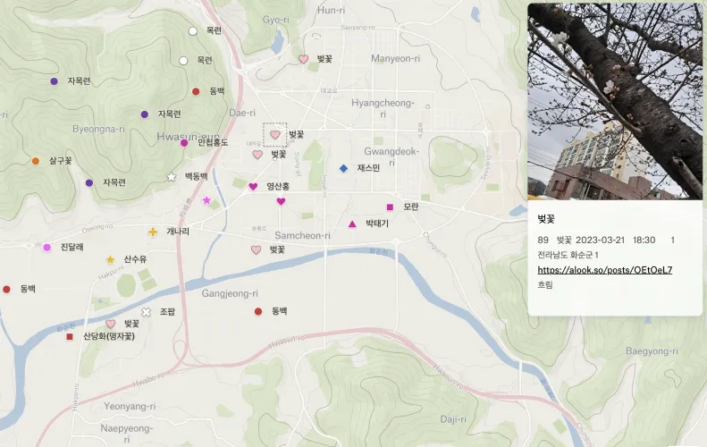
Blooming Magnolias and Cherry Blossoms
Yoon, Seoul-based Award-winning science journalist, sourced photos of magnolia trees and cherry blossoms from his readers and mapped the blooming trees all over Korea.
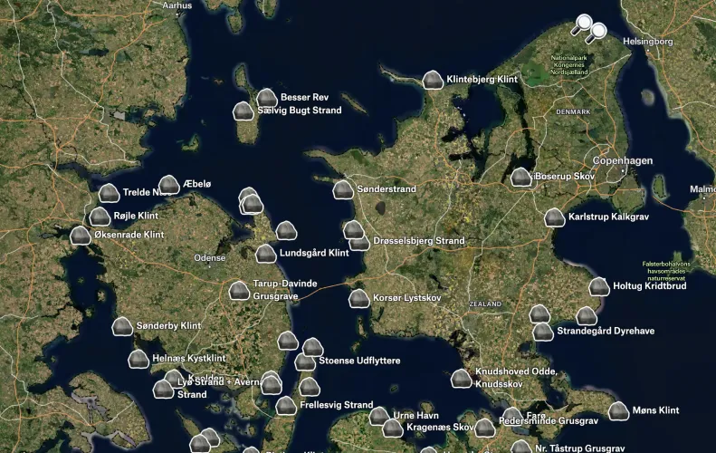
Known Fossil Locations in Denmark
History and geography teacher Caspar made a web map of the known fossil locations in Denmark in an effort to make fossil hunting available for more people.
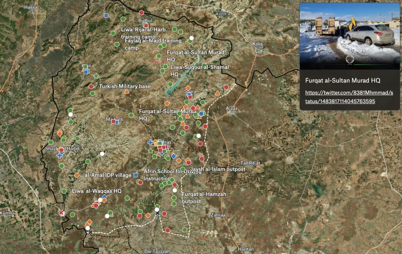
Afrin after 2018 Military Operation
Open source investigator Alexander McKeever used Felt to upload information he'd saved over the years on Afrin's towns and villages (Arabic/Kurdish names), infrastructure, shrines, and historical sites. Afrin is the majority-Kurdish district of northwest Syria that was in the epicenter of a military operation launched by the Turkish Armed Forces and the Turkish-backed Free Syrian Army against the Syrian Democratic Forces in 2018.
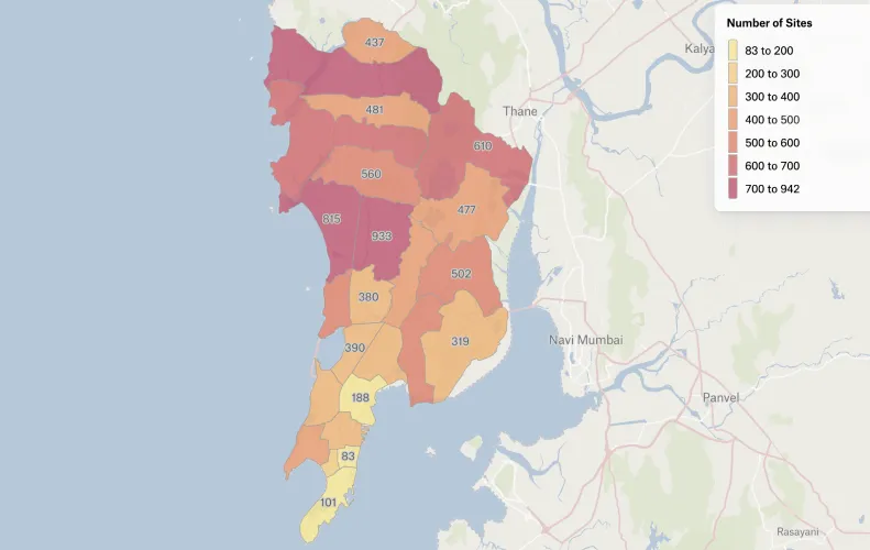
Mumbai Construction Sites
The Hindustan Times published an article explaining how the city's building construction sites contribute the city's air pollution problem. Journalists didn't include a map, so Jacob visualized 11,125 active construction sites construction sites as of March 2023 — his map shows the density of construction sites in each administrative division.
Want to share your map and get featured?
We recently launched our new Slack group where you can connect with other folks using Felt. Post your favorite Felt maps in #showoff-your-map channel and we will feature the best maps in the beginning of May!
Compare Felt using AI