How Innovate Memphis put every parcel in Shelby County on one public map
The tools we’ve built with Felt have multiplied our impact in Memphis. It has opened doors and brought leads to projects we would not have had otherwise.
The challenge: a decade of good data, with no good delivery mechanism
Innovate Memphis exists to reimagine local government and community development work, and its data team does the unglamorous part: finding the data, standardizing it, and getting it to the people making decisions about housing, vacancy, and neighborhood investment. Data Director, Kira Morin, and her team operate on a simple premise: good ideas that aren’t accessible and easy to use tend to die on the vine.
Their flagship product, the Memphis Property Hub, was neither. Version one, more than a decade ago, was a spreadsheet – parcel-level data pulled from five or six agencies and standardized into one very wide table for over 350,000 properties in Shelby County, TN. Usable only if you could already run your own analysis on a large dataset, and only if you happened to know where every address in Memphis was.
Later versions moved to a mapping tool, and performance became the blocker. Rendering the large public dataset took 30 to 60 seconds. "We would say: it’ll eventually work, but go get yourself a cup of coffee while you’re waiting for your browser to keep up," Jessica Lotz, Executive Director, says. It took long enough that at one point, the team thought it was broken.
When Kira joined Innovate to scale the data program, she inherited the demos and reached the same conclusion."Every time I was asked to give a tour of it, I did not feel comfortable because it would time out without a clear reason, undermining our credibility." So they largely stopped showing it. Decisions were delayed, conversation stalled, and no one could self-serve until they arrived at a better solution.
Why they chose Felt
Kira came to Felt on a referral and tested it against written requirements rather than a feature list: under one second from click to response, two or three clicks to restyle a layer, and interactive graphs and visualizations. She had a staffing constraint that ruled out traditional GIS, too. Innovate Memphis runs on a small team plus student fellows and interns, so the tool had to be something an entry-level analyst could pick up and build with.
The deciding test was whether Felt could carry the Property Hub itself, directly from Databricks. It could, and design control set it apart from what they’d used before. "It’s great that we can customize it the amount that we can," Jessica says. "Other tools we’ve used in the past are very out of the box. What you get is what you get."
Use case 1: Making property data accessible to the public
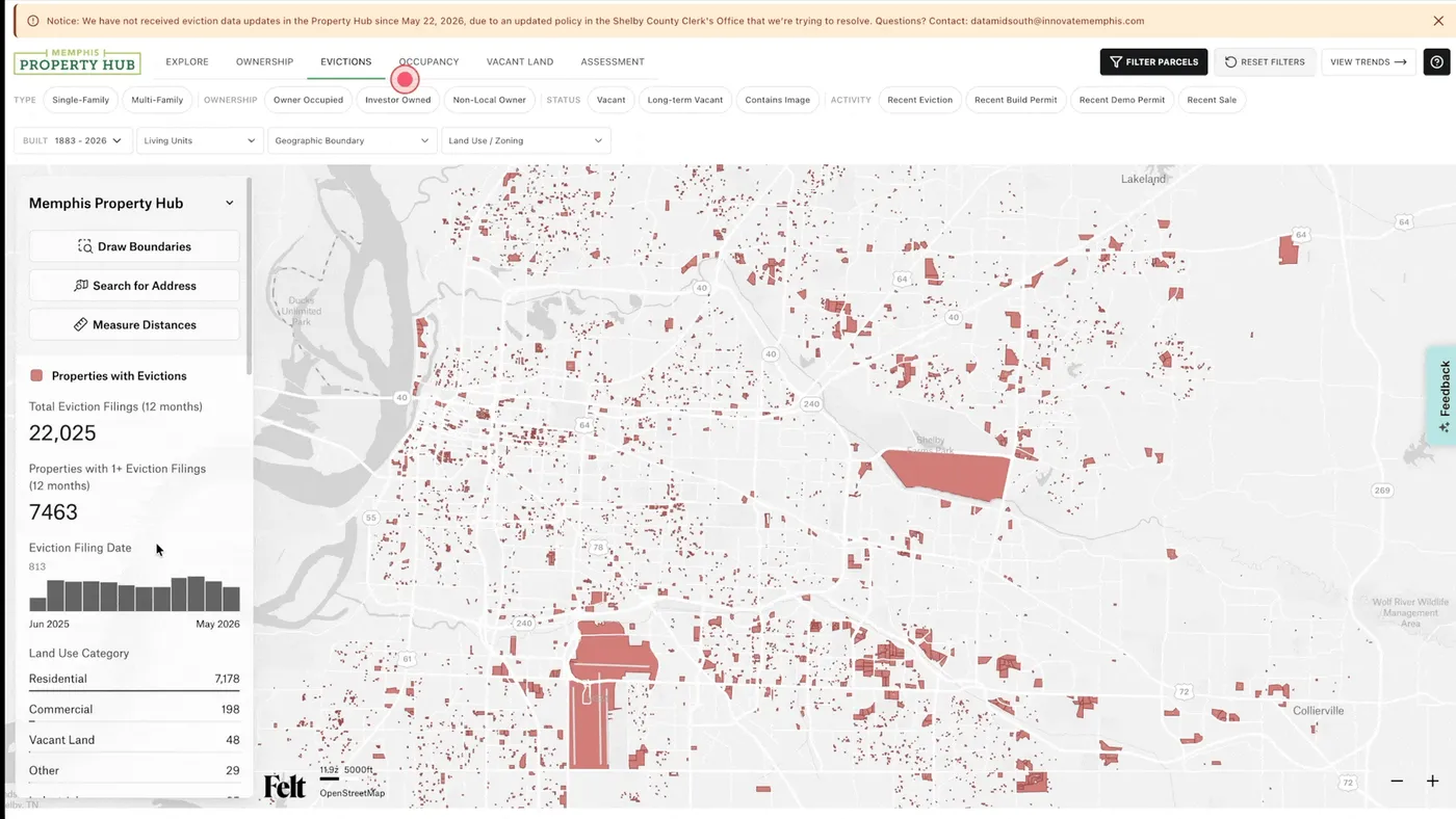
The Property Hub now runs on Felt across roughly 350,000 parcels in Shelby County, with dozens of data points each. Users explore vacancy, sales, evictions, and more by parcel or aggregated to Census tract, zip code, City Council district, or County Commission district. They filter instantly by owner type, land use code, year built, and permit activity — or draw a custom boundary. Every parcel has a profile with ownership, tax assessment, 311 services requests, and permits.
Performance is what made it publishable. "This is close to real time with 350,000 parcels and dozens of data points per parcel," Jessica says. "For it to render so fast and switch between views so quickly is the best I’ve seen. Now we get to bring it up in all kinds of meeting settings and know it’s going to be reliable and intuitive to the public."
Since launch, the team fields 5 to 10 new account requests every week even in times without active outreach. While Jessica spent last fall demoing at every housing event and university she could find; the pipeline is now almost entirely word of mouth, and users just keep coming back. "Its usability makes it really sticky."
Use case 2: Scaling impactful client work
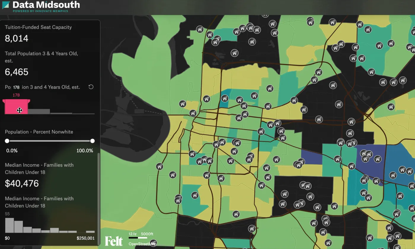
The Property Hub also serves as a foundation the team duplicates and modifies for clients — local nonprofits, community development corporations, and the City of Memphis.
For First 8 Memphis, Data Midsouth built an interactive Pre-K Capacity report showing Census tracts where 3- and 4-year-olds far outnumbered available seats, drillable by zip code and council district. First 8 Memphis took it into meetings with policymakers and turned those gaps into a concrete ask. The result: 230 new free pre-K seats at 13 sites for the 2025–26 school year. They’ve come back each year to repeat the reporting.
For the City of Memphis and local philanthropic funders, the team built a modified version of the Property Hub scoped to a single neighborhood receiving new tax increment financing, surfacing which institutions owned the most property there. The value, as Jessica describes it, was figuring out the land strategy with one shared dashboard, toggling through scenarios and narrowing in on the most efficient path to a deal.
Client work is ticking up on the strength of what the team can now produce. "We get a lot of leads," Kira says. "A lot of agencies and organizations reach out saying I really love what you’ve built and I’d like to work with you."
Use case 3: Self-serve maps as-needed
Data Midsouth, an open data portal on Huwise, hosts raw datasets alongside Felt visualizations, including every eviction filing and Register of Deeds transaction going back to 2016. As requests for information come in, everyone on the small team needs to be able to self-serve.
This is where Felt fits Innovate Memphis’ identity as an incubator, a role that runs on piloting and experimenting. "Felt is the perfect environment to complement that mission, because it’s very easy to get in there and say, let’s just see what this looks like," Kira says. She’s built maps live in the room: "I’ve asked people questions in the moment and just actively filtered or created components while they’re sitting there. With Felt we don’t have to wait."
The impact
A product they can stand behind, and charge for. Reliable performance and Databricks integration made a premium tier on the Property Hub viable. Users can now subscribe to full dataset access, which funds maintenance and continued development. Putting their name on a paid product is its own kind of endorsement of the data underneath it. And this approach helps subsidize a basic free tier of the Property Hub so that the data is still accessible for everyone.
A wider funnel of opportunities. Client projects are ticking up since they released the Property Hub. "It has opened doors and got us leads to projects that otherwise we wouldn’t have had," Kira says.
More output from the same small team. Fellows and interns now build maps themselves instead of queuing work behind whoever knows GIS, and Kira spends her time delivering results rather than on technical support. It’s the difference between a team that ships one flagship tool and a team that can also manage a public data portal, take on client work and stand up one-off maps on request.
Learn more about how Felt can help your team build delightful public-facing spatial tools.
Book a demo.