Skip to content
LAT37.8044° NLON122.2711° WX-13611157 mY4551831 mE564166 mN4184363 mE6050014 ftN2120204 ftBRG041.0°041.0°040.6°042.1°ZOOM11.0CRS
County GIS dataChecked Nov 7, 2026

Madison County, Texas GIS data

Parcels, city limits, flood zones, transmission lines and census tracts for Madison County, Texas (county seat: Madisonville), each from its official source and checked, with a map you can open in Felt. Parcel records as of March 2026, from the appraisal district.
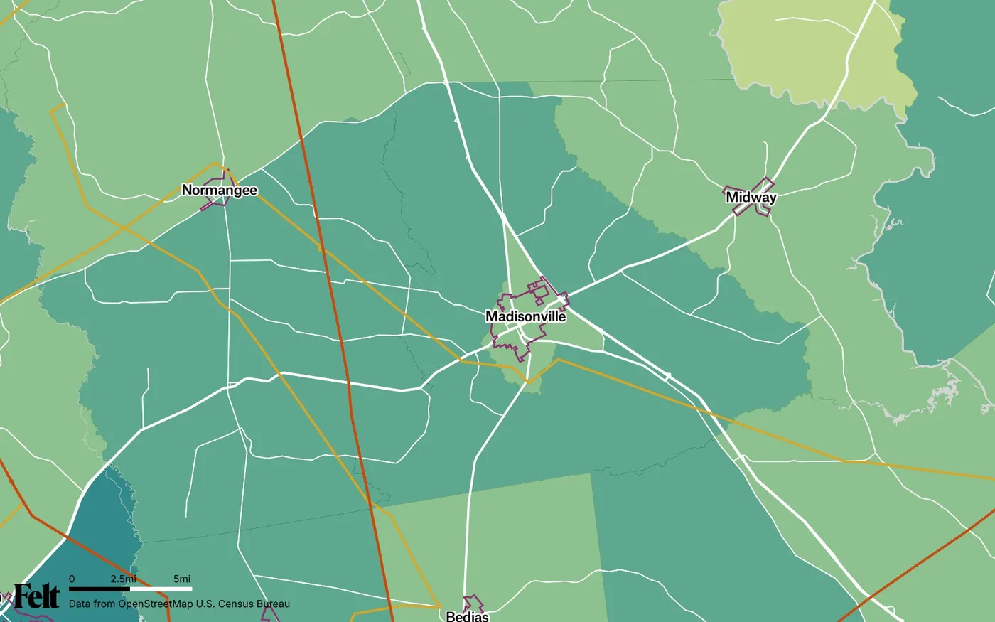
Map of Madison County, Texas: the county outlined, with transmission lines over median household income by census tract
Madison County, Texas, outlinedOpen the live map →
01
4,140
households across 466 square miles
02
53 mi
of transmission line, up to 345 kV
03
2
cities and towns mostly in the county
04
$67,128
median household income; Texas $76,292

Where Madison County's data lives

Each source is the publisher's own service, checked on November 7, 2026. A source that stops answering drops off this page rather than staying as a dead link. Add any of them to a Felt map by URL.

DataPublisherCheckedUpdatedService
ParcelsTxGIO StratMap, from Madison County's appraisal districtTax year 2026. Appraisal district boundaries: approximate, not a survey.LiveMarch 2026Service URL ↗
City limitsTxDOT City BoundariesEvery incorporated city in Texas; the layer on the live map.LiveOctober 31, 2026Service URL ↗
Flood zonesFEMA National Flood Hazard LayerNo countywide digital flood map for this county.Live—Service URL ↗
Transmission linesHIFLD Electric Power Transmission LinesA national snapshot: new lines and upgrades since then can be missing.LiveSeptember 5, 2023Service URL ↗
Census tracts and incomeCensus Bureau ACS 2019–2023, via Esri Living AtlasOn 2020 census tract boundaries; older tract counts for the county will differ.Live2019–2023 estimatesService URL ↗

Madison County's own maps and records

Property search, parcel maps and data downloads from the appraisal district; the county clerk's deed and plat records; the county and city GIS, floodplain and zoning resources a local search turns up; and the state's survey, oil and gas and soil maps. Each was opened on November 7, 2026. These are where parcel records, deeds, permits and zoning decisions come from.

Common questions about Madison County

01Where can I find a Madison County parcel map and parcel data?

Free, from the source. The Texas Geographic Information Office's statewide StratMap parcel layer carries Madison County's parcels from the county appraisal district, tax year 2026, collected in March 2026. The appraisal district's own property search and parcel map are listed under local sources above. TxGIO's DataHub also offers the county's parcels as a free shapefile download. Data resellers charge for copies of the same records. Add the layer to a Felt map by URL to filter, measure and share parcels with your team.

02Does Madison County have zoning, and where is the zoning map?

Only inside city limits. Texas counties have no general zoning power, so unincorporated land in Madison County is unzoned. Unzoned is not unregulated: Texas counties review subdivision plats and septic systems, and most permit development in the floodplain. Each city decides whether and how to zone. The city limits layer shows which city, if any, governs a site, and city planning, GIS and zoning pages are listed under local sources above.

03Where are Madison County deed and plat records?

With the county clerk, not the appraisal district. Deeds, plats, easements and other real property records are recorded by the Madison County Clerk; the appraisal district's records and parcel maps are for property tax, and its boundaries are approximate, not a survey. The clerk's office and its online records search are listed under local sources above. For a property's legal boundary, the recorded plat or a licensed surveyor's survey is the authority.

04How do I find the original survey or abstract for land in Madison County?

Rural Texas land is described by its original survey, abstract number, and block and section. The Railroad Commission's public GIS viewer maps survey lines with their abstract numbers across the state, along with oil and gas wells and pipelines, and offers the same layers as free county downloads. The General Land Office holds the original survey and land grant files, searchable by county and abstract number, and 52 historic maps of Madison County, from county maps to surveyors' working sketches. All are listed under local sources above.

05Which cities are in Madison County?

2 cities and towns lie mostly inside Madison County: Madisonville and Midway. Parts of Normangee reach in from neighbouring counties. The Census Bureau's current boundaries for incorporated places map each one.

06Where is the Madison County flood map, and how much is in a flood zone?

FEMA's National Flood Hazard Layer has no countywide digital flood map for Madison County, so it gives no countywide floodplain figure. It may have an older paper map, or none. For a specific property, look up the effective map at FEMA's Map Service Center.

07Where are the high-voltage transmission lines in Madison County?

HIFLD maps 53 miles of transmission line inside Madison County: 38 mi at 138 kV and 15 mi at 345 kV. It marks 31 of those miles in service and records no status for the rest. The live map colours each line by voltage.

08What is the median household income in Madison County?

$67,128, against $76,292 for Texas (ACS 2019–2023 5-year estimates). Across its 4 census tracts (2020 boundaries), tract medians run from $59,957 to $76,477, with a median across tracts of $62,290.

Try Felt

Bring your data, see it on the map

Connect a database or drop in a file and see your data live on a map in minutes.