The Google Earth Pro alternative for your KML and KMZ files
Google Earth Pro is going away. Your KMZ files don't have to.
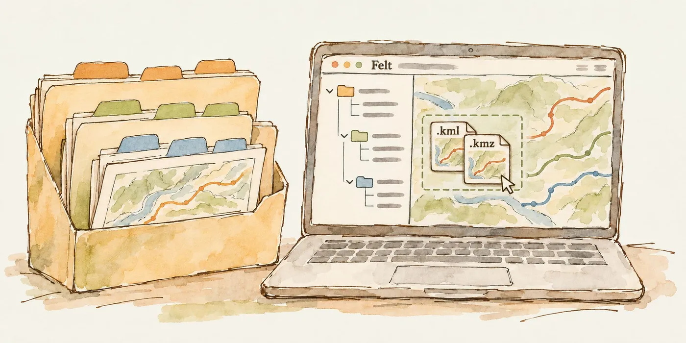
Google Earth Pro desktop downloads end in June 2027. Here's how to move your KML and KMZ files to Felt, keep their folder structure, and share them in a browser.
Google Earth Pro is going away. Your KMZ files don't have to.
Google Earth Pro on desktop will no longer be available for download beginning June 25, 2027 (Google). For a lot of teams, that app is where years of work live: vendor routes, site surveys, field notes, project boundaries, all saved as KML and KMZ files in carefully nested folders.
If you're looking for a Google Earth Pro alternative, the hard part isn't finding another map. It's finding one that opens your files as they are, keeps the folder structure you built, and lets the rest of your team see the result without installing anything.
That's what we built in Felt. Drag a KMZ onto a map, and every placemark, line and polygon comes in, organized the way it was in Google Earth, ready to style, analyze and share from a browser.
What are KML and KMZ files?
KML (Keyhole Markup Language) is the format Google Earth uses to store places, paths and shapes. A KMZ is simply a zipped KML, often bundled with icons or images, which makes it smaller and easier to email. For more on the difference, see KML vs. KMZ.
What makes these files tricky is the folders. In Google Earth, you organize data in a tree: a project folder, a folder per vendor or site, a folder per proposal inside that, and so on. Real-world files get deep fast. One telecom team we work with receives vendor KMZs that are three or more levels deep, with hundreds of route segments and 150+ folders in a single file.
Most web map tools either reject files like that or flatten them into a pile of features with no memory of where each one came from. Lose the folders, and you lose the information about which vendor, which proposal and which version a line belongs to.
What to look for in a Google Earth alternative
Google's own answer is Google Earth on the web, and desktop GIS tools like QGIS and ArcGIS Earth can open KML too. Which one fits depends on who needs to use the map. (We compare more options in Google Earth alternatives.) Before you move, check five things:
- It opens your real files. Not a sample KML, but the vendor KMZ with 150 nested folders.
- It keeps your organization. You should be able to filter and style by the folders you already set up.
- It works in a browser. No installs, no license keys, no "which version do you have?"
- Non-GIS people can use it. Most Google Earth users aren't GIS specialists, and the replacement shouldn't require them to become one.
- Sharing is a link. Emailing KMZs back and forth is how versions drift. One live map fixes that.
How to import a KML or KMZ file into Felt
Importing takes about as long as the upload. Here's the whole process.
- Export from Google Earth Pro. Right-click the folder you want in My Places and choose Save Place As, then save it as a .kmz. Export the top-level folder to bring everything at once.
- Open a map in Felt. Create a new map or open an existing one.
- Upload the file. Drag the KMZ onto the map, or click Upload Anything > Upload file. Shortcut: Cmd+U on Mac, Ctrl+U on Windows.
- Let Felt organize it. How the folders come in depends on the file (see below).
- Style and share. Color by vendor, label by folder, and send the link.
How Felt keeps your folder structure
Felt reads your Google Earth folders and turns them into something you can work with on a web map.
| Your file | What you get in Felt |
|---|---|
| 10 folders or fewer | A layer group, with one layer per folder, so the legend mirrors your Google Earth tree |
| More than 10 folders | Up to three layers (points, lines, polygons), with every feature tagged with the folders it came from |
For large files, each feature carries a folder_path attribute with its full path, plus one column per level (folder_1, folder_2, folder_3 and so on). That means the structure is still there: it's just in the data instead of the legend. Want to color routes by vendor? Style by the folder level that holds vendor names. Want to see a single proposal? Filter on it.
Prefer your legend to look like your Google Earth sidebar? Ask the Felt AI assistant to rebuild it from the folder paths. Try "Rebuild the legend to match the folder structure," and it will split the features back into layers and groups that follow your original tree, so you can toggle a vendor or a proposal on and off just like you did in Google Earth.
This matters most for big, messy files. Before, a KMZ with hundreds of folders hit a layer limit and had to be split. Now it uploads in one go, and you can see every vendor's segments together on one map.
A few things to know
- Uploading files needs a paid Felt plan. Large-file handling is available on Team plans and up.
- Felt doesn't carry over Google Earth's colors and icons. You restyle in Felt, which takes a minute once you style by folder.
- If a .kmz fails with "This file is empty or unsupported," unzip it and upload the .kml inside. The upload troubleshooting guide covers other errors.
- Descriptions with packed-in details can be split into proper columns. Ask Felt AI to do it.
What you can do once your KMZ is in Felt
Google Earth is good at showing data. Felt is built for working with it, together.
- Style by any attribute. Color lines by vendor, size points by capacity, or label by the folder name. The data table (press T) shows every attribute so you can see what to style by.
- Ask Felt AI. Type "show me every route within 100 meters of another vendor's route" or "which segments touch site EWR3?" and get a new layer back.
- Build a shared library. Keep reference layers, like your backbone network or committed routes, in Felt Server, then pull them into each project map instead of copying KMZs around.
- Collaborate in one place. Teammates comment on the map, and permissions control who can edit.
- Share with a link. Anyone you invite opens the map in a browser. No Google Earth install, no file attachments.
- Connect your systems. Use the Felt REST API to pull KMZs from tools like Jira automatically, so the map stays current.
Example: replacing Google Earth for network route planning
The infrastructure sourcing team at a global streaming company used Google Earth as their source of truth for fiber routes. Carriers send proposed routes as KMZs. The team compares them, color-codes vendors, and checks that paths stay diverse instead of collapsing onto the same corridor.
Their files were the hard kind: a folder per vendor, a folder per route proposal inside that, then each vendor's own structure below. Some files held 650+ segments across 150+ folders. They also had to split files just so Google Earth would stay fast.
In Felt, those KMZs now upload in one go. Every vendor's segments land on one map, and the folder levels become attributes. During a working session, the team labeled routes by the folder level that held the provider name, so the map showed carriers instead of thousands of segment IDs.
From there they moved to how they actually want to work:
- Shared reference layers, such as the backbone and committed routes, live in Felt Server and get pulled into each project map.
- Felt AI finds every connection touching a given site and flags routes that overlap near endpoints.
- Repeatable checks, like "which proposals collapse within 100 m of our backbone," can be built into one-click tools for the whole team.
What stood out to the team was how intuitive Felt is for people who aren't GIS specialists, which describes most people who used Google Earth.
FAQ
Is Google Earth Pro being discontinued?
Yes. Google says Google Earth Pro on desktop will no longer be available for download beginning June 25, 2027. Google is pointing users to Google Earth on the web and mobile.
What is the best alternative to Google Earth Pro?
It depends on your team. If you need a browser-based map that opens your existing KML and KMZ files, keeps their folder structure, and is easy for non-GIS teammates to use and share, Felt is built for that. For heavy desktop analysis, QGIS and ArcGIS are common choices.
How do I open a KMZ file online?
Drag it onto a Felt map, or use Upload Anything > Upload file. Felt reads the KML inside the zip and puts every placemark, line and polygon on the map.
Can I import a KML with lots of nested folders?
Yes. Files with up to 10 folders come in as a layer group with one layer per folder. Larger files come in as up to three layers by geometry type, and each feature keeps its folder path as attributes. Ask the Felt AI assistant to rebuild the legend from those paths and you get your Google Earth folder tree back as layers and groups.
Will my Google Earth styles carry over?
Not yet. Colors and icons aren't imported, but restyling by folder or any other attribute takes a few clicks.
How do I back up my Google Earth Pro data before it's gone?
In Google Earth Pro, right-click your top-level folder in My Places and choose Save Place As to export a KMZ. Upload that to Felt and your data lives in a shareable web map.
Can I share a KML map with people who don't have Google Earth?
Yes. Once it's in Felt, share the map link. Viewers open it in any browser.
Move your Google Earth files before the clock runs out
You have until June 25, 2027 to download Google Earth Pro, but there's no reason to wait to move your work. Export your KMZs now, drop them into Felt, and your folders, routes and placemarks will be in a web map your whole team can open.
Try Felt free and upload your first KMZ, or talk to our team about moving a larger Google Earth library.