For years, GIS systems have operated under the same architectural constraint: you can have fast maps or editable data, but not both. Pre-generate your tiles for speed and lose the ability to edit them. Keep your data dynamic and watch performance decline as your dataset grows beyond a few thousand features.
Today we're introducing Lightning, a next-generation tiling engine built on Tippecanoe, our open-source engine that transforms large geospatial datasets into fast map tiles. Lightning delivers instant editing across millions of features while maintaining the powerful performance of pre-generated tiles produced by Tippecanoe. This eliminates the fundamental trade-off that has constrained the industry for decades and delivers what modern GIS workflows demand.
The performance trade-offs that shaped an industry
When it comes to editable data, teams working with large spatial datasets have been forced to choose between three limited options:
- Keep data editable but accept slow performance. Vector services handle editing well with a few thousand features. But as feature counts approach hundreds of thousands to millions, rendering performance degrades substantially, making maps totally unusable.
- Pre-generate tiles for performance but lose editability. Pre-generated tiles solve the performance problem completely. Datasets with millions of features render instantly at any zoom level. But any edits to the underlying data require regenerating the complete tileset and waiting hours for updates to propagate to maps.
- Manage two versions and use rebuild workflows. Source data is edited in one place, tiles are rebuilt on a schedule, and the map displays a version that lags behind the current state, leaving teams to manage two versions of data that are always slightly out of sync.
These trade-offs have been treated as a fundamental architectural constraint for so long that they have shaped how platforms are built and what GIS practitioners assume is possible.
Lightning eliminates the trade-offs
Lightning enables full editability on tiled data while preserving fast rendering at every zoom level. Update a parcel boundary and it renders immediately. Modify a feature's attributes and see the changes reflected instantly in your map, tables, and stats.
Lightning unlocks critical workflows that have been impossible with existing architecture:
- Upload millions of features and edit instantly. Performance stays consistent at every zoom level regardless of dataset size.
- Zero downtime between editing and visualization. Edit features and they appear immediately on the map, without waiting for tiles to regenerate or running batch processing jobs to reconcile separate versions.
- Multiple users can edit the same dataset simultaneously. Changes appear instantly across all active sessions. Field teams update parcel boundaries and analysts see current data in real time, not yesterday's snapshot.
- Statistics update dynamically as you edit. Calculate totals, averages, and aggregates across millions of features and get immediate results.
How Lightning works
Lightning is built on a merge-on-demand architecture that combines three components: base tiles produced by Tippecanoe, an edit database that tracks changes, and a dynamic tiling engine that merges edits with base tiles in real time.
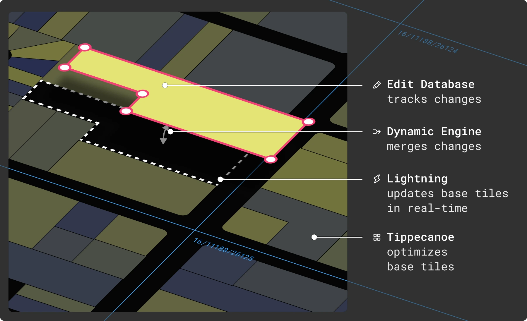
- Base tiles do the computationally expensive work once. Tippecanoe handles geometry generalization and optimization when data is first uploaded, delivering the rendering performance of pre-computed tiles.
- The edit database captures only what changes. Rather than rebuilding entire tilesets, only modified features, updated attributes, and new geometries are stored.
- The dynamic engine merges base tiles with edits on request. When you view the map, the engine combines base tiles with current edits in real time, giving you live, editable data at the speed of pre-computed tiles.
- Lightning continuously incorporates edits back into base tiles. A background process keeps the system efficient by ensuring it never dynamically processes more than a small fraction of the total data. This keeps performance fast regardless of dataset size or editing volume.
- The same pattern powers tables, search, and statistics. Base indices merge with live edits across all operations, ensuring everything works against current data.
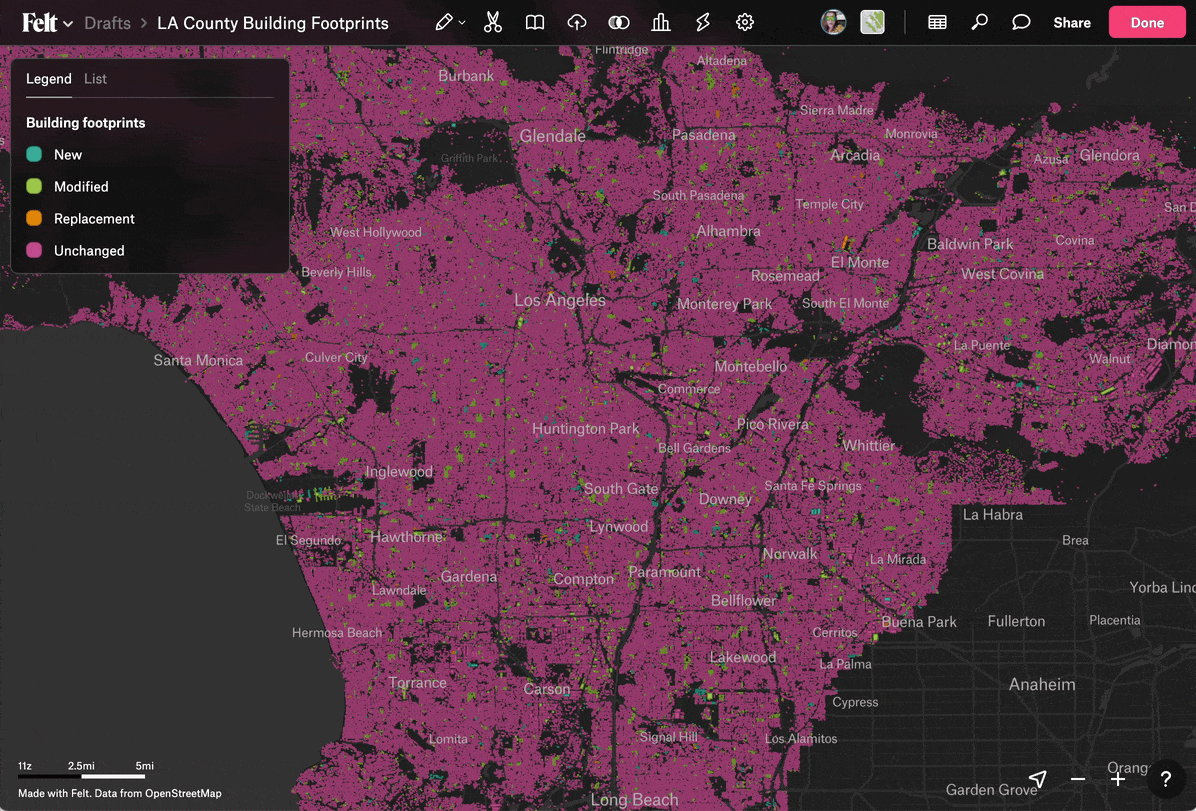
Lightning powered editing is live in Felt
Lightning is already powering your data in Felt. We've upgraded all existing datasets to use Lightning's architecture, so there's nothing you need to do to start benefiting from instant editing at scale.
This means you can:
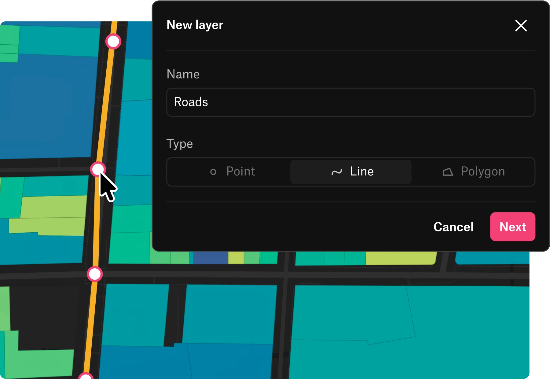
- Start editing data immediately. Click into any layer and modify geometries, update attributes, or delete features and see your changes render in real time.
- Create new layers. Quickly create structured point, line, or polygon datasets from scratch. Add custom attributes and start collecting data that stays fast and fully editable regardless of size.
Lightning is available as part of Felt's Enterprise plan. Ready to bring real-time collaborative editing to your organization? Reach out to our team to learn more.
Compare Felt using AI


.webp)