Print in Felt: from live map to finished report in minutes
Describe the page you need and Felt AI builds it from your map, in your team’s layout, ready to download. Or design it yourself in the print studio built into every Felt map.

The map your company runs on lives in Felt. Many of the decisions made from it still happen somewhere else: in the slide deck for Monday’s ops review, the PDF attached to a client proposal, the exhibit in a permit application, or the packet a crew lead carries to site.
Until now, getting the map into those deliverables has meant a screenshot. When the legend doesn’t fit, people screenshot that too and stitch the pieces together. When it has to look right, they file a ticket with the one person who knows the desktop GIS, and wait. Next week the data has changed, and they do it all again.
Print in Felt ends that loop, in two ways.
Every Felt web map now has a print layout designer built in, with legends, insets and scale bars. You can export a map to PDF, PNG, JPG or editable SVG. And Felt AI knows how to use it: describe the report you need, and it builds the pages from your map and hands you the file.
Ask Felt AI for the report
Most of the pages a team needs are easy to describe and slow to make. Now you can describe them.
People rarely start by asking for a page. They start with a question. An energy developer asked Felt AI to find county-owned parcels near high-voltage transmission lines, outside the flood plain and big enough for the project. Felt AI narrowed the map to a handful of candidates. Then came the request that used to mean a ticket: “I need an exhibit that shows these in a PDF.” The first version came back in about a minute.
From there, the page improves the way a draft does, in plain words:
- “Label each site A to D and add a scale bar.”
- “Add the parcel numbers and owners.”
- “I can’t see the parcels, the letters are too big.”
Each request returns a new PDF, PNG or SVG, with a Download button right in the chat. Felt AI works from a built-in layout or your team’s own, so the page arrives with a title, a legend and a locator, in your house style. To finish it by hand, open the same page in the designer.
The Felt MCP Server gives Claude, ChatGPT, Cursor and other AI agents the same tools, so the agent your team already uses can build and print pages too.
One page per site, crew or client
One request stands out, because it takes longest by hand: the same page, many times over. Desktop GIS calls it a map series or an atlas.
A volunteer coordinator divided a town into 27 canvassing areas, then asked for a page for each area and a master map of them all. A field manager asked for a status report with one page per worker. Both had the full set in about a minute, each page zoomed to its own area.
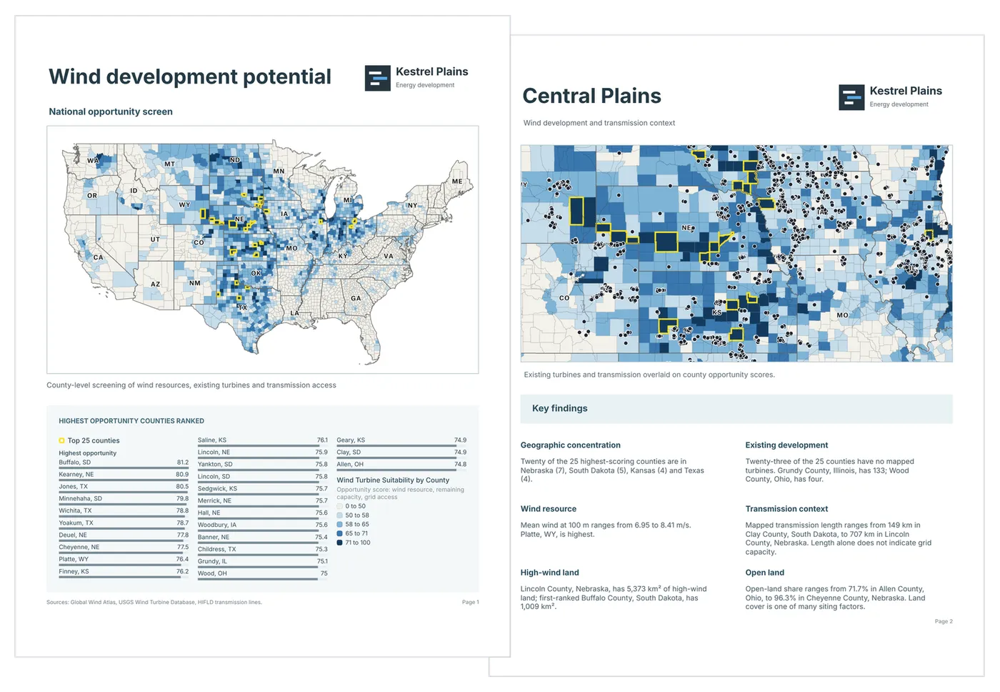
Ask for a page per neighborhood, per site or per client, and Felt AI frames each one, titles it and exports it.
Every page comes from the live map
A page made this fast is only useful if you can trust it. You can, because a Felt page isn’t a snapshot of the map. It’s another view of it.
Every map on a page draws from the same layers, styles and annotations your team is working in, so there’s no second set of print styling to keep in step. The preview is what you export: the extent, symbol sizes and label placement on screen are exactly what lands in the file. Raising the DPI makes the output sharper and changes nothing else.
That matters most the second time you print. Crews close out work orders, someone restyles a layer, a new parcel goes under contract. Open the page, export again, and it shows all of it.
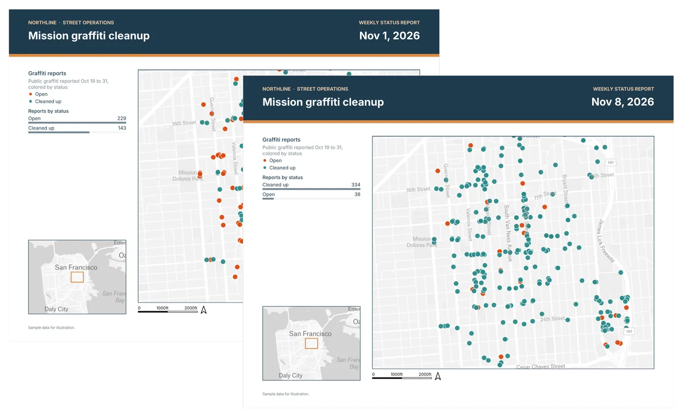
Your house style, saved once
Felt ships eight print layouts, each in landscape and portrait, from a standard exhibit with a legend and locator to side-by-side comparisons, map grids and a report page. Pages come in Letter, Tabloid, A4 and A3, or any custom size up to 100 inches.
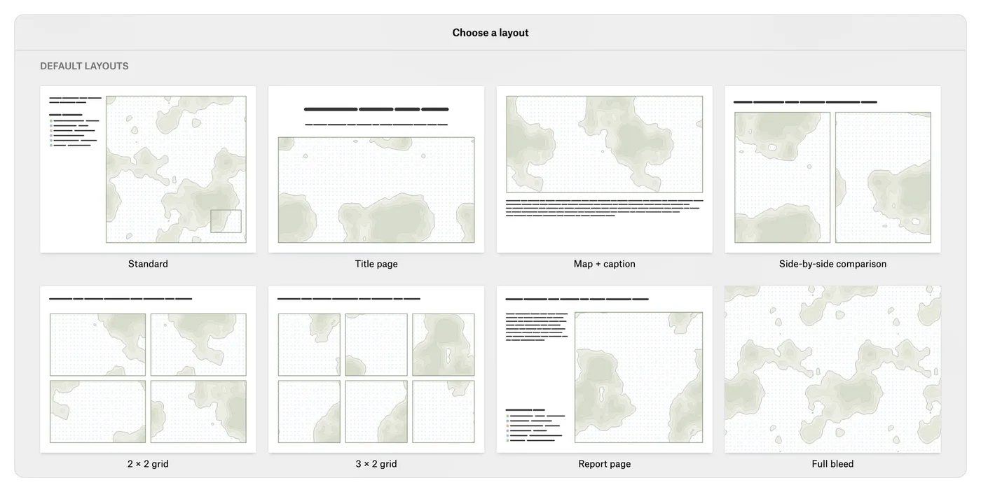
The built-in layouts are a starting point. Most teams have a house style: a logo in the corner, a set title block, a disclaimer, the legend where the client expects it.
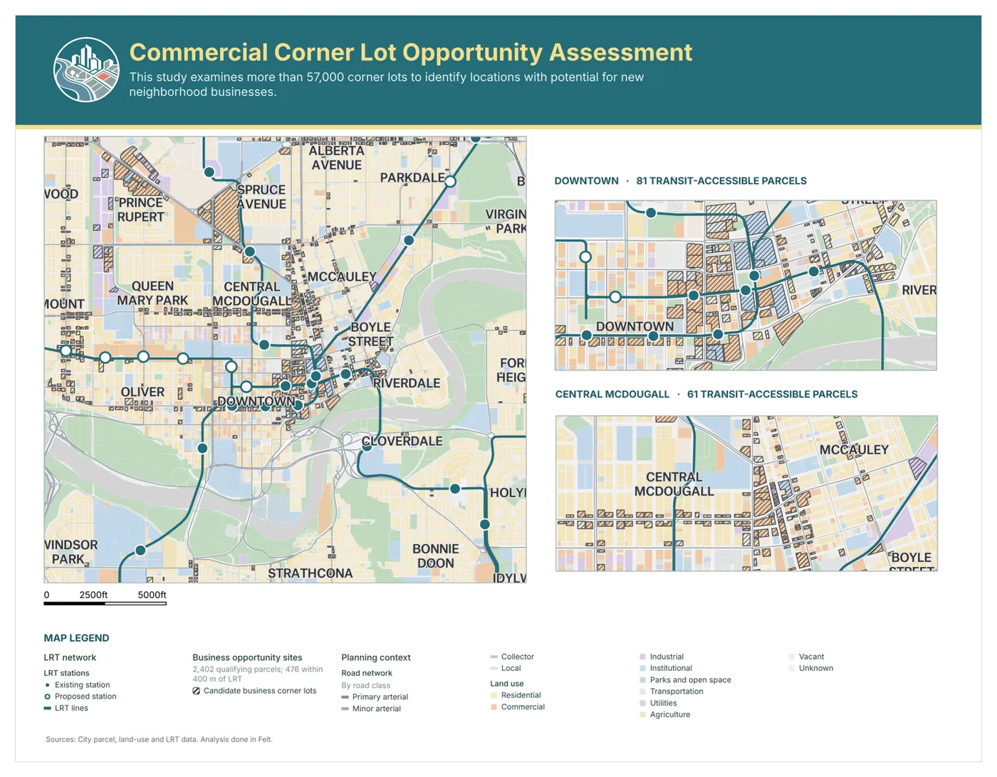
Build that page once and choose Save layout… to add it to your workspace’s layout library. Everyone on the team can start from it on any map, and so can Felt AI.
There are no print template files to email around and no print service for an administrator to configure. The person who owns the standard sets it once, and the rest of the team turns out correct, on-brand pages without going through them.
Legends that do the reporting
The legend is where most map exports break down. In a typical web print tool, a legend that’s too long is clipped or dropped without warning, and someone finds out after the file has gone to the client.
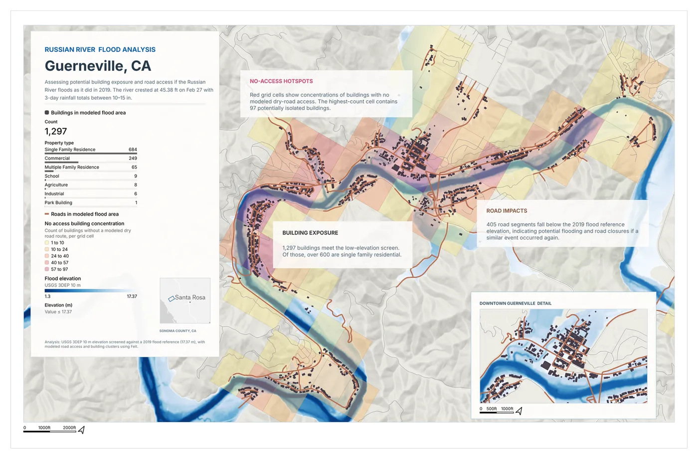
Felt’s legend always lists what its map draws. Give it a fixed box and it adapts, scaling text and adding columns until every entry fits. If it truly can’t fit, the designer warns you before you export.
Legends carry the numbers, too. Statistics, bar charts, histograms and time series can sit inside the legend, calculated for the area its map shows. Put a map of District 4 on the page and the legend reports on District 4. When a filter is on, the legend says so in plain words, so anyone reading the page knows what’s been left out.
The studio, when you want hands on
Every page Felt AI builds opens in the page designer, and you can start there from scratch as well. It handles layout work the way you’d expect:
- Multiple maps per page, each with its own extent, zoom, rotation and layers, plus locator maps that outline another map’s extent.
- Scale bars, north arrows and graticules attached to each map.
- Text, images and sections for title blocks, logos and notes. Paste or drag images straight onto the page.
- Snap guides, alignment and undo, so lining things up takes seconds.
- Live collaboration, so teammates can work on the same page at once.
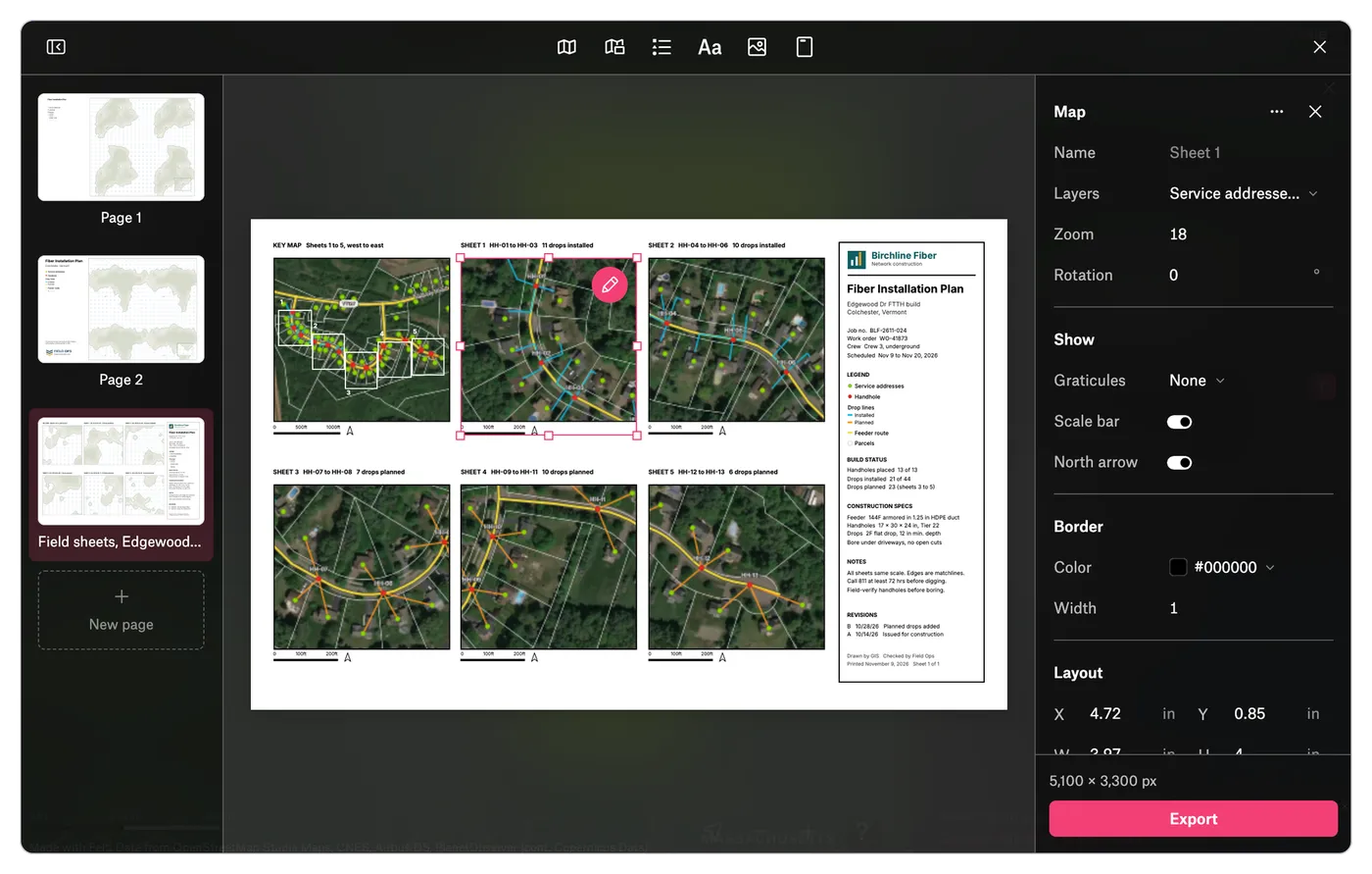
Export high-resolution files at 150, 300 or 600 DPI. Files record their DPI, so they come out the right size in a slide, in a Word document or at the print shop.
Out of Felt, three ways
Not every map needs a designed page, and not every page stops at a PDF.
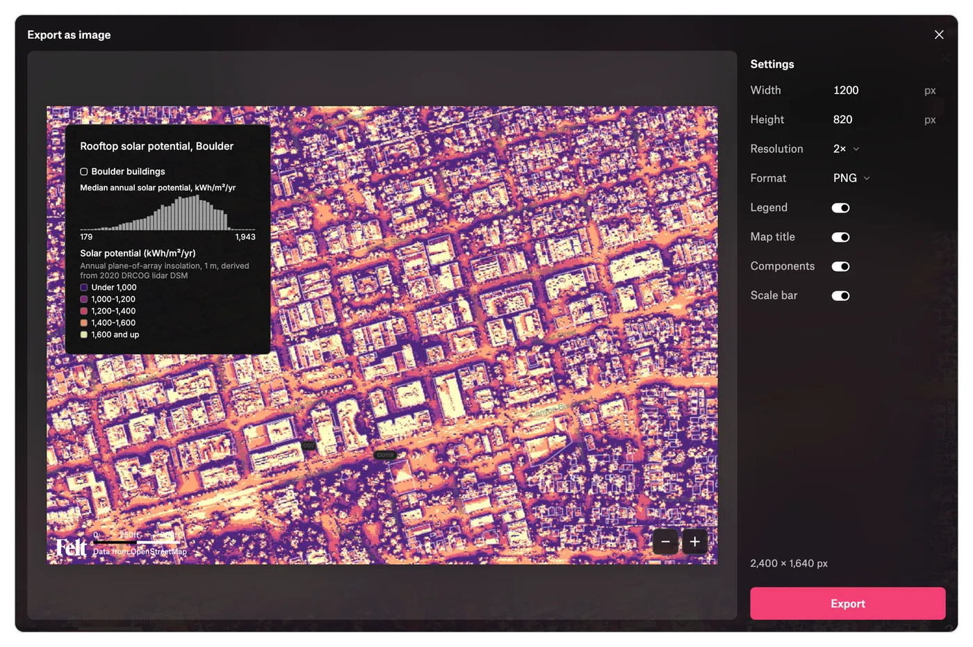
A quick image. Plenty of “print” never touches a printer. File › Export as image… takes the map as it looks right now, with its legend and scale bar, and exports the map to PDF, PNG or JPG at up to 4× resolution, with no print layout to design first.
An editable SVG. A map headed for an annual report or a brochure usually ends up in Illustrator or Figma, where a flat image means redrawing it. Felt exports SVG with each layer as its own named group, labels as editable text and shapes a designer can select one by one.
An automated export. If you make the same page every Monday, a script can make it for you. Every page is available through Felt’s REST API and comes back exactly as designed.
Available now
You no longer need a desktop GIS, or the person who runs it, for the pages your operation uses every week. For a 200-page map book, QGIS and ArcGIS Pro are still the right tools, and Felt works alongside them.
Print, team layouts and SVG export are available today on Business and Enterprise workspaces, as is designing and printing pages through Felt AI, the Felt MCP Server and the API. Export as image and the image-export API are available on Team and above. Open any map and choose File › Print… to start, or read the help center guide.