Felt reaches 1.0, now ready for teams
Felt has always been the best way to work with maps on the internet.

Felt has always been the best way to work with maps on the internet. Today we are announcing a huge milestone: we are no longer in beta.
Around the world, people rely on maps as a core part of their job. They work together to sketch out site plans, coordinate disaster responses, and understand the changing climate.
Felt has always been the best way to work with maps on the internet, and today we are announcing a huge milestone: we are no longer in beta.
With Felt 1.0 comes a whole new suite of tools for sophisticated groups and organizations, such as Teams, Team Libraries, and new features for professionals.
A Year of Incredible Maps
Since launching our public beta of Felt last year, we’ve been overjoyed by the response. Our customers have taught us a lot about what they need, and we’ve used that knowledge to make some major improvements to Felt:
- Upload anything, making almost every file work on map without the stress of map projections or converting formats;
- Powerful styling controls, allowing a map to be styled as easily as a design tool like Figma;
- Numeric visualizations, greatly increasing the range of maps possible in Felt;
- A new community, where 500+ map makers are sharing their tips & tricks;
- Tippecanoe, our major open source project used by the Washington Post and others to work with maps on the the internet.
But what’s got us most excited is the maps people have made with Felt:
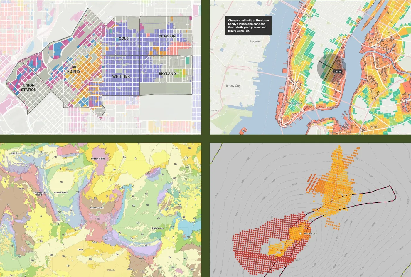
Folks were empowered by data:
“Felt quickly became an indispensable tool in my map-making kit. Thanks to Felt’s Upload Anything feature, sharing insights gleaned from the millions of property records in Regrid has never been easier.” - Alex Alsup, Vice President of Research & Development at Regrid
They told stronger stories:
“Being able to draw, paste photo examples, and upload property lines has allowed us to generate really productive dialogue remotely.” - Phillip Longenecker, Transportation Planner, Alta Planning + Design
And most importantly, they brought people together:
“There aren’t many tools that let you work with geo data on the fly. But now we’re running workshops where everyone’s in a map drawing together!” - Larisa Ovalles Paulino, Research Scientist, MIT Urban Risk Lab
To help organizations like these move faster and stay organized, we are introducing our biggest feature yet.
Move Faster with Teams & Team Libraries
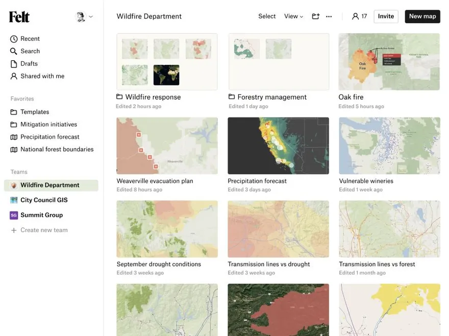
We’re so excited to launch Teams today. We designed Felt with collaboration in mind from day one, but until now, you had to add collaborators individually to each map. Teams changes that by enabling multiplayer collaboration with full control over who and when people can access your maps.
The first part of this launch is a redesigned App Home. This new dashboard lets you:
- Define a team and assign editing or viewing permissions to each member;
- Move maps between your personal drafts and the shared team space;
- Create folders to organize your team’s maps according to your system;
- Search and sort your maps using multiple views;
- Join and collaborate across multiple teams.
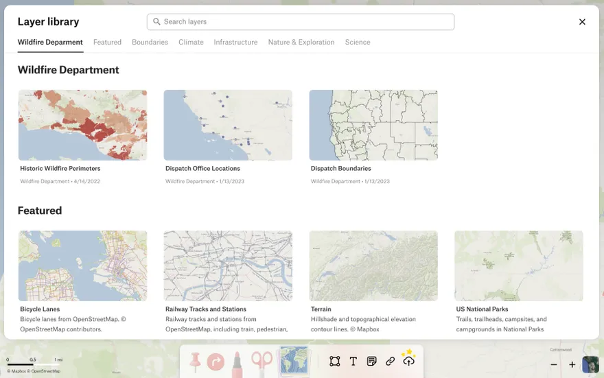
To help teams stay organized and move quickly, we’re also launching the Teams Library. This new section of the Library is yours to control. It makes it easy to:
- Publish your data layers so that your team can easily view and reuse them;
- Quickly find the right data set for the task at hand and apply it immediately;
- Add descriptions, metadata, and attribution information.
If one person on your team organizes the library, everyone benefits.
Now teams of all sizes working to develop a piece of land, design a new tunnel, or plan a solar farm, can build on each other’s maps, always work off the same versions, and cover more ground faster, together.
New Features For Professionals
While Teams is the major highlight of this launch, we always strive to overdeliver. Today we are also launching a broad set of new features for people who rely on maps in their day-to-day work. These features are designed to help professionals move faster, allowing them to build and share complex maps in even less time.
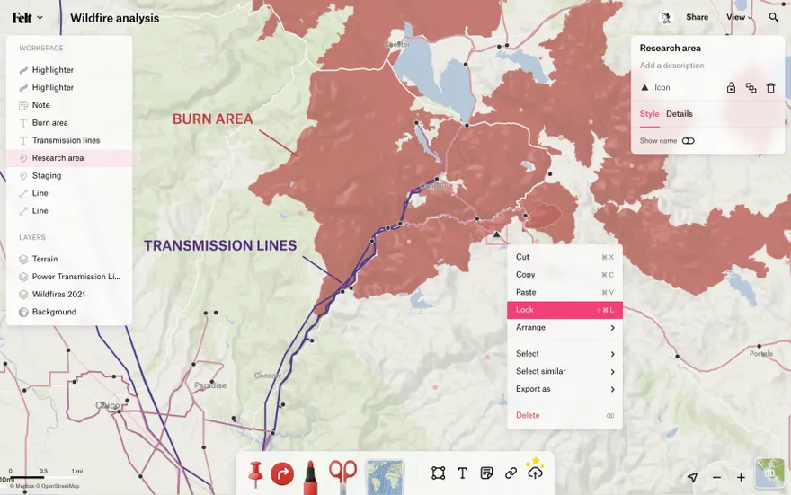
- A new rendering engine, for faster and smoother rendering especially in dense maps;
- A new list view (View > List), that displays every element in your map;
- Command-K quick action menu, for searching and using every action available in Felt;
- Right-click menus, everywhere throughout the app;
- A new help center, with guides for common workflows to get your team onboard;
- A new inspirational map gallery, to help you learn from, and build on other’s work.
Since the beginning, our plan has been to offer a free tier of Felt for personal use alongside paid tiers for professional teams. Starting in 2024, Teams and related features will be available only to paying customers. We’re making these features free for the first year to learn how people use them and to ensure our pricing matches user’s needs. We want to learn from you. If you’re interested in paid teams, reach out to the Felt team to share your feedback and tell us about your use case.
Add Your Team to Felt
Together, the above work enables teams to use Felt in new and powerful ways. We’re excited to see what you’ll do with it, so sign up and create a team today!