SUMMARY
Field data collection apps help teams capture information onsite using mobile devices, replacing paper forms with digital workflows that record GPS locations, photos, and notes.
Modern data collection tools support offline work, custom surveys through a form builder, and automatic syncing of mobile data once connectivity returns.
Popular tools include Fulcrum, FastField, and KoboToolbox, which support inspections, surveys, and structured field reporting.
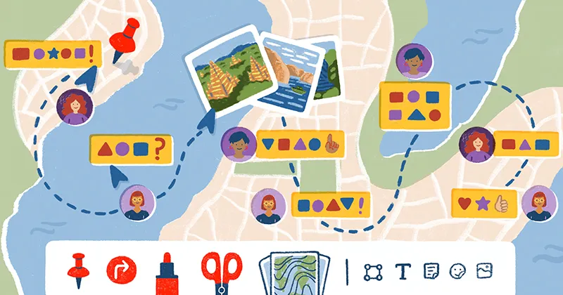
Instead of separating field reporting from mapping, platforms like Felt combine data collection, mapping, and collaboration in a single browser-based workflow with custom forms, geotagged observations, and shared maps.
Field data collection apps: Which app is the best?
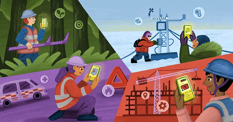
When field teams work onsite, they need a reliable way to capture and store information on the go. Data collection apps turn mobile devices into powerful tools that sync information in real time and keep all your details organized. They also come with a range of helpful features to help teams collect information offline, build custom forms, and capture GPS locations.
Let’s take a closer look at the best field data collection platforms available today — including Felt’s Field App, which makes it easy to gather details and stay connected across job sites.
What is a field data collection app?
A field data collection app is mobile and web-based software that lets teams capture, validate, and share information from wherever they're working. Instead of using paper forms or spreadsheets, you can record details onsite and in real time with greater accuracy. These apps also reduce manual data entry and processing times by:
- Automatically syncing information from mobile devices
- Validating inputs as they’re entered
- Organizing everything in a central dashboard
Most data collection tools come with offline usage and location tagging to help you track progress and add photos or notes where the work happens. Whether you’re logging inspection results or running customer surveys, these apps ensure every piece of information is properly stored. That way, your team spends less time chasing down details and more time making decisions.
8 best field data collection apps for mapping, surveying, and field work
If you need data collection software that’ll hold up in the field, these eight apps are top options to consider.
1. Felt’s Field App
With Field App from Felt, teams collect data directly on maps using intuitive and mobile-friendly tools. Users can build custom surveys, jot down field notes, and attach geotagged photos to specific map features.
Field App supports offline use, so data gathered in the field syncs automatically once your connection returns. And because Felt is an advanced mapping platform, it blends the best of field work and spatial context to deliver deeper insights across different locations.
Pricing: Paid Contributor seat starts at $30/mo/seat
2. Fulcrum
Teams often use Fulcrum’s flexible data collection app for inspections and field surveys. Key features include its drag-and-drop form builder and workflow automation, which are useful when you need advanced customization. Fulcrum also integrates with geographic information systems (GIS) and analytics platforms to maintain a single source of truth.
Pricing: Paid Professional plan starting at $41/mo/user license annual
3. ArcGIS Field Maps
ArcGIS Field Maps is an Esri-powered app that combines mobile forms, asset inspection, and location tracking. It’s popular for teams already embedded in the ArcGIS ecosystem, since any information collected in the field syncs to its web maps and dashboards. Other highlights include the high-accuracy GPS and data validation features.
Pricing: Paid Creator plan starting at $400/yr/seat
4. KoboToolbox
KoboToolbox is an open source app that collects structured mobile data in challenging environments like disaster zones. It provides offline mode and multimedia capture, as well as strong data security features. Since KoboToolbox is free for nonprofit and academic organizations, it’s frequently used in humanitarian work and social research.
Pricing: Paid Professional plan starting at $159/mo
5. ArcGIS Survey123
Survey123, from Esri, specializes in form-driven data collection. It’s a strong option for teams needing consistent, validated inputs — for tasks like environmental surveys and compliance work. The Survey123 app also enables offline activity, geotagged attachments, and advanced logic through XLSForm design.
Pricing: Paid Creator plan starting at $400/yr/seat
6. QField for QGIS
QField lets field teams work directly with GIS layers on Android or iOS devices. As a mobile extension of QGIS, it’s built for mapping-heavy workflows and can handle forms, geotagged photos, and high-precision GNSS with ease. Its offline capabilities allow field workers to carry full QGIS projects into remote areas.
Pricing: QField is free, open source software under the GPL v2+ license
7. FastField
FastField works well for repeatable workflows, such as inspections, QA checks, and field service reporting. Its form builder offers easy customization, and the app supports everything from geolocation to conditional logic. FastField also comes with a range of automations to reduce manual processing and speed up reporting.
Pricing: Paid Core plan starting at $24/mo/seat
8. Avenza
Avenza Maps focuses on offline asset tracking and field markups, which is ideal for teams operating in remote locations without connectivity. You can import custom maps, drop placemark pins, and attach photos or notes as you work. It’s widely used in forestry and emergency response services for documenting conditions in real time.
Pricing: Paid Plus plan starting at $34.99/yr/device
How to pick the best data collection app
Before choosing a mobile data collection app, it helps to remember they’re designed to keep teams organized and move information where it needs to go. Most tools have similar features, like offline options and media capture, but each has a slightly different approach. Use the following criteria to help you decide which app is the right fit:
- Offline capability: Your team won’t always have service, so choose an app that lets you store data offline and automatically uploads your data when you’re back on.
- GPS accuracy and mapping: If location matters for your work, look for tools with solid GPS performance and built-in mapping with precise coordinates and spatial context.
- Customizable forms and surveys: A flexible form builder can help you tailor templates like surveys and checklists. The more customizable the app, the better.
- Media capture: Photos, video, and audio notes add extra clarity to your field reports and let you collect information right inside your forms.
- Real-time sync and collaboration: These features are essential for teams spread across multiple sites that want to stay aligned and avoid lost or duplicate information.
- Data export and integrations: Information shouldn’t hide inside one platform, so pick an app that lets you export records and integrates with your mapping and analytics systems.
Powerful field collection, made effortless with Field App
Field data collection apps help you gather reliable information and keep it organized however long you’re offline. Felt’s Field App lets you standardize data collection and capture locations with precision. It combines real-time sync, full mobile GIS, and custom surveys that fit the way you work.
You can also document site conditions with photos and use advanced GIS tools right in the field. And because all your information updates instantly, your whole team can access the information they need across sites and projects.
If you’re ready to simplify your field work and level up data collection, book a Field App demo and see how easy it can be.
FAQ
What is the best free data collection app?
Several data collection apps are free — or offer free tiers — but the right app depends on your needs. Apps like QField and KoboToolbox have decent mapping and offline capabilities. But if you’re looking for real-time sync and customization, Felt offers a more powerful experience — though some features require a paid plan.
Are there data collection apps that integrate directly with GIS platforms?
Many data collection apps connect to GIS tools. For example, Felt and Fulcrum have strong GIS integrations that allow you to sync field data, map locations, and manage geospatial layers without extra steps.
How to collect data from a field?
A data collection app lets you capture field work on your phone or tablet. Start by creating a form or survey, then record details, photos, and locations onsite — even offline if needed. Once you’re back online, the app syncs everything so your team can review and use the data right away.
Compare Felt using AI


.webp)