
Government teams need access to powerful, spatial intelligence tools, but security and compliance requirements have kept them locked into legacy systems that aren’t built for the speed and scale needed for today’s mission critical workflows.
Today that changes. Felt is now available on AWS GovCloud (US), bringing our cloud-native GIS platform to federal agencies, government contractors, and organizations with the most stringent security requirements enabling the next generation of GIS for government.
One secure deployment with total control
This super-powered security builds on our self-hosted VPC offering for enterprises, giving users the complete Felt platform with real-time collaboration, AI-powered spatial intelligence, and modern workflows within infrastructure that meets FedRAMP High, ITAR, and DoD Impact Level requirements.
Whether you're coordinating disaster response, analyzing critical infrastructure, or supporting national defense operations, Felt on AWS GovCloud delivers:
- Full control over features & updates: The entire Felt infrastructure runs within the AWS GovCloud environment that you control and manage. As Felt provides new features and security enhancements – you decide when to deploy them.
- Ultimate data sovereignty: Your maps and data remain within the secure GovCloud environment. Felt has no access to your information or infrastructure. You maintain full control over who can access what, when, and how.
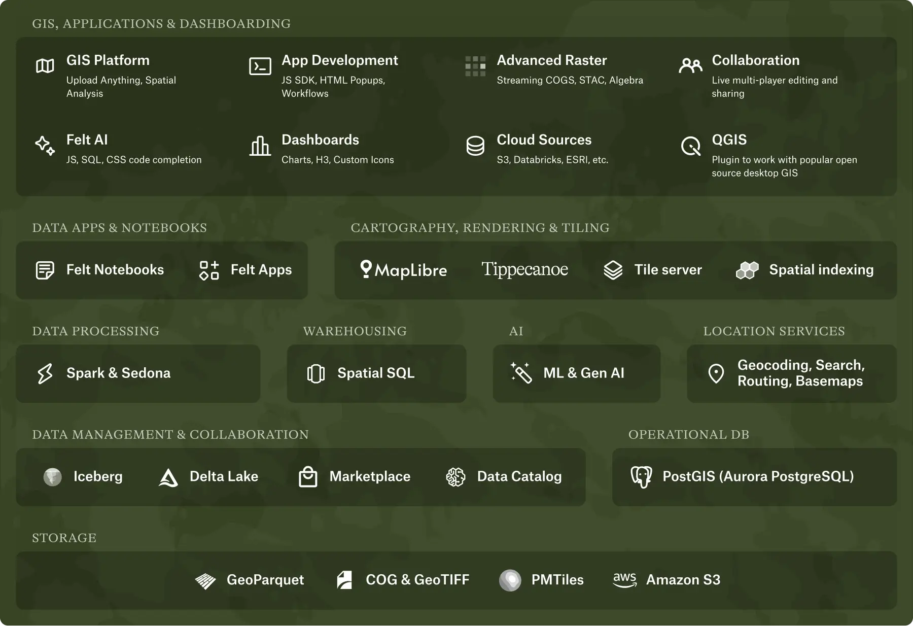
The power of modern GIS for mission critical operations
Legacy desktop GIS creates bottlenecks for teams that need to move quickly and efficiently. Felt removes these barriers by delivering modern capabilities with:
- AI-powered spatial intelligence: Build custom applications, query cloud sources, and create intelligent popups through natural language using AWS Bedrock's government-authorized LLM models. What used to require months of dedicated engineering resources and complex deployments now takes days and happens directly in your browser with zero infrastructure overhead.
- Enterprise database connections: Connect directly to Amazon S3, PostgreSQL, Snowflake, Databricks and other cloud investments behind your VPN with live updates to analyze and visualize raster and vector data at the scale and speed critical workflows demand.
- Instant rendering at any scale: Felt's Tippecanoe tiling engine delivers seamless performance across all zoom levels. Upload millions of features without preprocessing and navigate smoothly from global overviews to street-level detail, to explore massive datasets with the responsiveness time-sensitive operations require.
- Real-time collaboration: Multiple editors can work simultaneously on the same map, enabling the kind of rapid coordination that government operations demand.
- Seamless integrations: Securely embed interactive dashboards directly into Tableau, Power BI, SharePoint, and other tools your teams already use. Share insights with a single click for instant information sharing across agencies without switching between disconnected systems.
AI-native GIS for government has arrived
Felt is already transforming how enterprises work with spatial data. Now with availability on AWS GovCloud, government teams can adopt the same power of modern GIS within infrastructure that meets FedRAMP High, ITAR, and DoD Impact Level standards, accelerating mission-critical work without compromising security.
Ready to bring AI-native spatial intelligence to your government operations? Book a demo today to learn more.
Compare Felt using AI


.webp)