37° 48' 15.7068'' N, 122° 16' 15.9996'' W
cloud-native gis has arrived
37° 48' 15.7068'' N, 122° 16' 15.9996'' W
cloud-native gis has arrived
37° 48' 15.7068'' N, 122° 16' 15.9996'' W
cloud-native gis has arrived
37° 48' 15.7068'' N, 122° 16' 15.9996'' W
cloud-native gis has arrived
37° 48' 15.7068'' N, 122° 16' 15.9996'' W
cloud-native gis has arrived
37° 48' 15.7068'' N, 122° 16' 15.9996'' W
cloud-native gis has arrived
37° 48' 15.7068'' N, 122° 16' 15.9996'' W
cloud-native gis has arrived
37° 48' 15.7068'' N, 122° 16' 15.9996'' W
cloud-native gis has arrived
37° 48' 15.7068'' N, 122° 16' 15.9996'' W
cloud-native gis has arrived
37° 48' 15.7068'' N, 122° 16' 15.9996'' W
cloud-native gis has arrived
Ask a question. Get a map. The new era of GIS, powered by Felt AI.
Learn more
PLATFORM
Web GIS
Dashboards
Cloud Sources
App Development
Raster
Felt AI
Field App
Industries
agriculture
Cities and Government
CLIMATE and NATURAL RESOURCES
Education
Energy and Utilities
Engineering and Infrastructure
Insurance
Real Estate
Retail
Spatial Intelligence
Telecom
Transportation
Resources
Customers
Webinars
Help Center
Developer Docs
map Gallery
Blog
QGIS Plugin
PRICING
BOOK A
DEMO
Log in
Sign Up
Log in
SIGN UP
Book Demo
Pricing
Product
WEB GIS
Dashboards
Cloud Sources
App Development
Raster
Felt AI
Field App
Industries
agriculture
Cities and Government
CLIMATE AND NATURAL RESOURCES
Education
Energy and Utilities
engineering and infrastructure
Insurance
Real Estate
Retail
Telecom
Transportation
Spatial Intelligence
Resources
Webinars
Help Center
Dev Docs
Map gallery
Customers
BLOG
QGIS Plugin
Map Gallery
Cities and government
Felt Picks
Our selects for maps that we love, whether they’re useful, interesting, beautiful, or just unique.
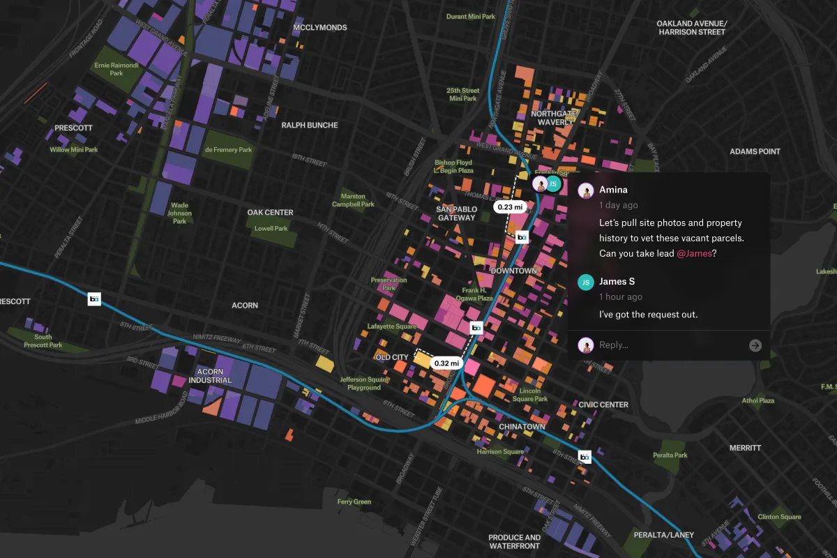
Business Development Opportunity Areas
Explore sites suited for commercial, mixed-use, industrial, and office development in incentive zones.
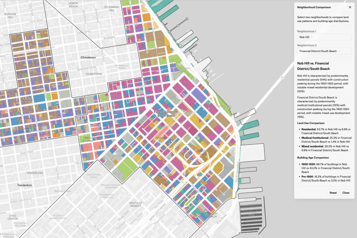
Neighborhood Land Use Comparison
Compare land use and building age across neighborhoods with dynamic summaries.
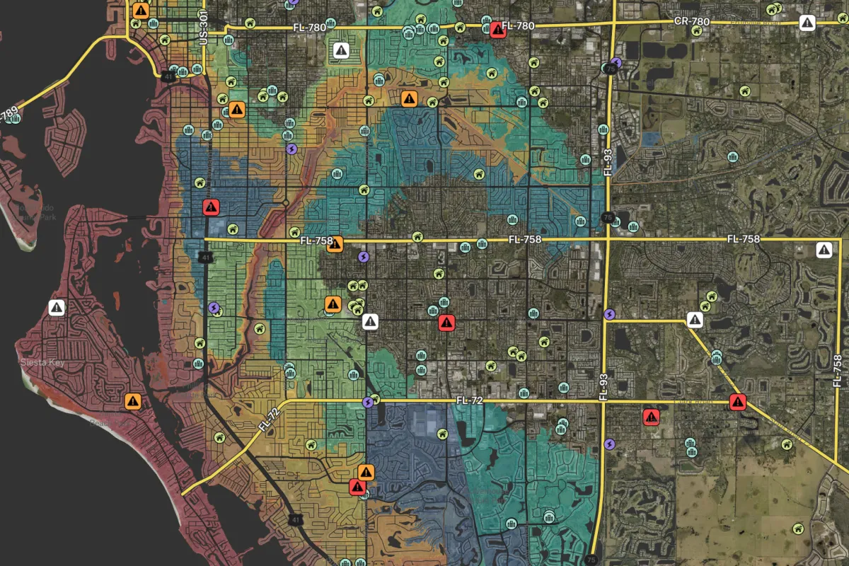
Hurricane Impact and Vulnerability
Share insights on recovery planning for critical infrastructure and at-risk communities after hurricane flooding.
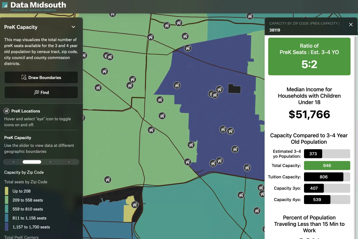
Pre-K Access and Funding
First 8 Memphis provides a comprehensive visual analysis of Pre-K access at both the census tract and zip code levels.
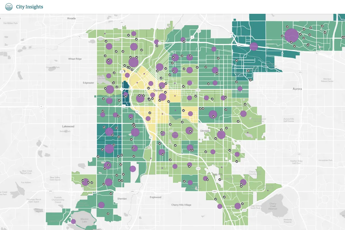
Public Schools and Student-Age Populations
See how public schools compare to the school aged population across Denver neighborhoods and City Council districts.
Categories
Agriculture
Cities and government
Climate and natural resources
Emergency response
Energy and utilities
Exploration
Finance
Insurance
Planning
Real estate
Spatial intelligence
Telecom
Transportation