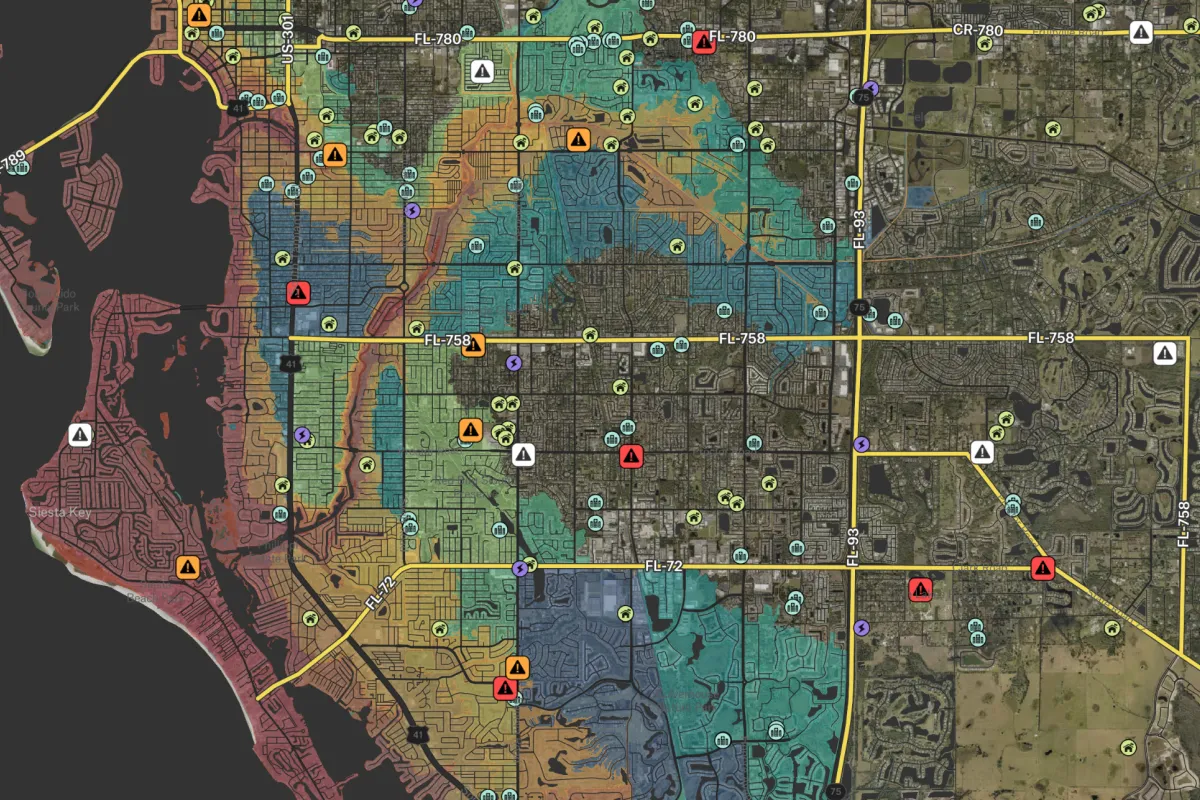
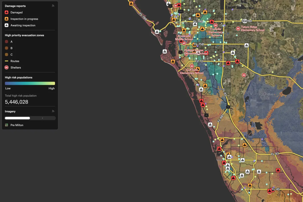
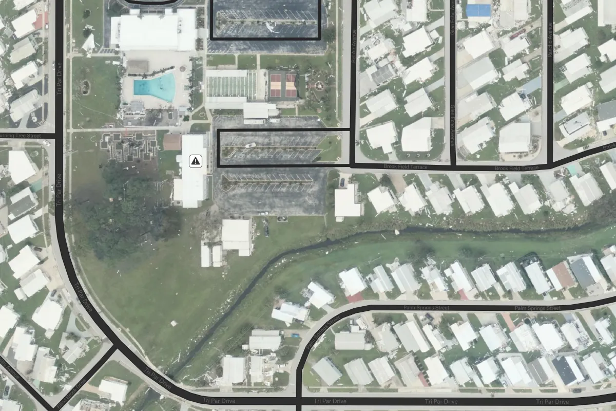
Use this map to understand where flooding impacted critical infrastructure and at-risk communities. It combines pre- and post-Hurricane Milton imagery with evacuation zones, vulnerability data, and real-time damage reports to support response and recovery planning.
.webp)