What is spatial data science? A data science definition with examples
If you’ve ever followed a hiking trail on your phone or watched a storm roll in on radar, you’ve already experienced spatial data science at work. It leverages location-based information to provide valuable insights into how places connect and interact. From predicting traffic flows to monitoring environmental change, this science field shows how geography and data analysis combine to explain patterns across space.
Learn what makes spatial data science unique, how experts analyze it, and where these techniques show up in everyday life.
What is spatial data science?
Spatial data science analyzes and visualizes information that has a spatial or geographic component. Unlike standard data science, where location is just one variable, it incorporates location directly into the analysis. Scientists rely on geographic information systems (GIS) and machine learning to explore spatial relationships like distance, direction, and proximity. Here’s a look at the foundations that support spatial data science.
Data science
Data science combines statistics and analytical thinking to extract deeper meaning from raw data. With the help of visualization and predictive modeling, scientists turn numbers and text into insights about customer behavior, resource allocation, and operational inefficiencies. Data science also supports decision-making by uncovering trends and patterns that guide strategy across diverse industries.
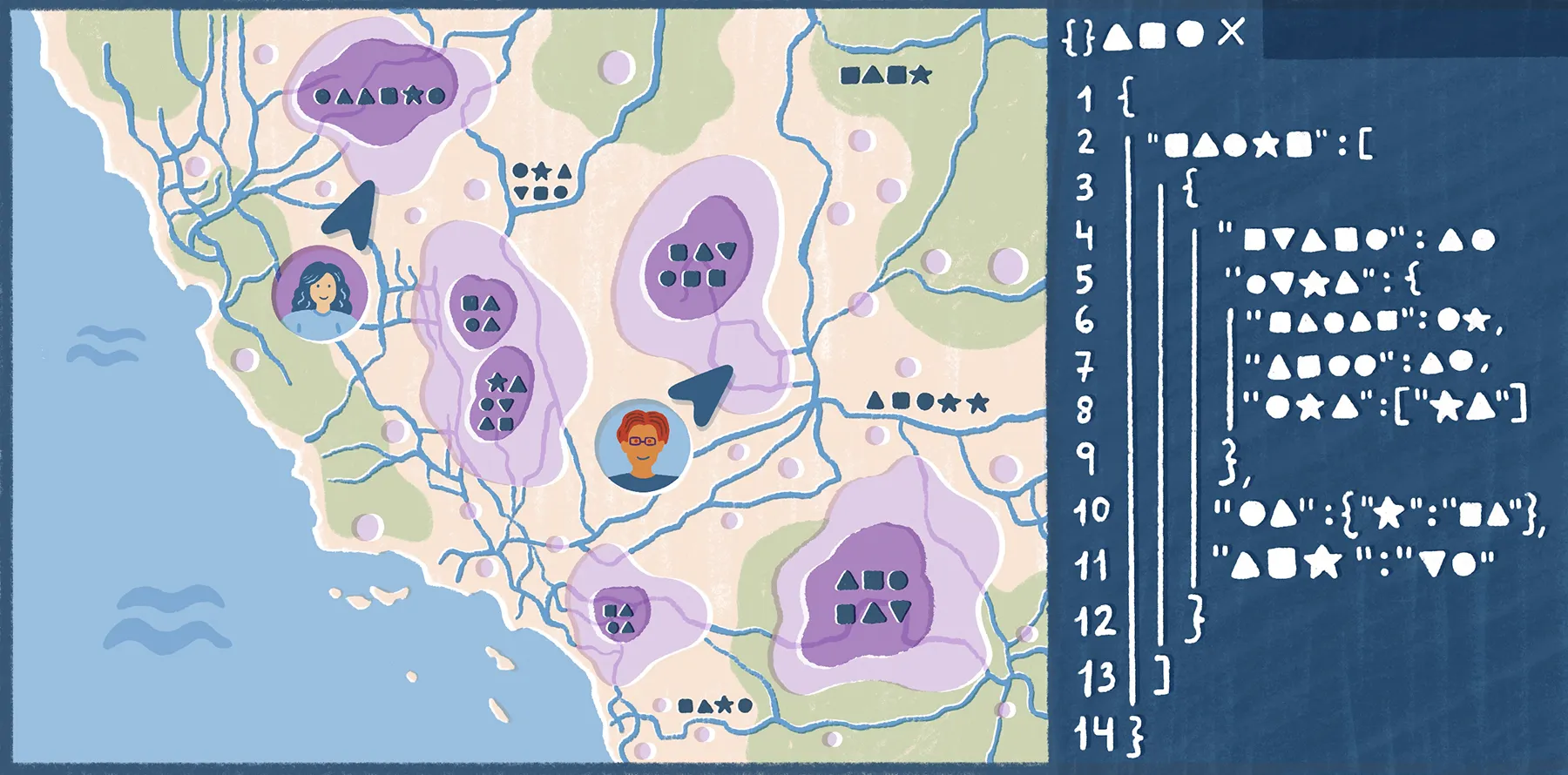
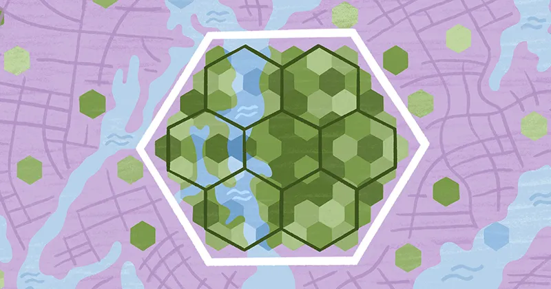
Spatial data
Spatial data is information that includes a location on Earth. For example, it can use points to represent store locations, lines for highways, and polygons for neighborhoods. It identifies where something exists and how it relates to other places, allowing you to analyze movement, patterns, and connections across geographic space.
Spatial analysis
The definition of spatial analysis describes methods used to study patterns and trends in spatial data. It helps us understand not only what is happening, but where and why location matters. Spatial data scientists frequently measure proximity, detect clusters, and identify correlations to surface insights that might otherwise go unnoticed.
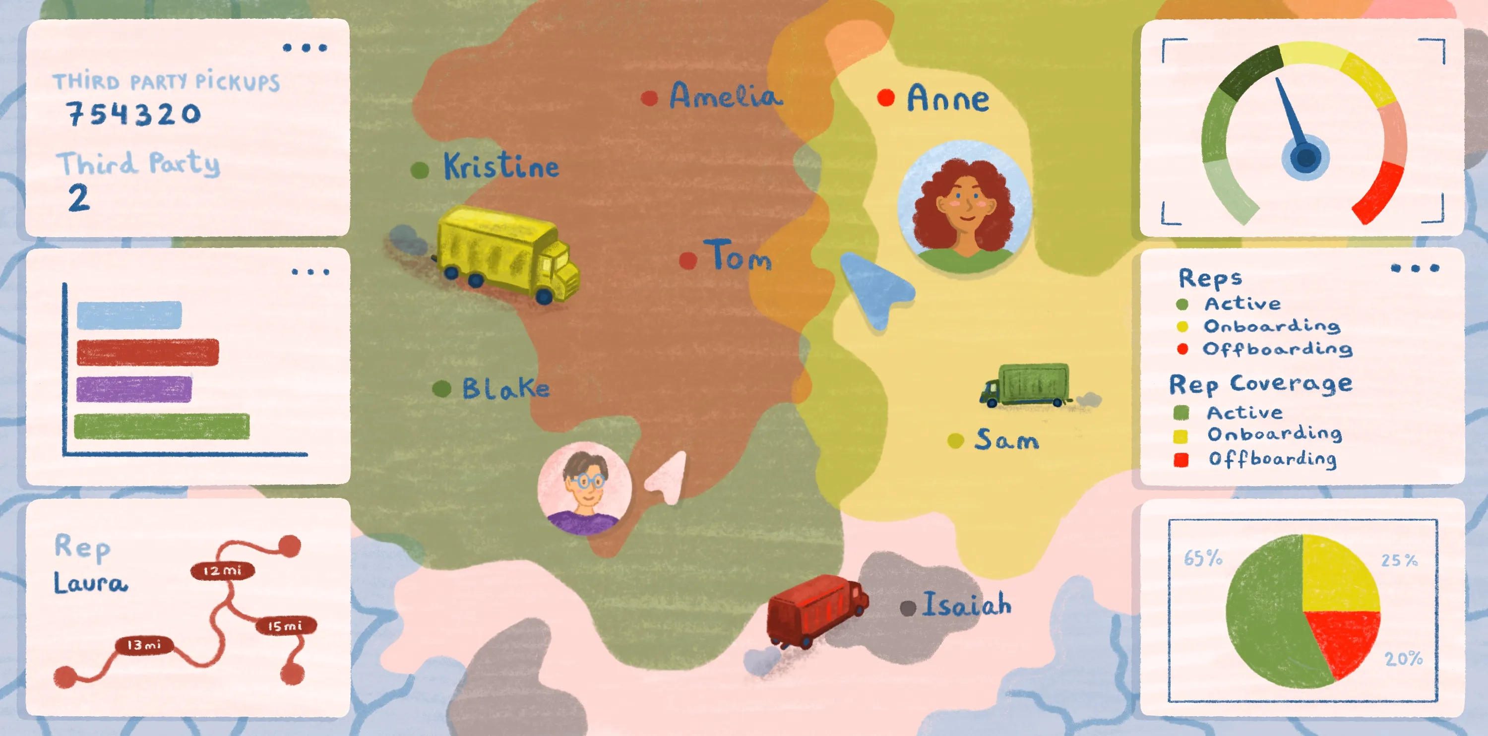
How is spatial data science applied in real-world analysis?
Nearly every real-world problem has a location component. That’s why spatial data science is so valuable — it reveals relationships and solutions that only emerge when you factor in geography. Here’s how industries apply spatial data science in everyday workflows:
- Agriculture: Farmers and agronomists use spatial and geospatial analysis to monitor crops, improve irrigation, and predict yields.
- Cities and government: Municipalities all over the world rely on GIS and spatial data to manage public services and plan infrastructure such as roads and bridges.
- Climate: Scientists turn to spatial analysis to track weather patterns and model environmental risks, including air pollution and coastal erosion.
- Education: Schools and universities map student populations and plan new campuses using spatial data science.
- Energy and utilities: Companies monitor power grids and plan maintenance for services like wind farms and transmission lines.
- Engineering and infrastructure: Spatial intelligence helps engineers design and develop transportation networks, emergency services, and community facilities.
- Insurance: Firms look at spatial data when assessing risks and managing claims from natural disasters.
- Public health: Agencies use spatial data to determine where new clinics and services should go. They also track disease spread with GIS software.
- Real estate: Agents leverage geospatial data to identify growth areas and target potential buyers or tenants.
- Retail: Businesses forecast demand and analyze customer behavior using spatial analysis.
- Telecom: Providers need geospatial data to help expand network coverage and improve service quality.
- Transportation: Spatial data science helps transportation and logistics providers coordinate delivery routes and create more efficient mobility systems.
Key differences between geospatial data science, spatial data science, and spatial analysis
While these three terms are closely related, each has a particular focus. Here’s how they compare at a glance.
While all three areas overlap, geospatial data science prepares the information, spatial data science interprets it, and spatial analysis provides the methods that tie everything together.
Unlock the power of spatial data with Felt AI
Felt AI makes it easy for anyone to see spatial data in action. You can load datasets — your own or one from Felt’s library — and instantly explore spatial patterns and geographic relationships.
With a simple prompt, Felt can generate features like stats, images, and full summaries that help explain your information. The platform also translates natural language into SQL queries so you can analyze large spatial datasets without writing code yourself.
Start your free trial today and experience the power of Felt AI firsthand.
FAQ
What is a spatial data specialist?
A spatial data specialist cleans, organizes, and manages spatial data so it’s accurate and ready for analysis. They also build geographic datasets and collaborate with other data scientists to reveal location-based insights.
What does a geospatial data scientist do?
A geospatial data scientist applies data science techniques to geospatial information, uncovering patterns and trends tied to geography. They use tools like GIS, PostGIS, and spatial analysis libraries to model and visualize data and run predictive analyses.
What is an example of spatial data?
Spatial data is any information that’s connected to a location on Earth. For example, GPS coordinates of delivery trucks or the location of weather stations are different types of spatial data. These datasets allow scientists to connect geography with analytics and visualization.
Compare Felt using AI