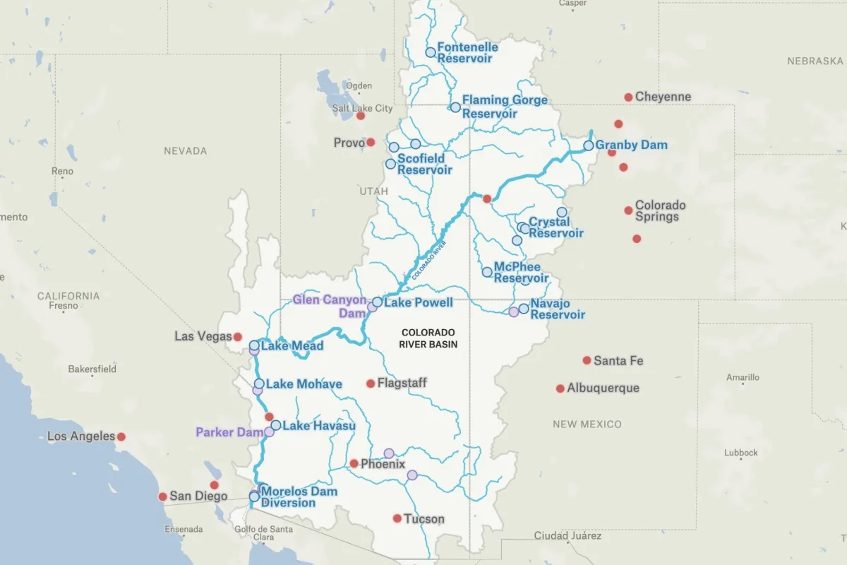
This map utilizes data from the Colorado River Basin GIS Open Data Portal to explore the 250,000 square miles of the Colorado River Basin, including its major reservoirs, dams, and the major cities that rely on it for water.
.webp)
The Colorado River stretches approximately 1,450 miles from the Rocky Mountains in Colorado to Mexico, flowing through seven U.S. states and carving iconic landscapes like the Grand Canyon. The river's basin covers roughly 246,000 square miles and provides water to about 40 million people across the Southwest. Two massive dams—Hoover Dam creating Lake Mead and Glen Canyon Dam forming Lake Powell—anchor a system of reservoirs that store water and generate hydroelectric power. The river was allocated in 1922 based on unusually wet years, promising 16.5 million acre-feet annually to states, but actual flows average closer to 12-13 million acre-feet. Climate change and prolonged drought since 2000 have pushed the system into crisis, with Lake Mead and Lake Powell dropping to historic lows. Agriculture consumes roughly 70-80% of the river's water, primarily for crops like alfalfa, cotton, and lettuce in California's Imperial Valley and Arizona's farmlands. The river supports a $1.4 trillion economy across multiple sectors including agriculture, recreation, and energy production. Native American tribes hold significant water rights to the river, though many have historically been unable to fully utilize their allocations. Mexico is entitled to 1.5 million acre-feet annually under a 1944 treaty, though the river now rarely reaches its delta. Ongoing negotiations among the seven basin states aim to establish sustainable water-sharing agreements as the region confronts a drier future. There are several regions that rely on the Basin. Los Angeles and Southern California receive Colorado River water through the Colorado River Aqueduct, serving roughly 19 million people across six counties. San Diego County depends on the river for about half its water supply, delivered via the All-American Canal and San Diego Aqueduct. Las Vegas draws approximately 90% of its water from Lake Mead, making it perhaps the most vulnerable major city to reservoir decline. Phoenix and the broader Phoenix metropolitan area (4.8 million people) relies on the river for about 40% of its water through the Central Arizona Project canal. Tucson receives most of its water from the Colorado River via the same 336-mile Central Arizona Project. Denver and Colorado's Front Range cities draw water from the river's headwaters through transmountain diversions like the Colorado-Big Thompson Project. The Imperial Valley and Coachella Valley in California—among the nation's most productive agricultural regions—use more Colorado River water than any other area. Yuma, Arizona serves as a major agricultural hub producing winter vegetables for much of North America using river water. Numerous smaller communities throughout Nevada, Utah, Wyoming, and New Mexico depend on the river and its tributaries for municipal supply. Twenty-nine federally recognized tribes have water rights to the Colorado River, supporting reservations including the Navajo Nation, Fort Mojave, and Colorado River Indian Tribes.
Yes, there are two distinct Colorado Rivers in the United States. The major one flows through seven western states (Wyoming, Colorado, Utah, New Mexico, Nevada, Arizona, and California) and into Mexico. The smaller Colorado River of Texas flows entirely within Texas, running from the Llano Estacado southeast to Matagorda Bay on the Gulf of Mexico.
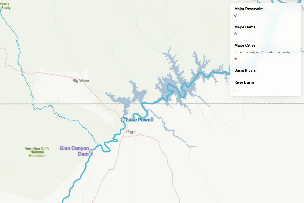
The main Colorado River begins in the Rocky Mountains of north-central Colorado, specifically in Rocky Mountain National Park at La Poudre Pass. It flows approximately 1,450 miles southwest through multiple states and historically ended at the Gulf of California in Mexico, though due to heavy water usage, it now often runs dry before reaching the sea.
The deepest part of the Colorado River reaches approximately 90 feet (27 meters) deep in certain sections, particularly in some of the canyon areas. However, depth varies significantly along its course depending on location, season, and water flow conditions.
.webp)