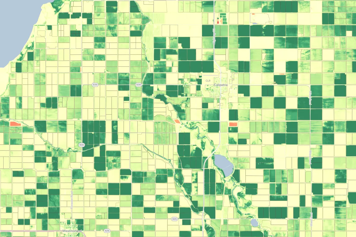
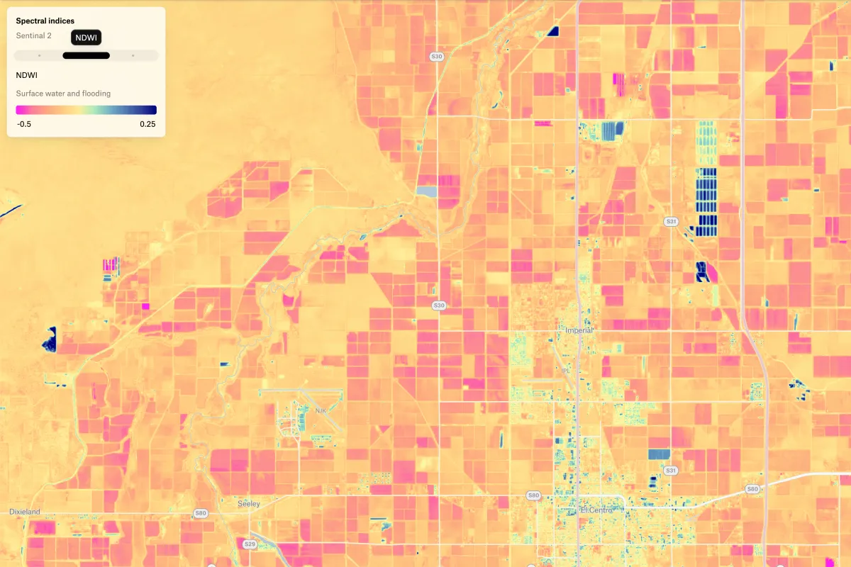
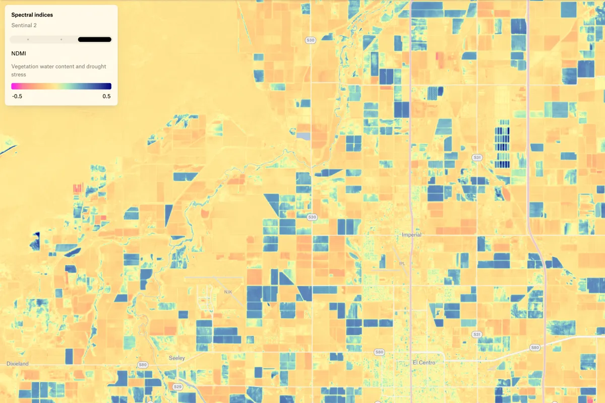
This map shows NDVI, NDWI, and NDMI from Sentinel-2 imagery to assess vegetation health, water presence, and moisture levels—supporting crop monitoring and seasonal change analysis.

.webp)