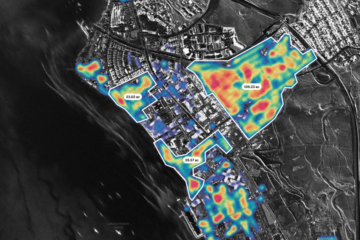
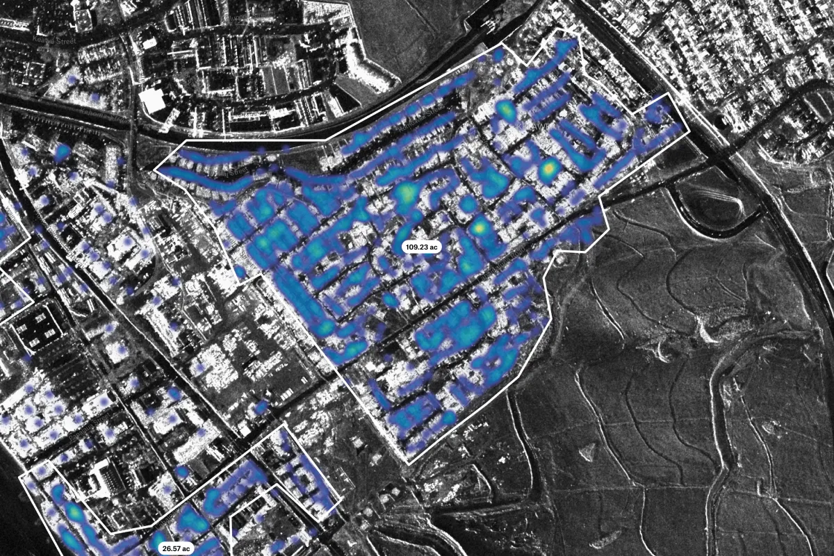
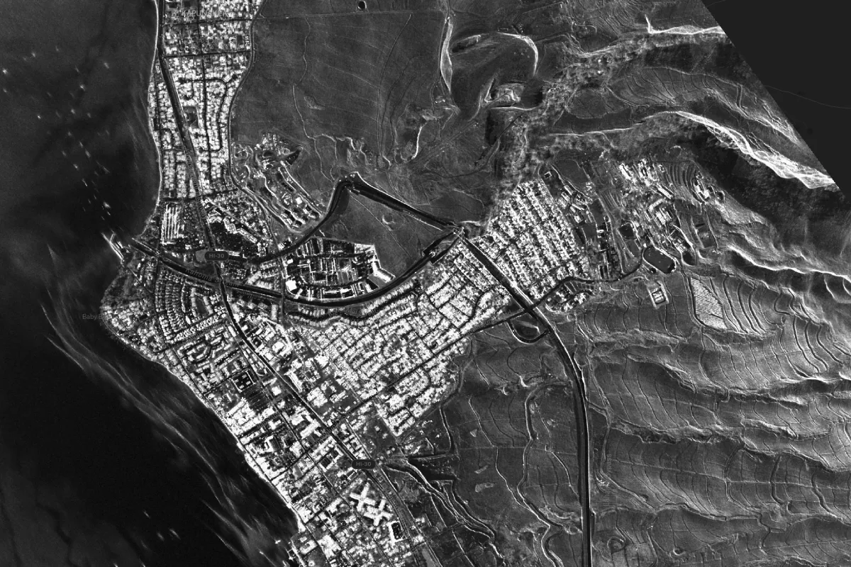
This map visualizes building-level damage detected after an urban fire, combining ground assessments with satellite-based SAR imagery for comprehensive impact analysis. Use it to communicate incident severity and support rapid response efforts—all in a shareable, cloud-hosted interface.
.webp)