SUMMARY
Top satellite imagery providers differ mainly in high resolution, revisit rate, coverage, and delivery model, with companies like Maxar and commercial SAR providers focused on faster, more detailed views of Earth.
Open-source systems like Sentinel and Landsat offer broad, accessible imagery, while commercial providers often deliver sharper panchromatic data and more frequent updates for time-sensitive use cases.
Tools like EarthExplorer help users access open satellite data, while modern mapping workflows increasingly combine optical and SAR imagery for analysis, monitoring, and decision-making.
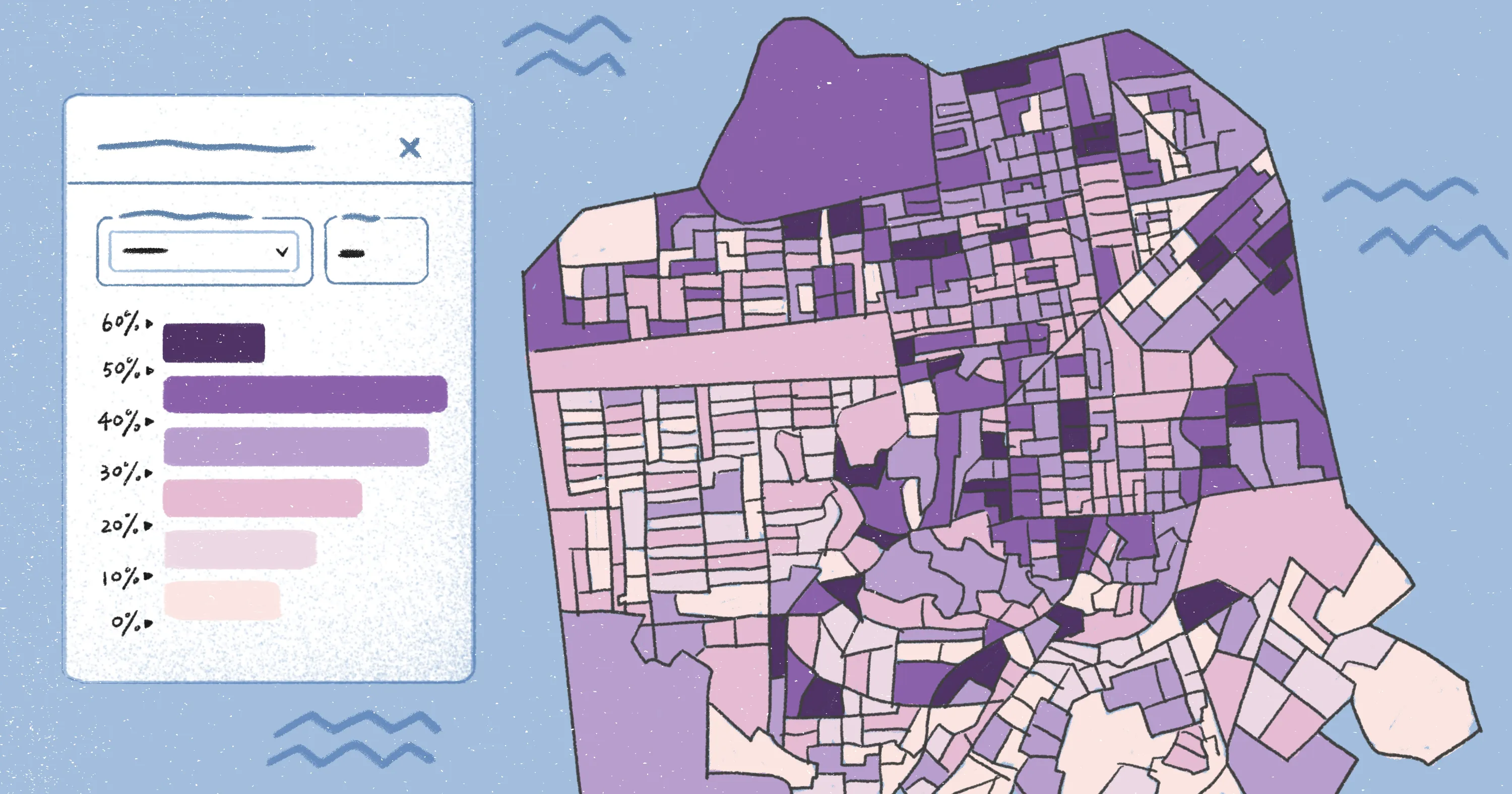
Platforms like Felt help teams move from raw satellite imagery to actionable insights, combining raster analysis, collaborative map layers, and real-time sharing in a single browser-based workspace.
Understanding today’s top satellite imagery providers
Satellite imagery companies are changing the way we see and analyze Earth. Their data shapes everything from climate change research to emergency response and city planning. While some companies rely on open-source systems like Sentinel and Landsat, others use their own commercial satellites to capture high-resolution imagery.
Let’s take a closer look at what makes these companies unique and how you can get the most out of their data using mapping platforms like Felt.
What defines a top satellite imagery provider?
Satellite imagery providers vary widely in how they capture, process, and deliver data. Some focus on global coverage and accessibility, while others specialize in high-resolution imagery. Here’s a look at the key factors that separate leading providers from the competition.
Resolution
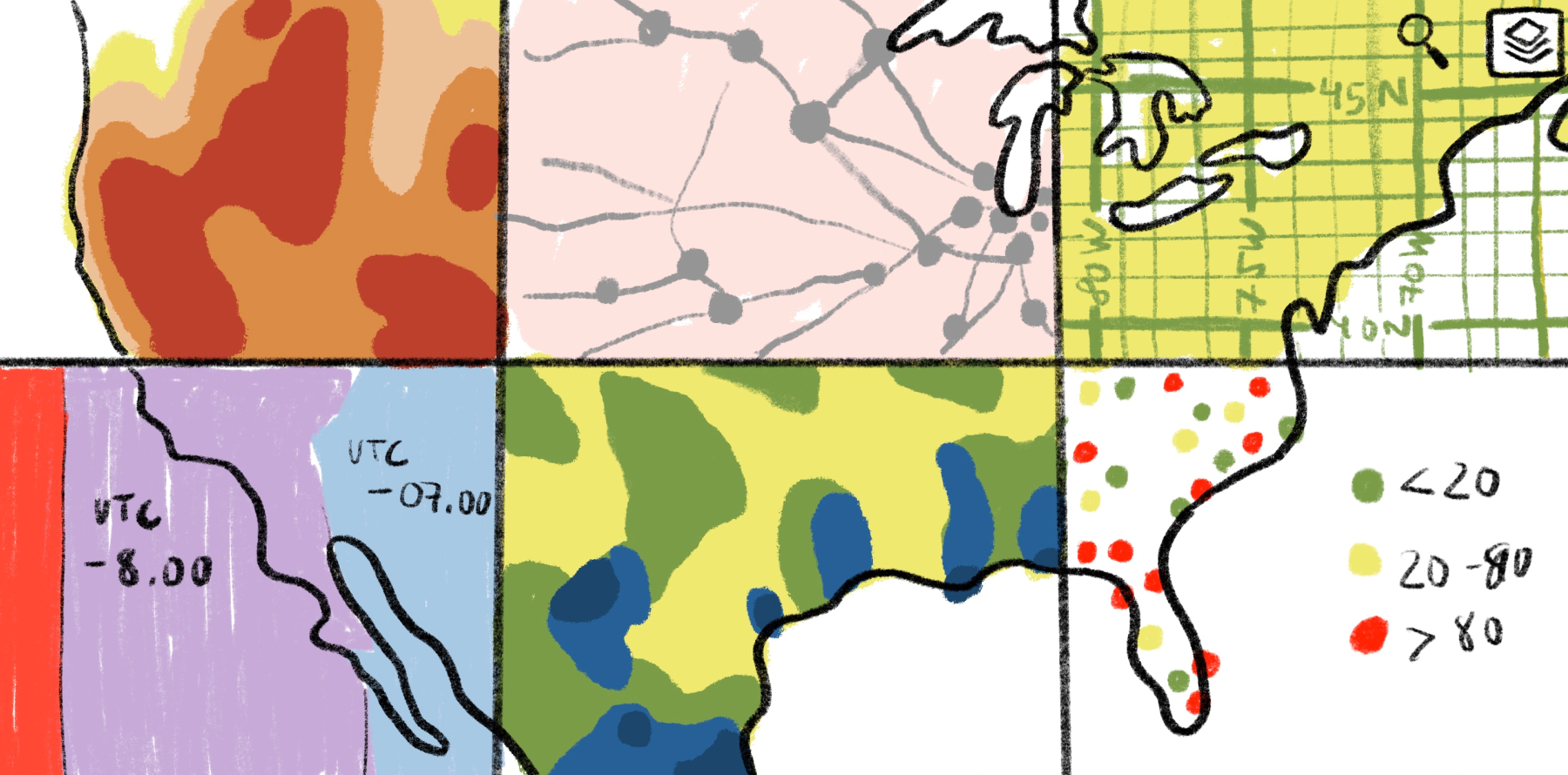
Commercial satellites take high-resolution, panchromatic, and multispectral shots you can use for deeper insight and analysis like tracking environmental trends. By contrast, open-source satellites offer broader coverage but lower resolution. They’re ideal for spotting deforestation or other changes in vegetation.
Revisit rate
The more often a satellite returns to the same location, the closer you get to real-time monitoring. Open-source satellites revisit every few days, which works well for analyzing slow changes like seasonal shifts. Commercial providers have more frequent passes with ultra-high-resolution imagery. This is a game-changer for emergency response efforts and managing natural disasters.
Coverage and accessibility
Open-source programs offer global satellite images for free, making them a popular choice among researchers and nonprofits. The downside is remote areas don’t update as frequently. Commercial companies charge for their data, but you get specialized images for specific regions, industries, and time windows.
APIs and integrations
Modern satellite imagery is no longer stuck in massive downloads. An application programming interface (API) lets different software systems connect and seamlessly share information. Now you can stream imagery directly into mapping platforms, making it easier for teams to manage supply chains and plan complex infrastructure projects.
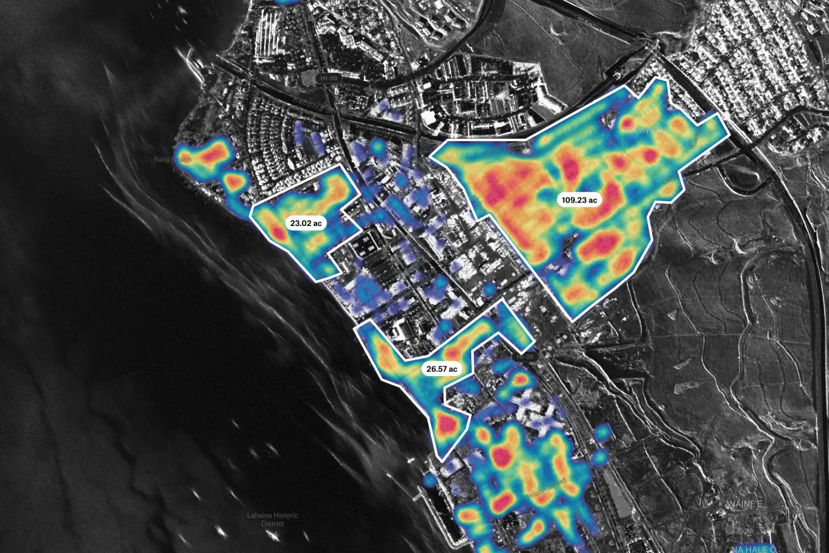
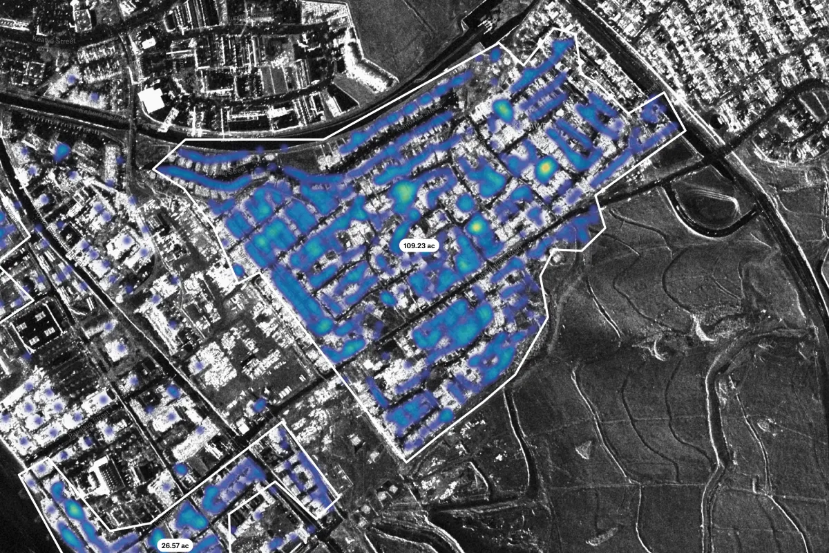
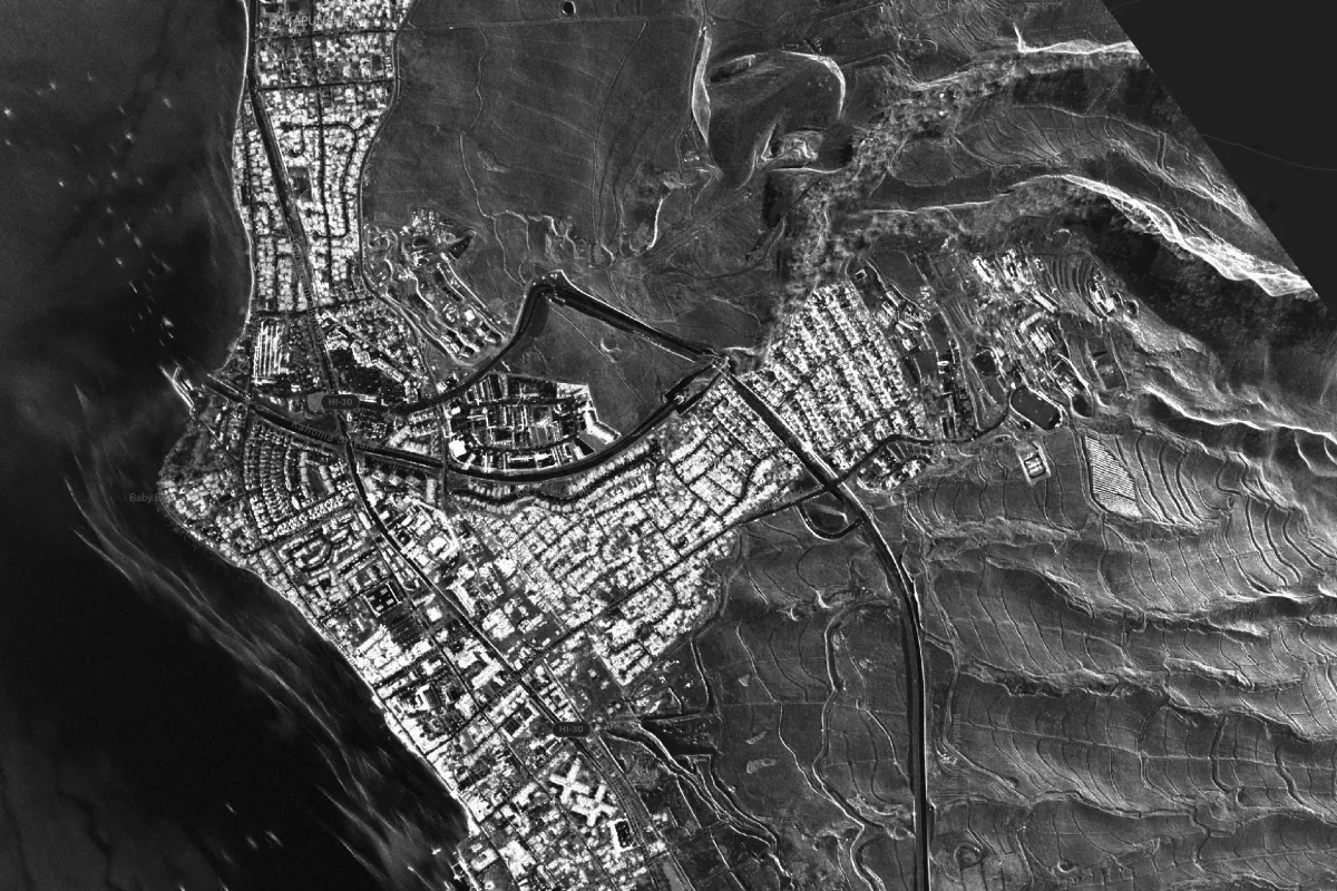
Source: Map created in Felt
Alt text: A map created in Felt showing building-level damage detected after an urban fire, combining ground assessments with satellite-based SAR imagery for comprehensive impact analysis.
The leading satellite imagery companies
From high-resolution commercial constellations to open-source government programs, today’s satellite imagery providers offer a range of capabilities. Here’s a closer look at the top satellite imagery companies and what sets each one apart.
1. Maxar Technologies
Maxar Technologies delivers some of the sharpest commercial satellite images available, down to 30 cm panchromatic detail. Defense teams and disaster responders count on Maxar for near real-time views of conflict zones and transit routes. NASA researchers, government agencies, and commercial analysts worldwide rely on Maxar’s data.
2. Planet Labs
Planet Labs runs a vast fleet of small commercial satellites in orbit, capturing daily images of Earth. With a high revisit rate, it’s a favorite for crop monitoring and supply chain management. The platform delivers a continuous stream of up-to-date, moderate-resolution images for more informed decision-making.
3. Airbus Defence and Space
Airbus Defence and Space brings together high-resolution commercial and security satellite images and broad coverage, ideal for city planning, mapping various communities, and managing natural resources. Their satellites provide rich, multispectral, and panchromatic images that support industries from agriculture to environmental consulting. Airbus also supplies vital intel for defense and security sectors.
4. BlackSky
BlackSky specializes in real-time monitoring and event-based analytics using a commercial satellite network. Their imagery catches changes almost instantly, which is why they’re so integral to border security and emergency response. BlackSky’s analytics platform enhances geospatial decision-making so you can react quickly to time-sensitive situations.
5. Sentinel Hub
Sentinel Hub provides free multispectral images from the European Space Agency’s (ESA) open-source Sentinel satellites — great for environmental research and land-use analysis. The resolution isn’t as sharp as other options, but the coverage is global and consistent. Just keep in mind that while the data is free, using Sentinel Hub’s cloud-based platform requires a paid subscription.
6. ICEYE
ICEYE’s radar satellites generate commercial imagery day and night, in any kind of weather. That flexibility is advantageous for flood mapping, shipment tracking, and organizing emergency aid. Their data also pairs well with optical imagery, helping fill coverage gaps.
7. Capella Space
Capella Space runs a fleet of small commercial radar satellites that deliver high-resolution images no matter the weather or time of day. That’s why organizations worldwide use their data in maritime surveillance and crisis management — like monitoring oil spills and tracking wildfires. If you need to keep an eye on something unpredictable, Capella can help.
8. Umbra
Umbra uses synthetic aperture radar (SAR) to capture high-resolution commercial satellite images around the clock. These images have countless use cases, but they’re especially helpful for providing surveillance and assessing environmental impacts. Umbra’s satellites are easy to launch and have a quick turnaround for new pictures, ensuring agile data collection.
9. USGS/NASA
USGS and NASA set the standard for open, government-backed satellite imagery. Their Landsat program gives anyone free access to multispectral and panchromatic images, widely used for climate research and land management. And with tools like EarthExplorer, it’s easy to access and apply the data to your workflow.
How satellite imagery powers modern mapping
High-resolution satellite images have become essential for understanding Earth’s surface and making informed decisions across industries. But imagery alone isn’t enough. Turning pixels into patterns requires the right tools.
That’s where platforms like Felt come in. By combining satellite images with collaborative mapping features, these solutions help teams extract meaning, share insights, and act on geospatial data. Here’s how this works.
From pixels to patterns
A satellite image on its own is a messy grid of pixels — but with the right analysis and visualization tools, those pixels reveal patterns in land use, vegetation, and more.
City planners use Landsat images with population and traffic layers to monitor neighborhood growth. Meanwhile, farmers use Sentinel visuals with soil and weather inputs to spot crop stress early on. Even the free images from NASA and ESA offer valuable insights when viewed in the right context.
Integration with collaborative tools
The real magic happens when teams work together on the same map in real time. Felt lets you stack, compare, and mark up satellite layers in a single, cloud-native workspace. This makes it easier to manage projects across industries.
A climate team, for example, might combine recent satellite images with rainfall records to map out flood risks. Developers can overlay high-resolution imagery with zoning maps to find the best area for a new apartment complex. Felt doesn’t just make this possible — it makes it effortless.
See satellite data in action with Felt AI
Picking a satellite provider is only the start. The real value comes from turning your images into practical insights. With Felt, you can organize massive raster datasets, pull in information from external sources, and layer it with whatever else you’re working on.
Want to measure vegetation health or monitor water levels? Run NDVI, NDMI, or NDWI analyses straight from your browser and publish results instantly with a single link. This way, your whole team stays aligned and your maps become an active source of collaboration.
Try Felt today and see why it’s the ideal companion to any imagery source, helping teams across industries unlock the full potential of satellite visuals.
FAQ
Which satellite provides the highest-resolution images?
Maxar provides some of the sharpest high-resolution images available today. Its satellites capture incredible panchromatic and multispectral details down to about 30 cm, which can spot vehicles and small structures from space.
Are there free sources for satellite imagery?
Government programs like NASA, USGS Landsat, and ESA’s Sentinel missions offer free, global satellite data. EarthExplorer and Copernicus Open Access Hub help users download and explore these images.
How often is satellite imagery updated?
Daily refreshes are common for fast-moving commercial providers, while some government satellites only return to the same location every few days or weeks.
Compare Felt using AI